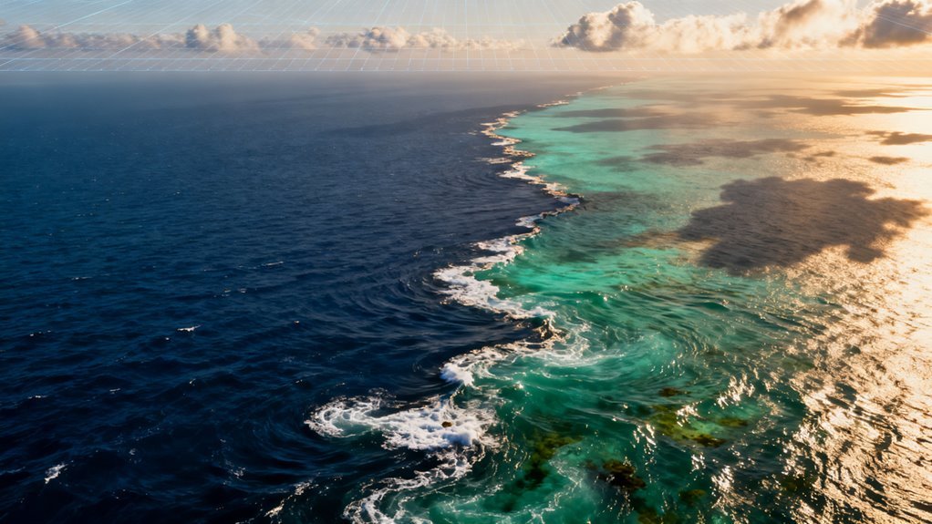

Most of the living world on this planet is still a blank space on our maps, and most of that unknown life is in the ocean. At the same time, artificial intelligence is moving from lab demos into real world infrastructure, including the systems that monitor climate, biodiversity and natural resources. Those two trends are now colliding in a very practical way. AI is starting to change how fast we discover new marine species, how reliably we catalogue them and how widely that knowledge is shared.
This matters right now because decisions about deep sea mining, marine protected areas and climate policy are already being made with only a partial view of ocean life. If AI can shrink the time it takes to go from an image or specimen to a vetted species record, it changes the evidence base for those decisions in a very direct way. In a recent example of this acceleration, the Nippon Foundation-Nekton Ocean Census announced the discovery of 1,121 new marine species in a single year, illustrating how quickly our picture of ocean life can change. Additionally, the integration of AI infrastructure is crucial for enhancing the efficiency of these discovery processes.
How much ocean life we still do not know
The ocean covers about seventy one percent of Earth’s surface and holds over ninety percent of the planet’s habitable volume. Yet marine biologists still only have formal descriptions for roughly a few hundred thousand marine species, typically quoted around two hundred forty thousand to two hundred fifty thousand.
Multiple studies and global assessments converge on an estimate of one to two million marine species in total, which implies that somewhere between sixty and ninety percent of ocean species remain undescribed. This is not a fringe view. The Census of Marine Life program, which ran for a decade and coordinated thousands of scientists, concluded that the majority of marine species have not yet been documented.
Later analyses that combined expert opinion with statistical models came to similar numbers, often highlighting that whole habitats such as the deep sea floor, seamounts and hadal trenches are still lightly sampled. In other words, the limiting factor is not that life is rare in the ocean. It is that our traditional methods for finding, sorting and describing that life are slow and labor intensive compared with the scale of the problem.
Why traditional discovery has been so slow
For most of the twentieth century, marine species discovery followed a familiar pattern. A research expedition collected specimens with nets, grabs or trawls, brought them back to shore, preserved them and then shipped them to taxonomic experts who might specialize in one narrow group such as deep sea worms or small crustaceans.
The expert would compare specimens with descriptions in printed monographs and museum collections, often working through subtle differences in morphology by hand and eye. That workflow produced reliable species descriptions, but it did not scale. There are only so many trained taxonomists, and they tend to retire faster than new specialists are trained.
At the same time, modern ocean science has embraced industrial scale sampling. Autonomous underwater vehicles, towed camera systems and fixed observatories now return millions of high resolution images and long video streams from remote environments that were rarely observed even a generation ago. Human experts simply cannot examine every frame.
The result is what many researchers now call an image backlog. Unfamiliar organisms appear repeatedly in archives from deep sea plains, seamounts and trenches, but they often remain in limbo. They are clearly not in the limited set of known, labeled images. Yet no one has the time to annotate and cross check them across different expeditions and institutions.
The rise of AI assisted ocean imaging
This is where AI has become more than a buzzword. Computer vision models, especially convolutional neural networks and their successors, are now routinely trained to recognize marine organisms in underwater imagery. The key ingredient is data.
Open datasets such as FathomNet aggregate labeled images from research cruises and robots into a shared resource that can be used for training and benchmarking. These collections capture organisms under different lighting conditions, viewing angles and depths, which is essential in a medium where visibility and color shift constantly.
Once trained, these models can process new imagery many orders of magnitude faster than manual review. Some groups report that AI systems can scan underwater images thousands of times faster than humans, while still achieving useful accuracy on well represented taxa.
In practice, that means a model can flag every likely squid, sponge or coral in a large image set, and then highlight unusual shapes and textures that do not match known categories. Those outliers are often where the potential new species hide.
It is important to be clear about what these systems do and do not provide. AI does not magically prove that a given organism is a new species. What it can do is rank and cluster observations so that human experts can focus their time on the most informative cases, cross reference images from different cruises and link them to specimens and genetic information where available.
That shift alone can compress the discovery cycle from many years to months or less in some cases.
Citizen science as a force multiplier
Another significant change is that the task of labeling and vetting marine images is no longer reserved for specialists. Citizen science platforms and games invite members of the public to help annotate ocean imagery, sometimes by turning the process into a simple exploration challenge.
In projects similar in spirit to the FathomVerse game described in the research context, participants click on visible animals, assign tentative labels, and flag cases that look strange or uncertain. Individually, those contributions are noisy. People make mistakes and interpretations vary.
Collectively, however, they generate large annotation sets that are extremely valuable for training and validating AI models. With appropriate quality controls, such as consensus labels and expert review of outliers, citizen contributions can dramatically expand the range of organisms and environments represented in training data.
That combination of AI assisted pattern recognition and distributed human input is particularly powerful in the deep sea, where human dive time is scarce and expensive. Every extra bit of information that can be squeezed from existing imagery increases the return on investment from past expeditions and equipment.
Ocean Census and the new discovery pipeline
The Ocean Census program is the clearest example of this technological pivot from slow specimen work toward integrated digital discovery. It is framed as one of the largest coordinated efforts in history to discover new marine life, with a public goal to find and describe at least one hundred thousand new marine species within about a decade.
To put that in context, the current global rate of new marine species descriptions has been estimated at only a little over two thousand per year, a pace that has not changed much since the nineteenth century. Ocean Census and related initiatives try to break that logjam by combining three things.
High resolution imaging from ships, submersibles and robots. Rapid DNA sequencing for genetic barcoding and deeper genomic analysis. Machine learning models that can propose identifications and highlight potential novelties across both images and genetic data.
As of recent updates, Ocean Census and its partners have already reported hundreds of candidate new species, with one announcement highlighting the identification of around eight hundred sixty six new marine species from early expeditions and analyses. Those figures are still being refined as formal taxonomic descriptions progress, but they show that the pipeline can scale beyond traditional rates.
Crucially, the program emphasizes data infrastructure. Digital morphology records, genomic markers and contextual information such as location and depth are pushed into shared databases that interoperate with resources like the World Register of Marine Species and global biodiversity platforms.
Automated workflows then use this integrated record to flag likely new species within days or even hours of collection, instead of the historical average lag which has been on the order of a decade.
Implications and risks
The upside of this shift is significant. For biodiversity science, AI accelerates the move from anecdotal discovery to systematic mapping of who lives where in the ocean. That richer baseline can improve models of ecosystem function, estimates of extinction risk and assessments of how climate change is reshaping marine communities.
For policy and industry, more complete and timely species data can sharpen debates that are currently dominated by uncertainty. Deep sea mining proposals, for example, are being weighed against concerns that vast areas of the sea floor host endemic and fragile species that could be wiped out before they are even recorded.
AI supported surveys of potential mining zones have already revealed thousands of species, most of them previously unknown to science, underlining how little we still know about these environments.
There are also clear risks and limitations. AI systems are only as good as the data they see. If certain habitats, depths or regions are underrepresented in training sets, model performance will be biased accordingly. That can lead to overconfidence in some areas and blind spots in others.
There is also a danger that institutions with more resources will generate and control larger datasets, potentially widening gaps between well documented and poorly documented regions. On the scientific side, there is an ongoing debate about how to balance rapid digital discovery with the rigor of formal species description.
Images and genetic sequences can strongly suggest the existence of distinct lineages, but many taxonomists argue that without physical vouchers and careful morphological work, the resulting species concepts may be unstable. AI can help manage this tension by flagging likely novelties and linking digital records to specimens, but it does not resolve the underlying need for expert judgment.
Ethical questions are also emerging. Detailed maps of species distributions can highlight areas that deserve protection. They can also be used to target valuable biological resources for commercial exploitation, including compounds with pharmaceutical potential. Governance frameworks will need to evolve to ensure that benefits from such discoveries are shared fairly and that sensitive data are handled responsibly.
What this means for technology and business
From a technology perspective, ocean discovery is becoming a compelling real world benchmark for AI and robotics. Underwater environments are notoriously challenging for perception and control. Models that perform well across turbid water, moving particles and shifting lighting often generalize to other messy sensing contexts better than those tuned only on clean web images.
That feedback loop is already drawing commercial interest from companies working on autonomous inspection, offshore energy, carbon monitoring and climate risk analytics. Businesses that depend on the ocean, from fisheries to shipping to renewable energy developers, will increasingly operate under regulatory regimes shaped by AI informed biodiversity data.
Early adopters that engage with these tools and help validate them may gain both scientific credibility and a more accurate view of ecological risk around their activities. There is also a quieter software story. Building and maintaining shared datasets like FathomNet, standardizing annotation formats and keeping models reproducible over time require robust engineering, clear licensing and long term funding.
That creates opportunities for specialized platforms that combine data management, annotation tooling and model deployment for scientific and environmental use cases.
The road ahead
The pattern that is emerging in ocean science echoes what has been seen on land. Once AI systems and shared datasets pass a certain threshold of quality, they do not replace experts, but they redraw the boundary between routine work and genuine discovery.
Instead of spending years manually checking whether a specimen matches a known description, taxonomists can focus more on difficult edge cases, evolutionary questions and the synthesis of large patterns. At the same time, it would be a mistake to assume that AI driven discovery is inevitable or evenly distributed.
Many coastal states most vulnerable to climate change and dependent on marine resources still lack sustained funding for deep ocean research, let alone sophisticated AI infrastructure. Without deliberate efforts to share tools, training and data, the benefits of this new discovery pipeline could remain concentrated in a handful of institutions.
The most realistic outlook is a hybrid future. Human curiosity and taxonomic expertise remain at the core of biodiversity science. What changes is the instrumentation around that expertise. Autonomous vehicles, high throughput sequencers and machine learning models work together to turn raw observations into structured knowledge far more quickly than before.
If that knowledge is paired with thoughtful governance and inclusive participation, AI assisted exploration could help society finally see the living ocean with enough clarity and speed to protect it, rather than just exploit it.
Conclusion
Something important is happening under the waves. For decades, the limiting factor in ocean discovery was not the ability to collect data but the ability to look at it. Now artificial intelligence is starting to unlock millions of archived seafloor images and videos, revealing new species and habitats that were literally hiding in plain sight. This matters right now because governments, companies and conservation groups are under pressure to understand and protect ocean ecosystems while deep sea mining, climate change and high seas governance accelerate.
How ocean discovery worked before AI
Marine biology has a long tradition of painstaking work. A research cruise might return with hard drives containing thousands of hours of video and millions of still images. A small team of experts and students would then spend months or years clicking through frames, annotating animals and substrates and trying to maintain consistency over long nights and large datasets. Fatigue and limited time made it inevitable that some rare or unfamiliar organisms would be missed.
Robotic vehicles and towed cameras increased the volume of data but did not solve the bottleneck. A study of robot assisted seafloor surveys found that even with partial automation, animal identification in seabed images reached about eighty percent accuracy on average and could climb to over ninety percent for specific species when enough labeled examples were available. That was promising, but still required significant human supervision and careful annotation.
Meanwhile, taxonomists continued to describe roughly two thousand new marine species every year, mostly from painstaking specimen collection and lab work rather than from imagery. Large imaging archives were valuable, but they functioned more as supporting evidence than as a primary engine for discovery.
The new generation of ocean image archives
In the past few years, a different pattern has emerged. Several groups have built very large, carefully curated image datasets specifically designed for training and evaluating machine learning models on seafloor scenes.
One of the most ambitious efforts is BenthicNet, a global compilation of seafloor imagery that brings together more than eleven million images from diverse ocean regions. The creators selected a subset of around 1.3 million images to preserve diversity while reducing redundancy and added a labeled collection of nearly one hundred eighty nine thousand images containing more than 3.1 million annotations of organisms and substrates. On top of that dataset, they trained a large self supervised model that can support automated analysis at both small and large scales, from identifying individual animals to mapping habitat patterns.
Other initiatives focus on specific regions or workflows. The Institute of Marine Research in Norway has compiled around one million photos from the seafloor to help identify bottom dwelling animals and to standardize annotation for future machine learning models. The Koster Seafloor Observatory built an open source pipeline where researchers can upload subsea movies to a dedicated portal, invite citizen scientists to classify footage, and then use those aggregated labels to train object detection algorithms that pick out species of interest in new videos.
Community science is also being integrated directly into dataset creation. The FathomVerse project introduced an online game in which players view regions of interest from deep seafloor images and classify them into twelve morphological groups such as corals, sponges or brittle stars. Those consensus annotations feed into a broader program called FathomNet, aimed at building robust training data for ocean computer vision systems.
These archives and platforms are more than just big folders. They embed scientific metadata such as location, depth and camera system, and they expose machine learning models through application programming interfaces, which lets other teams reuse and challenge existing workflows. That infrastructure is what turns raw imagery into a foundation for systematic discovery.
How AI actually finds hidden species in the data deluge
Modern ocean image analysis uses a mix of classic machine learning and deep learning techniques. One accessible approach combines an off the shelf convolutional neural network with a simpler classifier. In one benthic habitat study, researchers used a standard VGG16 network purely as a feature extractor for seafloor photographs, then fed those features into a support vector machine that assigned each image to one of several habitat classes. This two stage design lowered the barrier for non specialists and showed that useful pattern recognition is possible even without extensively customizing the network.
At the cutting edge, convolutional neural networks and attention based models are achieving very high accuracy on specific marine tasks. A survey of recent work reports identification rates of more than ninety four percent for fish species, corals, plankton and marine mammals, with specialized architectures pushing close to ninety eight percent for some datasets. For example, a tailored fish classification model built on a ResNet backbone has reached over ninety eight percent accuracy on underwater video, while models for sea cucumbers and microalgae also report performance above ninety percent.
These models are increasingly embedded inside automated underwater cameras, remotely operated vehicles and autonomous platforms. Equipped with trained algorithms, the systems can run continuously in the field, capturing and classifying imagery in near real time and flagging unusual observations for human review. Workflow papers from the tropical North Atlantic describe full pipelines in which two separate AI systems annotate seafloor substrates and megafauna taxa, then feed those outputs into clustering and multivariate analyses that delineate habitats and reveal distribution patterns. In those cases, AI does not just label animals but supports ecological interpretation by highlighting how different species and sediments co occur.
Through algorithms trained on vast archives of seafloor imagery, artificial intelligence now scans tens of millions of frames that would overwhelm human teams, surfacing organisms, behaviors and community structures that previously passed unnoticed in the data. As scientists refine these tools and carefully validate each candidate species with morphological and genetic checks, discovery becomes faster, more systematic and less constrained by human fatigue or limited expert availability. This shift points toward a future where machine pattern recognition and human expertise jointly map the still largely unknown contours of marine biodiversity, layer by layer across seafloor regions worldwide.
Flagship projects that show what is possible
Several high profile projects illustrate how these techniques move from theory into practice.
The Deep Vision project, supported by a large climate and nature fund, is using artificial intelligence to process thousands of hours of seafloor videos from areas beyond national jurisdiction, often referred to as the high seas. The goal is to extract biodiversity observations quickly enough to inform conservation decisions and policies for regions that lack detailed ecological baselines. That kind of pipeline is essential for international negotiations over deep sea mining and protected areas.
In polar regions, ocean teams working around Antarctica are now using AI to analyze seafloor images in seconds. These systems rapidly identify deep sea species such as starfish, corals, sponges and various fishes, helping researchers build maps of fragile benthic communities that may be sensitive to warming and changing ice conditions. Fast, consistent annotation lets scientists compare surveys over time and detect shifts that would be hard to see through manual review alone.
Other groups are exploring generative models that start from curated image libraries. In the LOBSTgER project, generative AI is trained solely on carefully validated underwater photographs that include correct species identifications, technical details and geographic context. The aim is to synthesize realistic scenes that help scientists think through what to look for and how to interpret complex habitats, while also providing training material that avoids misleading artifacts.
On the operational side, agencies such as the National Oceanic and Atmospheric Administration are testing deployable AI systems on exploratory expeditions. These efforts involve running trained models directly on board to assist with interpreting live camera feeds, with an emphasis on workflows that are robust enough to handle changing conditions and hardware constraints at sea. Complementary work on edge based computer vision, such as the UDEEP framework, focuses on in situ processing for underwater observatories and long term monitoring platforms where sending all raw data back to shore is impractical.
Even recreational divers are entering the loop. Services like SCUBA AI allow divers to upload reef photos and receive species identifications, while each confirmed label becomes an observation in a growing dataset. That combination of citizen input and machine processing can extend coverage to nearshore areas that research cruises visit less frequently.
What this means for science and conservation
Taken together, these developments mark a genuine change in how marine science can be done.
Discovery potential expands. When models can screen millions of images for rare shapes, colors or movement patterns, they can flag candidate species that only appear in a handful of frames spread across distant sites. That gives taxonomists a starting point, shortening the path from first sighting to focused sampling and description. Programs such as the Nippon Foundation Nekton Ocean Census, which already report hundreds of newly identified marine species using imaging, genetic sequencing and AI platforms, illustrate how integrated pipelines can raise the pace and ambition of biodiversity surveys.
Monitoring becomes more continuous. Once cameras and vehicles are equipped with embedded recognition models, they can act as persistent observatories that log changes in community composition and habitat structure at fine spatial scales. AI can help standardize labels across years and projects, reducing the subjectivity and inconsistency that have often plagued long term ecological datasets.
Conservation decisions gain stronger empirical support. Deep Vision and Antarctic projects show that AI assisted analysis can rapidly produce maps of sensitive habitats in regions that are politically and logistically hard to survey. Those maps can feed into environmental impact assessments and the design of marine protected areas, allowing regulators to balance extraction and protection with more concrete information.
Societal engagement increases. Community science platforms like FathomVerse and the Koster Seafloor Observatory invite a wider public to contribute annotations, while divers using SCUBA oriented tools build shared datasets one photo at a time. That participation helps with label volume and diversity and also builds trust, because people can see how their input shapes models and conclusions.
Risks, limitations and points of uncertainty
Despite the excitement, a realistic assessment needs to acknowledge risks and unresolved questions.
Data bias is a central issue. Large image compilations tend to over represent certain regions, depths and camera technologies. Models trained on those datasets may perform poorly in under sampled environments or on cryptic species, which could lead to systematic under detection in precisely the areas where discovery is most needed. Ongoing work to balance BenthicNet and similar collections is important but will never fully eliminate uneven coverage.
Ground truth is still hard to obtain. Image based detection can suggest candidate new species, but formal description relies on specimens, genetics and detailed morphology. Pipelines that combine AI with DNA approaches are promising, yet they require careful sampling and can be limited by logistics in remote or deep areas. Claims that AI alone has discovered new species should be viewed cautiously unless they are backed by transparent taxonomic protocols.
Model performance can be overstated. Reported accuracies above ninety five percent in controlled studies often reflect relatively clean datasets with constrained environments. In the wild, lighting, turbidity, camera angles and animal behavior all introduce noise. Edge systems and deployable AI frameworks are still being evaluated for robustness under real world expedition conditions, with performance varying by task and hardware.
There are also governance concerns. As AI makes it easier to map resources and biodiversity in the high seas, questions arise about who owns and controls the resulting data and models. Projects funded by large philanthropic initiatives and national agencies bring different expectations about openness, commercial use and long term stewardship. The ocean science community is actively debating how to design data sharing and governance structures that encourage collaboration without enabling unregulated exploitation.
Finally, trust must be earned. While citizen science and transparent platforms help, many stakeholders remain wary of black box systems that influence policy. Efforts like the Koster Seafloor Observatory, which exposes algorithms through interfaces and allows researchers to test performance under different thresholds, are steps toward more accountable AI. Clear documentation of datasets, training procedures and known limitations is essential if these tools are to be integrated into regulatory and conservation processes.
Implications for technology and industry
These advances have broader knock on effects beyond academia and conservation.
Technology companies are finding that ocean datasets are demanding test beds for computer vision and edge computing. Models must handle low light, backscatter, variable color balance and unusual shapes that differ from typical consumer imagery. Progress here can feed back into other domains, such as medical imaging or industrial inspection, where robustness to noise and domain shift is essential.
The marine robotics industry is integrating AI workloads into vehicle designs. Autonomous underwater vehicles and remotely operated systems need onboard computing that can run recognition models within power and bandwidth constraints while logging metadata for later auditing. This drives innovation in specialized chips, software frameworks and real time visualization tools tailored to underwater work.
Resource industries, including energy and prospective mining operators, face new expectations. If AI can quickly produce detailed maps of benthic communities and sediment patterns, regulators may require such analyses as part of baseline and monitoring plans. Companies will need to engage with ocean scientists and possibly support shared datasets and independent model evaluations to demonstrate environmental responsibility.
What to watch in the next decade
Looking ahead, several trends are worth watching for anyone interested in trustworthy AI for ocean discovery.
First, the evolution of global image archives. As BenthicNet and similar compilations grow and incorporate new regions, they will shape which questions can be asked and answered. Open contributions from research cruises, industry surveys and citizen sources could move the field toward more representative coverage, but only if governance and incentives are designed carefully.
Second, the integration of imagery with other data streams. Combining machine interpreted images with acoustic measurements, physical oceanographic data and genetic sampling could enable models that infer ecosystem states rather than just counts of visible animals. That would have real consequences for climate models, fisheries management and biodiversity targets.
Third, the maturation of deployable AI and edge vision systems. Frameworks like UDEEP and expedition trials by agencies will show whether real time interpretation becomes standard practice or remains a specialist capability. Success will depend on reliability, ease of use and the ability to keep models updated as new species and habitats are documented.
Finally, the development of norms around evidence and communication. Ocean science has a long tradition of cautious taxonomic work. Integrating AI into that culture without losing rigor will require clear guidelines for how machine outputs are reported, validated and credited. Platforms that keep humans firmly in the loop and that document uncertainty rather than hiding it will be central to maintaining trust.
Takeaways
Artificial intelligence is not magically discovering ocean life on its own, but it is transforming how scientists and explorers can work with the massive image archives that modern instruments produce. By training models on large, curated datasets and embedding them into cameras, vehicles and open platforms, researchers are turning the deluge of underwater imagery into a new lens on marine biodiversity.
The most trustworthy progress comes when machine pattern recognition is treated as a powerful assistant rather than an oracle. Human taxonomists, ecologists and data specialists remain essential for designing datasets, validating species, interpreting patterns and setting ecological and policy context. At the same time, citizen scientists, divers and community contributors have a growing role in shaping the data that models learn from and in scrutinizing their outputs.
In the coming years, the balance between opportunity and risk will hinge on openness, methodological rigor and transparent communication. If ocean AI evolves in that direction, the field can help society see and understand parts of the planet that have been effectively invisible until now and can support more informed choices about how to use and protect them reddit