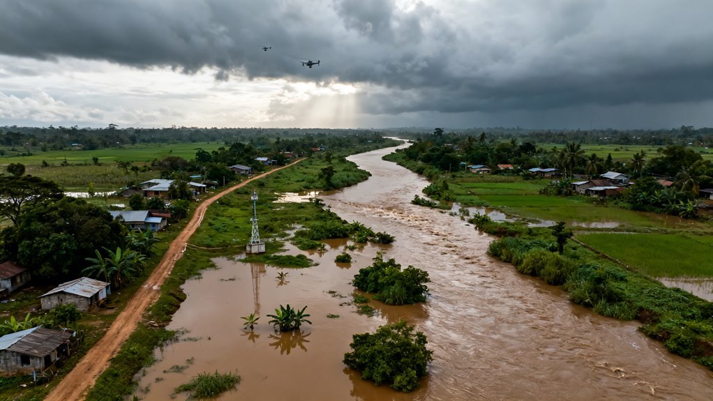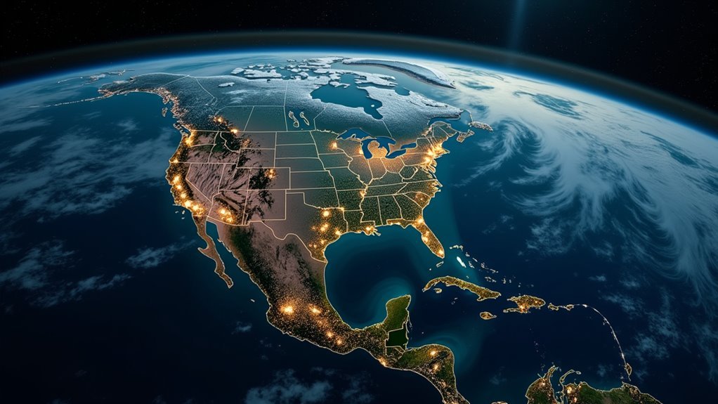

Artificial intelligence is quietly changing how the world watches over nature. Instead of occasional surveys and incomplete maps, researchers are starting to receive continuous signals about forest loss, habitat degradation, and shifting biodiversity from space and from the ground. In a decade defined by climate stress and accelerating species decline, that shift from sporadic observation to always-on monitoring is not a technical curiosity. It is a fundamental change in how societies can manage ecosystems, if they choose to act on what the data reveals. In regions such as the Amazon Basin, AI-powered remote sensing is beginning to reveal how tropical rainforests safeguard global biodiversity and regulate climate. Additionally, these innovations underscore the importance of AI safety as part of a broader framework for managing environmental risks.
From occasional surveys to continuous planetary sensing
For most of the history of ecology, monitoring meant sending people into the field with notebooks and simple instruments. Surveys were expensive, slow, and often limited to a few locations. Satellites began to change that picture in the late twentieth century, offering repeated global imagery but at relatively coarse resolution and with long delays between data and decisions.
Over the past decade, Earth observation has moved into a different phase. Deep learning and other machine learning techniques now run across the entire satellite data pipeline, from image compression and transmission through to automated recognition of land cover and prediction of environmental variables such as biomass and land use. As a result, the same constellations of satellites that once produced static maps can now underpin near real-time systems that flag deforestation, land conversion, or unusual ecosystem behavior as it happens.
At the same time, the gap between satellite pixels and ecological meaning is starting to close. A recent meta-analysis of satellite-based machine learning for ecosystem service indicators found that random forest models are widely used to link landscape patterns with stocks such as biomass, water, and food production, often using Landsat as a primary data source while many practitioners favor Sentinel 2 for its finer spatial and spectral detail. That kind of work turns remote sensing from pretty pictures into quantitative signals about how ecosystems are functioning.
How AI sees change before people do
The most visible example of this shift is forest monitoring. Global Forest Watch has spent years providing near real-time alerts about tree cover loss around the world, giving governments, companies, and civil society early notice of where forests are being cut. Recent updates add another layer of intelligence. New AI models classify those deforestation alerts by likely driver in major tropical regions such as the Amazon, the Congo Basin, and Indonesia, distinguishing small-scale and large-scale agriculture, road construction, mining, and wildfires at fine spatial resolution. That distinction matters because the right response to a wildfire is very different from the right response to illegal clearing for cattle.
A complementary data set developed by World Resources Institute and Google DeepMind pushes this idea further by mapping the dominant driver of tree cover loss at one-kilometer resolution from 2001 to 2024 using a customized ResNet convolutional neural network trained on Landsat and Sentinel imagery along with biophysical and population data. Instead of simply showing where forests disappeared, the maps show why, and how those causes shifted over more than two decades. That provides a powerful baseline for policymakers and conservation planners who need to decide where enforcement, incentives, or restoration will make the greatest difference.
Similar approaches are emerging far beyond forests. The Connected Conservation Foundation and Airbus Foundation have launched an Ecosystem Insight Hub that fuses very high-resolution satellite imagery from platforms such as Pléiades and Pléiades Neo with AI, in situ measurements, and community-led conservation projects to inform landscape-scale decisions. At these resolutions, individual trees, hedgerows, and small wetland patches become visible, allowing AI models to track fragmentation, edge effects, and encroachment that are almost impossible to spot from ground patrols alone. Companies like Gentian are training AI systems specifically to recognize and quantify habitat types from this kind of imagery, generating detailed habitat maps over large areas far more quickly than traditional survey methods while maintaining accuracy.
Taken together, these systems shift ecosystem monitoring from a backward-looking activity toward something that resembles an early warning radar. Instead of waiting for canopy dieback or obvious land clearing, algorithms can detect the first hints of pressure as patterns of vegetation, moisture, and temperature begin to diverge from seasonal norms.
From habitats to species and communities
Monitoring land cover is only one part of biodiversity. The harder question is how many species are present, where they live, and how their communities are changing. That has traditionally required field taxonomists and long-term ecological studies, both of which are chronically underfunded and geographically uneven.
Artificial intelligence is now starting to fill some of that gap, though not replace the need for field expertise. Work by the National Center for Ecological Analysis and Synthesis highlighted that most digital biodiversity platforms rely heavily on satellite data, focus mainly on plants at coarse taxonomic levels, and are concentrated in North America and Europe. The same assessment emphasized the opportunity for machine learning to identify species from photographs and sound recordings, extract ecological indicators from satellite imagery, and integrate data across platforms. In practice, that means AI can help transform millions of scattered observations and images into coherent maps of where species are likely to be and how that is changing.
One striking demonstration comes from an AI-based satellite survey that estimated the abundance of a terrestrial mammal species directly from very high-resolution imagery combined with machine learning, illustrating that satellite data can support scalable wildlife monitoring that goes beyond simple presence or absence. That kind of work remains at an early stage but points to a future in which abundance estimates for many conspicuous species could be updated regularly without disturbing them.
Projects like GUARDEN in Europe show how these technical pieces can be assembled into practical biodiversity indicators. GUARDEN uses satellite-based habitat indicators in combination with AI-based ecological modeling, citizen science platforms, acoustic sensors, and augmented reality tools to generate scalable measures of biodiversity risk and ecosystem services for planners and consultants. Evaluation of the project found that the most robust results came from combining Earth observation data with AI ecological models, allowing comparisons across different landscapes and governance contexts and enabling earlier intervention when indicators start to signal trouble.
Networks of AI sentinels on the ground
Satellites are only one vantage point. A parallel trend is the rise of AI-enabled sensor networks in forests, wetlands, and coastal ecosystems that complement space-based observations with granular local data.
Microsoft’s SPARROW platform is a prominent example. SPARROW nodes combine solar power, a low-energy graphics processing unit, and modular visual, acoustic, and environmental sensors in rugged devices that can operate autonomously in remote environments. Wildlife AI models run directly on these edge devices, processing images, audio, and sensor streams locally and transmitting summarized insights through low Earth orbit satellites or mobile networks so that researchers can access near real-time biodiversity information without needing frequent field visits. Effectively, SPARROW builds a network of ground-based sentinels that watch and listen continuously, then feed concise signals into global monitoring systems.
This architecture addresses one of the practical bottlenecks in conservation technology. Collecting data is relatively easy with cheap sensors. Getting that data out of remote sites, processing it quickly, and turning it into usable information for rangers, land managers, or policymakers is far harder. Edge AI and satellite backhaul are a pragmatic way to close that loop.
Data fusion, de-biasing, and the role of citizens
Modern biodiversity monitoring is inevitably multi-source. Satellite imagery, climate records, topography, land use maps, acoustic recordings, camera trap images, and citizen science observations all contain different pieces of the ecological puzzle. Stitching them together in a reliable way is where AI can be most powerful and most fragile.
Projects such as GUARDEN explicitly use citizen science platforms alongside satellite indicators to refine risk assessments and to direct professional surveys toward the most uncertain areas. NCEAS has also pointed out that uneven geographic coverage, taxonomic focus, and data quality are major challenges in existing biodiversity data sets and that machine learning de-biasing techniques will be needed to correct for those sampling imbalances. These techniques include weighting observations from underrepresented regions more heavily, explicitly modeling observation effort, and integrating acoustic and image data that can fill gaps where traditional surveys are scarce.
There is also growing interest in geospatial foundation models, which compress vast image archives into compact representations that can be reused across tasks. While still emerging, these models offer a way to bring together satellite history and ground observations in a shared feature space, making it easier to train species distribution models or habitat suitability indices with limited labeled data. As always, however, the quality and representativeness of training data will determine how trustworthy those models are for decisions in new regions or under novel climate conditions.
Opportunities and risks for technology, business, and society
For technology companies and researchers, AI-driven ecosystem monitoring is an attractive proving ground. It combines large data volumes, clear problem statements, and high social relevance. Platforms like SPARROW show how advances in edge computing, low power hardware, and satellite connectivity can be productized for conservation. Remote sensing startups and consultancies are using high-resolution imagery and habitat classification models to offer services to infrastructure planners, insurers, and regulators, often positioning themselves as providers of environmental intelligence to support compliance and risk management.
For public agencies and conservation organizations, these tools can change operational workflows. Near real-time forest loss alerts, complete with driver classification, allow enforcement teams to focus on high-risk hotspots rather than patrolling blindly. Landscape-level habitat maps derived from very high-resolution imagery and AI can guide restoration toward corridors that maintain connectivity and reduce fragmentation. Scalable indicators from projects like GUARDEN help planners compare biodiversity risks across proposed development sites and identify where mitigation or offsets would be most impactful.
The societal upside is clear. Better information, delivered earlier, should in principle lead to smarter, more timely interventions and fewer surprises. Yet there are real risks and limitations that deserve equal attention.
First, AI models can be biased or simply wrong, particularly in regions with limited training data or rapidly changing land use. NCEAS has warned that most digital biodiversity assets are skewed toward certain regions and taxa, and that without deliberate correction, AI systems will reproduce those skews.
Second, many of the most advanced monitoring platforms are controlled by a small number of corporations and research institutions. That concentration raises questions about access, transparency, and the possibility of environmental data becoming a proprietary advantage rather than a public good.
Third, high-resolution monitoring has surveillance implications. Detailed imagery and sensor data can reveal not only ecosystem changes but also human activities, from smallholder farming to local resource use. Without clear governance and safeguards, there is a risk that technologies built for conservation could be repurposed for less benign forms of monitoring.
Finally, early warning is only valuable if there is capacity and political will to respond. Forest loss alerts do not stop chainsaws on their own. They provide evidence and urgency, but the outcome still depends on law enforcement, land rights, economic alternatives, and public pressure.
What to watch in the coming years
Looking ahead, several trends are worth following closely.
- The integration of geospatial foundation models with ecological data sets, which could make it much easier to build reliable species distribution and habitat quality models in data-poor regions.
- The expansion of edge AI sensor networks, from platforms like SPARROW into open and community-driven systems that local groups can deploy and maintain themselves.
- The maturation of governance frameworks for environmental data, including decisions about open access, privacy for local communities, and responsibility for acting on early warnings.
- Efforts to build global biodiversity indicators that combine satellite data, AI modeling, and citizen observations in ways that are understandable and actionable for non-specialists.
For now, the most important signal in all this activity is that ecosystems are becoming visible in new ways. Forest loss can be tracked and attributed in near real-time across the tropics. Habitat mosaics can be mapped at resolutions where fragmentation and edge effects are no longer invisible. Species and communities can be inferred from images and sound, offering at least partial coverage in places where field ecologists rarely go.
Those capabilities do not solve biodiversity loss by themselves, but they remove one of the longstanding excuses for inaction: that we simply did not know what was happening until it was too late.
The core challenge now is to turn these new streams of ecological intelligence into consistent, equitable action. That will require not only better models and sensors but also institutions that commit to using them, communities that demand accountability when alerts are ignored, and funding that supports long-term monitoring rather than short project cycles. If that happens, AI will be remembered not just as another set of tools, but as one of the ways humanity learned to finally see the living world with the clarity it deserves.
Conclusion
Earth is changing faster than many traditional monitoring systems can track, and that is why artificial intelligence applied to satellite data matters so much right now. AI can turn constant streams of imagery into practical early warning signals, giving governments companies and communities a chance to act before environmental damage becomes visible on the ground and locked in for decades.
From static maps to living alerts
For most of the satellite era environmental monitoring meant looking back at what had already happened. Landsat began imaging Earth in the nineteen seventies but maps of forest loss or land cover were typically updated every few years or even more slowly. By the early two thousands annual global forest change maps produced from Landsat data showed where tree cover had been lost but they were essentially historical records not operational tools for rapid response.
Over the last decade that picture has changed. The Global Forest Watch platform built by the World Resources Institute and partners turned satellite based forest data into an accessible online service with global tree cover loss maps fire data and a growing set of near real time alert systems. The GLAD forest alerts developed by the University of Maryland GLAD lab use Landsat imagery to automatically flag areas of canopy disturbance at a resolution of about thirty by thirty meters roughly the size of two basketball courts. These alerts are updated about weekly as new cloud free images arrive allowing users to see where tree cover may be disappearing while logging roads are still fresh and clearings are still small.
Initially GLAD alerts focused on the humid tropics but were later expanded across the pantropics as an operational service accessible to any user of Global Forest Watch. Similar ideas appeared in regional systems such as the SAD deforestation alert system for the Brazilian Amazon which uses MODIS data to provide monthly notifications of forest loss and degradation at two hundred fifty meter resolution. Together these projects mark the transition from static deforestation maps toward dynamic alert feeds.
Integrated alerts and the move beyond forests
Recent developments push further by combining multiple satellite streams and machine learning methods to monitor a wider range of ecosystems. Global Forest Watch now offers an integrated disturbance alerts layer that merges four independent systems GLAD L GLAD S2 RADD and DIST ALERT into a single view of vegetation loss. GLAD L continues to provide Landsat based alerts across tropical regions while GLAD S2 uses Sentinel 2 imagery to track primary forest loss in the Amazon basin at ten meter resolution. RADD uses radar data to detect canopy disturbance in cloud prone regions of the Amazon basin Sub Saharan Africa and insular Southeast Asia where optical sensors often struggle.
The newest component DIST ALERT extends coverage beyond forests to grasslands savannas shrublands wetlands and even crops. This system measures a quantity called vegetation fraction essentially the percentage of ground covered by vegetation and issues an alert when that fraction drops by at least thirty percent compared with the same period over the previous three years. It updates weekly and operates at global scale giving conservationists and land managers early signs of ecosystem disturbance far outside traditional forest monitoring.
These alert layers are not just images on a screen. They are backed by machine learning models that compare incoming satellite data with historical baselines identify anomalies and filter out noise such as seasonal changes or temporary cloud shadows. In practice this means an automated system is constantly asking whether each pixel behaves as expected for its ecosystem and time of year and raising a flag when it does not.
How AI actually reads the planet
Modern AI applied to satellite data draws on several technical building blocks that have matured over years of research.
Machine learning models trained on long historical sequences of satellite imagery learn typical patterns of vegetation growth disturbance and recovery for different landscapes. When they process new images the models can score each pixel for the likelihood that a real change has occurred for example a reduction in canopy density or a shift from forest to bare ground. Thresholds such as fifty percent canopy loss in a thirty meter pixel are used to convert these probabilities into discrete alerts that users can act on.
Deep learning methods can combine multispectral optical data radar backscatter and increasingly hyperspectral measurements to infer more subtle ecological changes. Companies such as Deep Planet describe systems that track vegetation indices canopy structure and land cover patterns to detect shifts in species composition or habitat quality that would be invisible to the human eye or to simple threshold rules. These models can automatically classify habitat types across large areas and monitor their condition over time offering a scalable way to watch biodiversity health.
On platforms like Global Forest Watch the outputs of these models are layered on maps alongside administrative boundaries land use data and information on the drivers of deforestation such as nearby roads or agricultural expansion. This context is crucial because an alert by itself is only a signal that something changed. Understanding why it changed and what should be done requires linking the AI output with on the ground knowledge and policy instruments.
Why this matters for conservation climate and business
Near real time AI powered monitoring has clear implications for conservation. Forest rangers community patrols and environmental agencies can subscribe to alert feeds for their areas of interest and receive notifications when new disturbances are detected. Instead of discovering illegal logging weeks or months after the fact they can investigate while operations are still ongoing increasing the chances of enforcement and deterrence. International programs that aim to reduce emissions from deforestation depend on timely and credible data to verify results and these alert systems provide a transparent way to track tree cover loss across protected areas and production landscapes.
For climate resilience the expanded coverage of systems like DIST ALERT means that more ecosystems that store carbon or regulate water cycles can be monitored in a consistent way. Grasslands savannas and wetlands are often overlooked yet their degradation can release significant greenhouse gases and undermine local livelihoods. Weekly global alerts make it possible to detect emerging hotspots and link them to climate policy decisions or adaptation planning before they escalate.
Businesses especially those with supply chains tied to land use face a different but related set of pressures. Financial regulators investors and consumers increasingly expect companies to demonstrate that their operations are not driving deforestation or habitat loss. When AI derived alerts are public and granular down to tens of meters it becomes difficult for companies to claim ignorance about land clearing linked to their suppliers. Global Forest Watch already offers tools that combine disturbance alerts with data on concessions and political boundaries which can be used to assess risk exposure and compliance.
Insurance and finance also stand to be reshaped. If an insurer can see environmental stress building in a region through consistent vegetation anomalies it can adjust risk models for agriculture flooding or wildfire long before traditional statistics catch up. Disturbance alerts across all vegetation types effectively become a layer of planetary insurance data that can inform pricing and capital allocation decisions.
Limitations uncertainty and responsible use
Strong E E A T demands being clear about what these systems cannot yet do.
Satellite based alerts are only as good as their input data and models. Optical sensors depend on clear views so their coverage can be patchy in persistently cloudy regions although radar based systems like RADD mitigate this to some extent. Update frequencies of about one week are a major advance over annual maps but they are not instantaneous. Fast moving events such as fires or flash floods may still outpace detection or be captured only after major damage.
Accuracy thresholds are another source of uncertainty. GLAD alerts report canopy loss when more than fifty percent of a thirty meter pixel appears to have shifted from forest to non forest which means subtle thinning or selective logging can be missed until it accumulates. DIST ALERT only displays changes where vegetation fraction loss reaches thirty percent compared with recent history so minor disturbances or short term anomalies may be filtered out. These design choices reduce false positives but they also mean that not every important ecological change will generate an alert.
Machine learning models can also struggle when land use patterns change faster than their training data. New crops novel logging practices or restoration efforts that do not match historical examples may be misclassified. That is why ongoing validation with field data and collaboration with local experts remains essential even as global AI systems improve.
There are social and ethical risks as well. Powerful monitoring tools can support conservation but they can also enable tighter surveillance of rural communities if used without safeguards. Public platforms like Global Forest Watch reduce the risk of data being controlled by a single actor yet there are still questions about who decides how alerts are interpreted and acted upon and whose rights are considered when enforcement actions follow. Clear governance frameworks transparency about algorithms and open dialogue with affected communities are needed to ensure that planetary monitoring serves both ecosystems and people.
What comes next
Looking ahead the most important trend is likely to be integration rather than just more data. Satellite alerts will increasingly be combined with sensor networks on the ground local reporting and new sources such as drone imagery to build richer pictures of ecosystem health. Academic work on AI for ecosystem monitoring already explores fusing remote sensing with digital agriculture and in situ measurements to improve predictions of stress and yield. Similar ideas can be extended to forests wetlands and coastal ecosystems.
Predictive models that not only detect current change but estimate the probability of future tipping points will become more common. Instead of asking where deforestation happened last week decision makers will ask where pressure is building such that habitat loss is likely in the coming season. This shift from detection to forecasting will require careful calibration to avoid overconfident claims but it could significantly improve the timing of interventions.
For businesses and governments the practical takeaway is that ignoring these systems is no longer an option. AI enhanced satellite monitoring has moved from experimental projects to operational infrastructure that underpins conservation policy climate reporting and land risk management. Organizations that engage with these tools now can help shape standards for accuracy ethics and transparency rather than reacting later to rules set by others.
For societies the opportunity lies in using continuous intelligent monitoring as a form of planetary insurance that buys time for better decisions. The risk lies in assuming that data alone will solve complex political and economic drivers of environmental change. The technology can expose where ecosystems are under pressure but it cannot decide whose interests should prevail or how trade offs are resolved.
The most credible path forward is one where AI systems in orbit are treated as trusted instruments within broader governance frameworks not as magic solutions. When alerts are combined with local knowledge and long term policy commitments they can help protect forests grasslands wetlands and farmlands before damage becomes irreversible and that is the kind of practical planetary intelligence that is urgently needed now reddit