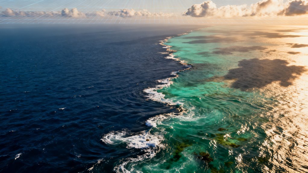
For decades, oceanographers have worked with a frustrating handicap. The instruments existed to observe the sea surface from space, and the data accumulated in enormous volumes, but the analytical tools to make sense of it all lagged far behind. That gap has now closed in dramatic fashion. A convergence of deep learning, massive satellite archives, and clever computer vision techniques is exposing an ocean in the middle of a transformation far more sweeping than conventional monitoring ever suggested. This is not a story about climate models predicting what might happen. It is about AI revealing what has already happened, quietly, beneath a surface that looked deceptively familiar.
What a Neural Network Found in 1.2 Million Satellite Images
The headline finding comes from a deep learning model trained on two decades of satellite imagery, covering 2003 through 2022. The model detected a significant global expansion of floating algae, both the microalgal scum familiar to anyone who has seen green coastal waters and the sprawling macroalgal mats like Sargassum that have increasingly choked Caribbean beaches and shipping lanes.
What makes this discovery methodologically important is the reason it went undetected for so long. Floating algae typically occupy less than one percent of an individual satellite pixel. At that subpixel scale, traditional threshold based detection methods essentially shrug. The algae are there, but they register as noise rather than signal. A deep learning approach, trained to recognize subtle spectral signatures across millions of images and thirteen geographic zones, overcame that limitation and classified blooms into five distinct algae categories.
The result: coverage has increased substantially across nearly every ocean region studied. This is a textbook case of AI not generating new data but extracting meaning from data that already existed. The satellites were watching. The images were archived. Nobody could read them properly until now. This breakthrough demonstrates how AI can enhance hypothesis generation in scientific research by processing existing data more effectively.
The expansion tracks closely with ocean warming and shifting nutrient inputs from agricultural runoff, changing upwelling patterns, and altered river discharge. In practical terms, this points to a climate driven reorganization of surface marine ecosystems that was essentially invisible to the monitoring frameworks governments and scientists relied on.
Turning Weather Satellites Into Ocean Current Trackers
A second development underscores just how much observational capacity was latent in existing infrastructure. The GOFLOW system uses a neural network to reconstruct high resolution ocean surface currents directly from sequences of satellite infrared sea surface temperature images.
Rather than measuring currents with altimetry or sparse buoy arrays, GOFLOW watches how temperature patterns deform between successive satellite frames and infers velocity vectors at submesoscale resolution. Think of it as optical flow analysis, the same computational approach used in video compression and autonomous driving, applied to thermal imagery of the ocean.
The technique exposes small scale currents, eddies, and filaments that traditional methods missed entirely. Validated against ship and buoy measurements, the system effectively repurposes existing weather satellites into real time trackers of flow structures that oceanographers previously could not observe without dedicated research cruises.
The strategic implication here is worth pausing on. Governments and agencies have spent billions on ocean observation infrastructure. GOFLOW demonstrates that a well designed neural network can multiply the return on that investment by orders of magnitude, extracting entirely new data products from instruments that were never designed to provide them.
This pattern, AI unlocking hidden value in legacy sensor networks, is one of the most consequential and underappreciated trends in Earth observation right now.
The Thermal Backdrop Is Shifting in Both Directions
These biological and dynamical changes are unfolding against a thermal backdrop that is itself moving fast. Over the satellite record, marine heatwave frequency has climbed by roughly 0.45 events per decade globally, adding more than five extra marine heatwave days per year by the end of the observational period.
Comparing the intervals from 1925 to 1954 and from 1987 to 2016, average marine heatwave frequency rose 34 percent, duration grew 17 percent, and annual marine heatwave days surged 54 percent. Satellite assessments now show that 38 percent of the world’s coastline experiences more frequent extreme high temperature days than had been previously documented.
But here is the detail that matters most for understanding the structural nature of this shift: the ocean’s cold extremes are simultaneously disappearing. Reprocessed satellite data for 1982 through 2021 reveal marine cold spell occurrences declining across large portions of the Atlantic, Indian, and western Pacific oceans, with many of those decreases exceeding 99 percent statistical confidence thresholds.
This asymmetry between rising heatwaves and vanishing cold spells is not what you would expect from random variability or cyclical oscillation. It signals a fundamental thermal restructuring of the upper ocean. The distribution of temperature extremes is not just shifting upward. It is compressing from below while expanding from above.
That distinction carries real consequences for marine ecosystems, fisheries, coral survival, and the accuracy of climate projections.
Why This Matters Beyond Climate Science
For the AI industry, these ocean discoveries illustrate something important about where applied machine learning creates the most value. The breakthroughs here did not require exotic new sensors, unprecedented compute budgets, or foundation models with hundreds of billions of parameters.
They required domain expertise married to well chosen architectures and, crucially, access to large structured datasets that had been sitting underutilized for years. This is a pattern playing out across scientific disciplines. In genomics, materials science, weather prediction, and now oceanography, the highest impact AI applications are often not the ones grabbing headlines in Silicon Valley.
They are the ones quietly reprocessing decades of archived observations and finding things that were always there but never visible. For businesses and governments that depend on ocean conditions, from shipping and insurance to fisheries management and coastal infrastructure planning, these findings demand attention.
The ocean that planners have been modeling and insuring against is not the ocean that actually exists. Algal blooms are more extensive. Currents are more complex. Heatwaves are more frequent. Cold buffers are eroding. Every risk model built on pre AI observational baselines is, to some degree, wrong. The cumulative area of microalgal blooms alone reached 43.8 million square kilometers over the study period, a figure that underscores the sheer scale of what legacy detection methods failed to capture.
What Comes Next
The near term trajectory is reasonably clear. As more research groups apply modern deep learning to satellite archives, expect a steady stream of similar revelations across other domains of Earth observation. Sea ice dynamics, land use change, atmospheric composition, and freshwater systems all have comparable backlogs of underanalyzed imagery.
The more interesting question is institutional. Will the agencies responsible for ocean policy and marine resource management actually integrate these AI derived insights into their decision frameworks? History suggests a lag. Scientific capability tends to outpace regulatory and planning adoption by years, sometimes decades.
The gap between what AI can now show us about the ocean and what policymakers are prepared to act on may turn out to be the most consequential bottleneck of all. What is no longer in doubt is the scale of what was hidden. The ocean was changing in ways that our observation systems could have detected, if only we had known how to look. Now we do.