The ocean has been hiding something enormous in plain sight, and it took a machine learning breakthrough to finally see it.
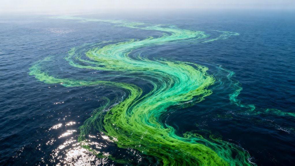
For roughly two decades, Earth observation satellites have been dutifully photographing the world’s oceans, capturing petabytes of imagery that scientists have mined for everything from sea surface temperatures to illegal fishing activity. But buried in that data was a signal so faint that no conventional detection method could extract it: algae blooms covering an estimated 17 million square miles of ocean surface, an area larger than the entire landmass of Russia and Canada combined. These blooms were there the whole time. They simply occupied less than 1% of any given satellite pixel, rendering them effectively invisible to the algorithms researchers had been using for years.
What changed is not the data. It is the analysis layer sitting on top of it.
A team of researchers trained deep learning models to detect subpixel signatures of algal growth across the full historical archive of ocean color satellite imagery. The technique works by recognizing spectral patterns that indicate biological activity even when the bloom itself is far too small to register as a discrete feature in a single pixel. Think of it as the difference between reading a book and reading between the lines. The information was always encoded in the light bouncing off the ocean surface. It just required a fundamentally different computational approach to decode it.
This is not the first time AI has revealed environmental phenomena hidden in existing datasets. Google’s work with Global Fishing Watch used similar principles to expose dark fleet fishing vessels that had switched off their transponders. DeepMind’s weather forecasting models found predictive signals in atmospheric data that traditional numerical weather prediction had missed. The pattern is becoming unmistakable: we are sitting on mountains of observational data that contain critical information we lack the perceptual tools to access without machine learning.
What the blooms actually tell us
The numbers deserve careful attention. Macroalgal blooms in the tropical Atlantic and western Pacific have been expanding at 13.4% annually since 2008. That is not a gentle upward trend. Compounded over 16 years, it represents roughly an eightfold increase in bloom coverage. The growth trajectory aligns with rising ocean temperatures, increased agricultural nutrient runoff, and shifting current patterns, all of which create favorable conditions for explosive algal proliferation.
Scientists involved in the research now suggest the ocean may have crossed a threshold into a fundamentally new environmental state. That phrase deserves unpacking because it carries significant weight. In complex systems science, threshold crossings are not gradual transitions. They are tipping points after which a system reorganizes into a different stable configuration, one that resists returning to its previous state. If the ocean’s algal dynamics have genuinely shifted in this way, the implications ripple outward into fisheries, carbon cycling, coastal economies, marine biodiversity and climate modeling.
Massive algae blooms are not benign. Sargassum invasions have already devastated Caribbean tourism and choked coastal ecosystems across Mexico and Florida. Harmful algal blooms produce toxins that contaminate shellfish, kill marine life and occasionally force beach closures that cost coastal communities millions in lost revenue. At planetary scale, the decomposition of enormous algal mats consumes dissolved oxygen, creating dead zones where little else can survive.
The AI angle that matters most
For the technology community, the deeper story here is not about algae. It is about what happens when deep learning is applied to historical observational datasets that were collected for one purpose and turn out to contain answers to questions nobody thought to ask.
This represents a category of AI application that is quietly becoming one of the most consequential in the field: retrospective discovery. Rather than generating new data through expensive new instruments or missions, these models extract novel insights from archives that already exist. The economics are compelling. Satellite imagery archives are largely publicly available through programs like Copernicus and Landsat. The computational cost of training and running inference on these datasets, while nontrivial, is orders of magnitude cheaper than launching new observation infrastructure.
NVIDIA’s investment in Earth observation AI, Microsoft’s Planetary Computer platform, and Google Earth Engine have all been building toward this kind of capability. The infrastructure for planetary scale retrospective analysis is maturing rapidly. What has been missing are the domain specific models trained to ask the right questions of the right data.
What comes next
Expect this discovery to accelerate funding for AI driven environmental monitoring. Governments and international bodies are already under pressure to improve ocean governance, and the revelation that existing monitoring systems have been blind to a phenomenon of this magnitude will sharpen the urgency.
For AI companies and research labs working in earth science applications, the commercial and policy implications are substantial. Insurance companies pricing coastal risk, fisheries managers allocating catch quotas, and climate modelers building the next generation of Earth system simulations all need access to this kind of previously invisible information.
The uncomfortable truth embedded in this finding is straightforward: we do not fully know what we do not know about the planet’s current state. If 17 million square miles of algae blooms went undetected for two decades in data we already had, it is reasonable to ask what else is hiding in the archives, waiting for the right model to look.
For two decades, algae blooms have been quietly swallowing the world’s oceans at a pace no one fully grasped. The reason is straightforward: nobody had the tools to look properly. Now, a deep learning analysis of 1.2 million satellite images has produced the first comprehensive global map of floating algae, and the picture it reveals is staggering. Blooms now cover roughly 17 million square miles of ocean surface. That is approximately four times the area of the United States. This was not a slow creep detected by incremental monitoring improvements. This was a planetary scale ecological shift that was effectively invisible until machine learning peeled it out of the noise.
The finding matters well beyond marine biology. It represents one of the clearest demonstrations yet of a pattern that is becoming impossible to ignore: AI is not just accelerating existing science. It is exposing realities that traditional methods structurally could not detect.
AI isn’t just making science faster — it’s revealing what science alone was never equipped to see.
Why Satellites Alone Were Not Enough
Earth observation satellites have been photographing ocean surfaces for decades. The raw data existed. The problem was always interpretation. Algae blooms, particularly the thin floating mats and scattered microalgal scum that dominate most of the ocean, often occupy less than one percent of an individual satellite pixel. To a conventional classification algorithm, that signal is indistinguishable from sensor noise, sediment plumes, sun glint, or mixed light reflections off choppy water. Coastal regions, where nutrient runoff fuels the most dangerous blooms, are precisely the zones where these confounding factors are worst.
Previous global estimates of algal coverage relied on coarser detection methods that essentially counted only the most dramatic, visually obvious events. The massive green tides that began choking the Yellow Sea around 2008 made headlines because they were impossible to miss from space. But the broader, more diffuse proliferation across tropical Atlantic waters, western Pacific gyres, and even open ocean basins far from any coastline went largely uncounted.
The research team solved this by training convolutional and deep learning architectures on multi and hyperspectral reflectance data combined with solar induced fluorescence signals. Critically, they used self supervised learning frameworks, meaning the models did not depend on hand labeled training datasets tied to specific instruments. This allowed them to fuse observations from multiple satellite missions into continuous, gap free maps spanning 2003 through 2023. The approach worked in precisely the optically complex environments where previous methods failed, including sediment rich waters off western Florida and Southern California that had long obscured bloom detection.
What the Map Actually Shows
The AI classification did not just find more algae. It revealed structural patterns in how blooms are distributed and evolving. Several findings stand out.
Floating macroalgal blooms in the tropical Atlantic and western Pacific grew at annual rates reaching approximately 13.4 percent, with sharp acceleration after 2008. Both macroalgal mats and microalgal scum increased globally across the full study period. Blooms appeared not only on nutrient enriched coastal shelves, which was expected, but also within oligotrophic open ocean gyres, regions traditionally considered too nutrient poor to support significant algal growth. The study documented blooms across the Atlantic, Pacific, and Indian oceans along with multiple marginal seas, a distribution far wider than any previous assessment recognized. Over the full study period, the cumulative area of microalgal blooms reached 43.8 million square kilometers, underscoring the sheer scale of the phenomenon that had gone largely unquantified.
The researchers characterized current ocean surface conditions as favoring a large scale environmental regime shift toward increased floating macroalgae. That language is deliberate and significant. It signals that this is not cyclical variation or a temporary response to a few bad years of agricultural runoff. The baseline has moved.
The AI Angle That Deserves More Attention
Much of the coverage around this finding will focus on the environmental implications, and rightly so. But the technical achievement here points to something the AI industry should be paying closer attention to.
Over the past several years, the most visible AI breakthroughs have been in language, image generation, and coding. The models from OpenAI, Google DeepMind, Anthropic, and Meta that dominate headlines are largely trained on human generated text and images. They are powerful, commercially valuable, and rapidly improving. But they operate in domains where humans were already competent, even if slower.
This ocean mapping work sits in a fundamentally different category. The spectral signatures that these deep learning models detected were, in many cases, literally invisible to human analysts reviewing the same imagery. Sub pixel algal signals mixed into noisy coastal reflectance data are not something a trained expert can reliably identify by looking at a screen. The AI did not do faster what humans could already do. It did something humans structurally could not.
This distinction matters for understanding where AI creates the most irreplaceable value. Natural language processing makes knowledge workers more productive. Computer vision in manufacturing catches defects faster. These are efficiency gains. But AI applied to remote sensing, geophysics, materials science, and other domains involving signals below the threshold of human perception represents a categorically different kind of contribution. It expands the boundary of what is knowable.
NVIDIA has been making exactly this argument in pushing GPU infrastructure for scientific computing. Google DeepMind’s AlphaFold protein structure predictions followed a similar logic. The algae mapping work is less famous but arguably more consequential in near term policy impact, because it directly changes the factual basis on which ocean management, fisheries regulation, and climate adaptation decisions rest.
Who Benefits, Who Loses, and What Gets Harder
The immediate beneficiaries are obvious. Environmental agencies, fisheries managers, coastal municipalities, and climate modelers now have a far more accurate picture of bloom distribution and trends. For governments in regions like the Gulf of Mexico, the South China Sea, and West Africa, where harmful algal blooms threaten both ecosystems and local economies, this data provides a planning baseline that simply did not exist before.
The commercial remote sensing industry also stands to gain. Companies like Planet Labs, Maxar, and Satellogic have been building increasingly dense constellations of Earth observation satellites. The bottleneck has never been image collection. It has been image interpretation. This research validates that deep learning can extract commercially and scientifically actionable insights from existing satellite archives, not just future high resolution imagery. That strengthens the business case for every company selling geospatial analytics.
On the other side of the ledger, the findings create uncomfortable pressure. Agricultural interests and coastal development lobbies in regions now clearly linked to bloom intensification face harder scrutiny. If blooms are expanding into open ocean gyres, the argument that nutrient pollution is a localized, manageable problem becomes much more difficult to sustain. Regulatory agencies that have been setting nutrient discharge limits based on older, less complete bloom data may find their standards suddenly inadequate.
There is also a subtler challenge for the scientific community itself. A 20 year planetary phenomenon went largely unquantified until an AI system processed the full satellite archive. That raises pointed questions about how many other large scale environmental changes are sitting in existing datasets, undetected, because the analytical tools have not caught up with the data collection.
The Regime Shift Question
The researchers’ use of “regime shift” language deserves careful attention. In ecological science, a regime shift describes a fundamental, often irreversible reorganization of a system’s structure and function. It is a stronger claim than saying blooms are increasing. It implies that the ocean has crossed a threshold into a new stable state where extensive algal coverage is the norm rather than the exception.
If that assessment holds up under further analysis, the downstream implications extend well beyond marine ecology. Massive algal blooms alter ocean surface albedo, affecting heat absorption. They change oxygen dynamics in underlying water columns, contributing to dead zones. They interfere with fisheries, tourism, and desalination infrastructure. And when certain species are involved, they produce toxins that enter food chains and drinking water supplies.
The 13.4 percent annual growth rate in tropical macroalgal blooms, sustained over more than a decade, is the kind of exponential trajectory that makes environmental scientists deeply uneasy. Compounding at that rate, even if it eventually levels off, means the problem in 2030 will look substantially different from the problem in 2023.
What Comes Next
Three developments are likely in the near term.
First, expect other research groups to apply similar deep learning frameworks to different satellite archives, looking for analogous hidden signals in ocean chemistry, ice dynamics, forest health, and atmospheric composition. The methodological template here is highly transferable. Self supervised learning on multi sensor remote sensing data is not specific to algae.
Second, the operational monitoring of algal blooms will almost certainly shift toward real time or near real time AI driven systems. The 20 year retrospective analysis proved the concept. Government agencies like NOAA and the European Space Agency’s Copernicus program already run satellite monitoring services that could integrate these techniques, moving from periodic surveys to continuous automated detection.
Third, this work will intensify the already growing debate about AI’s role in environmental governance. When the most accurate picture of a global ecological crisis comes from a machine learning pipeline rather than from traditional monitoring networks, it raises questions about institutional capacity, data access, and decision making authority. Who validates the model? Who acts on its outputs? What happens when AI derived evidence conflicts with politically convenient narratives?
These are not hypothetical questions. They are arriving faster than most institutions are prepared to answer them. The algae blooms were already there, spreading across 17 million square miles of ocean. The AI just made it impossible to pretend otherwise.
AI’s role in enhancing environmental monitoring systems is now clearer than ever, as it enables unprecedented insights into previously hidden ecological shifts.