
When Fire Creates Weather: What AI Just Revealed About Europe’s Mega Wildfires
The fires burning across southern Europe in recent years did something that would have sounded like science fiction a decade ago. They got hot enough, and big enough, to manufacture their own thunderstorms. And it took a combination of satellite data, ground sensors, and machine learning to finally explain the precise mechanism behind this terrifying escalation.
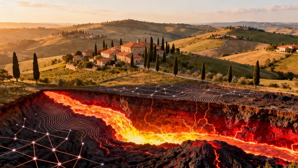
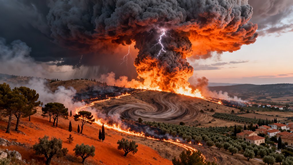
Researchers used AI models to sift through enormous volumes of atmospheric and environmental data from wildfire events in France and Spain, identifying the exact conditions under which a large fire crosses a critical intensity threshold. At that point, superheated air rises so violently that it punches into the upper atmosphere and forms towering convective plumes. Those plumes condense into pyrocumulonimbus clouds, massive electrified storm systems born entirely from fire. The storms then feed back into the blaze, throwing erratic winds and lightning strikes across the landscape in a self reinforcing cycle that overwhelms traditional firefighting strategies.
What makes this work notable is not simply the finding itself. Firefighters and atmospheric scientists have observed pyrocumulonimbus events before, particularly in Australia and the western United States. The breakthrough here is in the specificity of what the AI models identified: a seasonal fingerprint. Wet winters that fuel dense vegetation growth, followed by prolonged severe droughts that turn that same vegetation into an enormous fuel load. That sequence, which climate models suggest is becoming more frequent across the Mediterranean basin, is the catalyst that pushes ordinary wildfires into a different category entirely.
Why Machine Learning Changed the Equation
Identifying this pattern required processing datasets far too large and interconnected for traditional statistical methods. Satellite imagery captures surface conditions across millions of hectares. Ground stations record temperature, humidity, wind speed, and soil moisture at granular intervals. Atmospheric soundings measure vertical temperature profiles that determine whether convective plumes can form. The relationships between all of these variables are nonlinear and highly dependent on local geography. Machine learning models, particularly deep learning architectures trained on temporal sequences, excel at finding these kinds of complex conditional patterns.
This is a meaningful example of AI applied to earth sciences in a way that produces genuinely actionable knowledge rather than incremental improvements to existing models. The distinction matters because much of the recent conversation around AI and climate has focused on either energy consumption concerns or broad promises about optimization. Here, the technology delivered something concrete: a predictive signature that fire agencies can monitor in real time.
It also highlights a shift in how environmental AI research is maturing. Early applications tended to focus on detection, using computer vision to spot fires from satellite imagery or identify deforestation. That work was valuable but reactive. What we are seeing now is a move toward understanding mechanisms and predicting emergent behaviors, which is a fundamentally harder problem and a more consequential one.
The Feedback Loop Problem
The most unsettling aspect of the findings is the feedback loop. Once a fire generates its own pyrocumulonimbus cloud, the storm does not simply sit above the fire. It actively makes things worse. Downdrafts from the storm push winds outward at ground level in unpredictable directions, potentially spreading the fire far faster than terrain and ambient wind conditions would normally allow. Lightning from the storm can ignite entirely new fires kilometers away. And the convective energy of the plume draws in surrounding air, effectively creating its own wind field that can override regional weather patterns.
For fire management agencies, this means that the window between a manageable wildfire and an uncontrollable atmospheric event may be narrower than previously understood. If the AI models are correct about the seasonal preconditions, then the critical decisions happen months before the fire starts, during the planning and resource allocation phase when vegetation management and pre positioning of assets can still make a difference.
Broader Implications for Climate Adaptation
This research sits at the intersection of two converging trends that will define much of the next decade. The first is the accelerating impact of climate change on extreme weather events, which is no longer a projection but an observable reality across multiple continents. The second is the growing capacity of AI systems to extract predictive intelligence from complex environmental datasets.
Governments across Europe are already under pressure to modernize their wildfire response infrastructure. Greece, Portugal, and Spain have invested heavily in aerial firefighting fleets and early warning systems. France expanded its Sécurité Civile capabilities after devastating fires in the Gironde region. But most of these investments are oriented around fighting fires once they start. The AI findings suggest that a meaningful portion of the strategic response needs to shift upstream, toward monitoring the seasonal conditions that create mega fire potential in the first place.
There is a parallel here to how the insurance industry has begun using AI to reassess risk exposure in wildfire prone areas. Companies like Jupiter Intelligence and One Concern have built platforms that combine climate projections with property level data to model future risk. The discovery of specific precursor patterns for pyrocumulonimbus events could feed directly into these models, sharpening the distinction between regions facing ordinary fire seasons and those facing potential atmospheric fire events.
What Comes Next
The logical next step is operationalization. Research findings of this kind typically take years to filter into government decision making, but the urgency of the wildfire problem in southern Europe may compress that timeline. The European Union’s Copernicus Emergency Management Service already integrates satellite monitoring with fire danger forecasting. Adding a machine learning layer that flags the wet winter to severe drought sequence as a precursor for pyrocumulonimbus risk would be a relatively straightforward extension of existing infrastructure.
More ambitiously, this kind of AI driven atmospheric analysis could eventually feed into dynamic fire simulation models that account for the possibility of fire generated weather in real time. Current operational fire spread models, such as those based on the Rothermel equations, generally assume that weather is an external input. They do not model the fire changing the weather. Incorporating that feedback loop into simulation tools would represent a significant advance in predictive firefighting, though it would also demand substantially more computational resources and validation against observed events.
The broader lesson here extends well beyond wildfires. We are entering a period where AI’s most important applications in climate and environmental science will not be the ones that automate existing processes. They will be the ones that reveal dynamics we did not fully understand before, dynamics that matter enormously for how societies prepare for and respond to the physical realities of a warming planet. This research is one of the clearest examples yet of that shift in action.
For decades, the idea of a wildfire generating its own thunderstorm belonged to the wildlands of Australia, Siberia, and the American West. Europe was supposed to be different. Its landscapes were more fragmented, its fire seasons milder, its atmospheric conditions less extreme. That assumption collapsed during recent summers when wildfires raging across southwestern France and Spain did something that forced fire scientists and atmospheric researchers to recalibrate their models entirely: the blazes manufactured their own storms.
What makes this story relevant to the AI and technology community is not the fire science alone. It is the fact that AI driven modeling was the tool that allowed researchers to reconstruct these events, identify the atmospheric thresholds involved, and begin building predictive frameworks for a phenomenon that had essentially zero observational history on the European continent. This is a case study in how machine learning is being deployed not just to optimize ad clicks or generate text, but to decode planetary scale physical processes that traditional simulation methods struggle to capture in real time.
What Actually Happened Over Gironde
On July 25, during one of the most destructive fire seasons in modern French history, wildfires burning through the Gironde department reached a critical intensity threshold. Firefighters on the ground confirmed the formation of a pyrocumulonimbus cloud directly above the blaze. This was the first recorded instance of a wildfire in France producing its own electrified storm system.
The physics are worth understanding because they illuminate why AI modeling matters here. Burning vegetation superheats near surface air, launching vertical plumes of hot gas, smoke, ash, and water vapor into the upper atmosphere. As these plumes climb into cooler, lower pressure regions, water vapor condenses around particulate matter, forming towering convective clouds.
Once the cloud tops push above the freezing level, ice crystal collisions begin separating electrical charges, enabling lightning. The entire system functions like a chimney that can punch into the stratosphere, with cloud columns in these European events reaching heights near 10 kilometers.
The dangerous part is not the spectacle. It is the feedback loop. The fire feeds heat and moisture into the storm. The storm generates erratic, powerful downdrafts and wind shifts that push the fire in unpredictable directions. Firefighters on the ground in southern Europe reported winds that defied every suppression tactic they attempted. These storms also produce dry lightning that strikes with little or no accompanying rain, capable of igniting entirely new fires many kilometers from the original blaze.
Convective columns reached six miles high, sustaining extreme burning conditions that no ground crew could meaningfully contain. The fire and the storm became a single self-reinforcing system.
Why AI Was Necessary to Understand This
Traditional weather and fire behavior models were not designed to handle pyroconvection events in European environments. The training data did not exist. Historical records showed nothing comparable on the continent, and the atmospheric dynamics involved are highly nonlinear, meaning small changes in humidity, wind speed, or fuel moisture can determine whether a fire simply burns hot or crosses the threshold into weather generation.
AI driven analysis filled this gap by ingesting satellite observations, ground station data, atmospheric soundings, and fuel condition assessments to reconstruct the chain of events with a granularity that conventional simulation could not match. AI-driven modeling enabled researchers to explore previously uncharted data relationships and patterns.
Machine learning models identified the specific pattern that enabled these storms: an unusually wet winter drove dense growth in grasslands, shrublands, and forest understory. Repeated heat waves and drought then desiccated that abundant vegetation into highly flammable fuel. Wind speeds reaching approximately 65 kilometers per hour promoted rapid fire spread and supported the intense convective plumes necessary for cloud formation.
None of these individual factors were unprecedented. What the AI modeling revealed was the precise combination and sequencing that tipped the system from ordinary wildfire behavior into pyrocumulonimbus territory. That is the kind of threshold identification problem where machine learning excels and where physics based models, which require predetermined parameterizations, often fall short.
The Broader Pattern in AI for Earth Science
This work sits within a rapidly expanding domain where AI is being applied to geophysical phenomena that are too complex, too data intensive, or too novel for traditional approaches. Google DeepMind’s GraphCast weather model demonstrated in 2023 that machine learning could outperform the European Centre for Medium Range Weather Forecasts on 10 day predictions.
NVIDIA’s FourCastNet has shown similar capabilities. Huawei’s Pangu Weather model achieved comparable results using vision transformer architectures.
What distinguishes the wildfire pyroconvection application is that it operates at the intersection of fire behavior modeling, atmospheric science, and ecosystem dynamics simultaneously. It is not simply predicting tomorrow’s temperature. It is identifying when a biological and atmospheric system will undergo a phase transition from one regime to an entirely different one.
That class of problem, detecting tipping points in complex systems, is arguably where AI’s impact on earth science will be most consequential over the next decade.
The commercial implications are not trivial either. Insurance companies, reinsurers, utility operators, and land management agencies across Europe are now confronting a fire risk profile that looks fundamentally different from what historical actuarial tables assumed.
AI models capable of predicting pyroconvection risk could become critical infrastructure for these industries. Companies like Descartes Labs, Planet, and Zesty.ai have already built businesses around AI driven risk assessment for natural hazards. European wildfire pyroconvection adds a new, high stakes use case to that market.
What People Are Overlooking
The discussion around these events has largely focused on climate change driving hotter, drier conditions. That framing is accurate but incomplete. The wet winter that preceded these fire seasons was equally important. It generated the fuel load that made extreme fire behavior possible.
Climate models suggest that many European regions will experience increased precipitation variability, meaning wetter winters followed by hotter summers, which is precisely the pattern that produces pyrocumulonimbus risk.
This creates a counterintuitive problem for land managers: more rain can ultimately mean more catastrophic fire. AI models are well positioned to capture this kind of lagged, nonlinear relationship because they can learn from data patterns without requiring researchers to specify the causal mechanism in advance.
There is also a detection challenge that deserves more attention. Pyrocumulonimbus clouds can inject enormous quantities of aerosols into the stratosphere, affecting air quality hundreds of kilometers downwind and potentially influencing regional weather patterns for weeks.
The 2020 Australian fires, which produced dozens of pyrocumulonimbus events, measurably cooled stratospheric temperatures. If similar dynamics begin occurring regularly in Europe, the downstream effects on agriculture, aviation, and public health could be significant.
Satellite based AI detection systems will be essential for monitoring and quantifying these impacts.
What Comes Next
The documented events in France and Spain have effectively ended the debate about whether European landscapes can produce fire generated thunderstorms. The question now is how frequently this will occur and whether AI models can provide enough lead time for meaningful operational response.
Several research groups are working on near real time pyroconvection prediction systems that integrate weather forecast data with satellite derived fuel moisture estimates and active fire detection. The goal is to give incident commanders hours of warning before a fire crosses the threshold into storm generation, rather than discovering it after suppression options have already evaporated.
Longer term, these AI systems could inform land use planning, prescribed burn scheduling, and infrastructure siting across southern Europe. The regulatory environment is moving in this direction. The EU’s revised Civil Protection Mechanism and updated forest strategy both emphasize technology driven early warning, and pyroconvection prediction fits squarely within that mandate.
For the AI industry more broadly, wildfire pyroconvection modeling represents exactly the kind of high consequence, data rich, physically grounded application where machine learning delivers value that no other approach can replicate.
It is not glamorous work compared to chatbots and image generators. But it is the kind of work that justifies the enormous compute investments the industry is making and demonstrates that AI’s most durable contributions may ultimately be measured not in tokens generated but in disasters anticipated.