
Artificial intelligence is finally starting to do something conservationists have dreamed about for decades. It is turning scattered photos, videos and satellite pixels into reliable maps of where wild species live and how their habitats are changing, with Google Gemini sitting right in the middle of that transformation. This shift matters now because biodiversity loss is accelerating, while budgets and field staff are under pressure, and the old way of counting animals one photo or one transect at a time simply does not scale.
From clipboards and field surveys to AI powered wildlife maps
For most of the twentieth century, wildlife monitoring meant people on the ground with binoculars, notebooks and later GPS units, slowly building up knowledge of species ranges and population trends. Satellite imagery began to enter the picture in the late twentieth century, but resolution was coarse and analysts mostly used those data to characterize broad habitat types rather than individual animals.
Deep learning changed that equation. Research teams have now shown that modern computer vision can automatically detect and count large mammals such as wildebeest and zebra in fine resolution satellite imagery over thousands of square kilometers, achieving an overall F1 score above eighty. Other studies have demonstrated that combining satellite remote sensing with advanced machine learning provides cost effective biodiversity monitoring, including tracking ecological change and habitat degradation. AI integration is becoming an essential tool in this effort.
Deep learning turns satellite pixels into scalable wildlife counts and cost-effective biodiversity monitoring
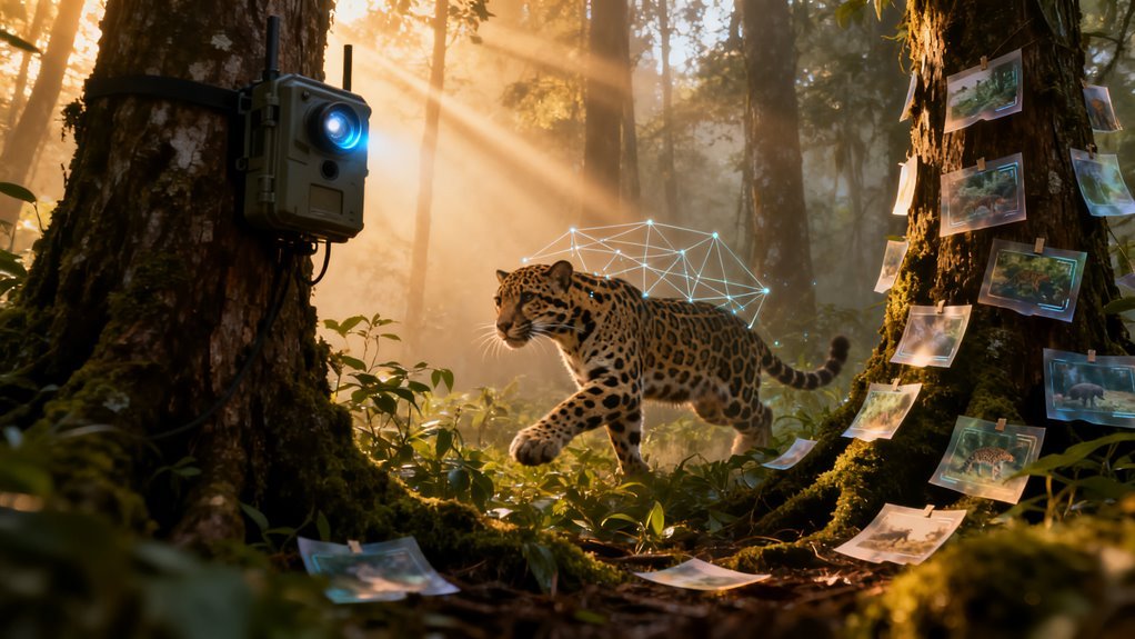
At the same time, camera trap projects exploded worldwide, generating millions of images that were impossible to label manually in reasonable time. In 2019 Wildlife Insights, built with Google technology, began hosting global camera trap archives in the cloud and running species identification models over the images, giving conservation scientists map based views of wildlife presence and population health. This is the backdrop against which Gemini and related tools are now being deployed.
What Gemini actually does for species identification
Several recent applications show how Gemini is being used as a flexible recognition and analysis layer on top of visual wildlife data. BioDetect is an educational web application that lets users upload photos of plants, animals or insects and receive a short, structured description of the organism. Behind the scenes a Python backend sends each image to the Gemini 1.5 Flash API, which returns a detailed narrative description that is then parsed into species names, key traits and habitat information.
This may sound simple, but it compresses what used to require an expert field guide and years of taxonomic experience into a workflow that runs in seconds for global users.
Developers have extended similar logic into broader experiences such as Backyard Safari. While public documentation is still emerging, the idea is to combine global biodiversity occurrence records, curated imagery and Gemini based guidance so that people can connect what they see in their garden or local park to much larger patterns visible in Earth observation data.
Conceptually this links three layers of information. First, the citizen or researcher supplies a ground photo or observation. Second, Gemini extracts candidate species names and ecological traits. Third, geospatial layers derived from satellites indicate where suitable vegetation, climate or water conditions exist for that species, helping users understand whether their sighting fits expected ranges or points to an outlier.
There is also growing interest in using Gemini Flash models for bird recognition workflows where photos are passed as encoded data and transformed into scientific names and common names in multiple languages, including English and several South Asian languages. This multilingual capability matters because many community scientists and park rangers work outside English speaking contexts, yet their data still needs to feed into global biodiversity platforms.
Video is a natural next step. One developer tutorial walks through a Gemini powered zoologist workflow in which a Colab notebook uploads a clip of an American black bear, configures Gemini with instructions to behave like a zoologist and returns both the common and Latin names of the species. The same pattern can be applied to camera trap videos or drone footage, especially when those clips include timestamps that can be aligned with satellite time series showing habitat change.
In practical terms, analysts can begin asking not only what species appears in a video, but also how vegetation cover, snow dynamics or water levels in that location have shifted around those observations over months or years.
SpeciesNet, MegaDetector and the ecosystem of wildlife models
Gemini sits within a broader ecosystem of models that have been steadily maturing. SpeciesNet is an open source classifier trained on more than sixty five million labeled images to identify roughly two thousand five hundred categories of mammals, birds and reptiles, providing species level predictions and confidence scores at the individual level. As an open-source model, SpeciesNet is now used by conservation projects worldwide to accelerate camera trap analysis and deepen understanding of wildlife behavior and habitat.
Coupled with object detectors such as MegaDetector it becomes possible to scan entire camera trap collections, locate the pixels that contain animals and assign species labels with high accuracy, while ignoring blank frames that show only moving vegetation or humans passing by.
Wildlife Insights operationalizes this combination at global scale. Camera trap projects upload their imagery to the platform and receive automated filtering of empty images plus mapped predictions of which species appear at each site. When these outputs are projected onto satellite basemaps and elevation models, planners can visualize strongholds for rare species, evaluate corridors and assess connectivity between protected and unprotected areas.
Gemini adds an extra layer here by offering more flexible description and reasoning. For example, it can turn a detection event into a short narrative summary of behavior or habitat context, or translate scientific names into local common names for community reporting, using the same core imagery inputs.
The satellite side of the story
As impressive as species recognition on ground imagery is, much of the real impact comes when it intersects with modern Earth observation. Recent work shows that satellite imagery can be processed with AI to detect deforestation, track changes in vegetation cover, monitor invasive species and assess ecosystem health across remote regions that are difficult or dangerous for humans to access.
High resolution optical imagery, multispectral data and radar are being used to build detailed habitat maps that are updated frequently rather than every few years. Companies and research consortia are already offering biodiversity monitoring services based on these capabilities.
Projects such as GUARDEN have combined satellite derived habitat indicators with AI based ecological models and citizen science data to produce scalable biodiversity risk maps and ecosystem service indicators. Firms like Gentian and Deep Planet train AI models on very high resolution satellite imagery to recognize and quantify habitat types, detect subtle shifts in vegetation structure or species composition and flag potential loss or degradation.
Other platforms focus on biodiversity net gain monitoring, using satellite imagery and AI to classify habitat types with high precision and feed those classifications into regulatory reporting and corporate nature strategies.
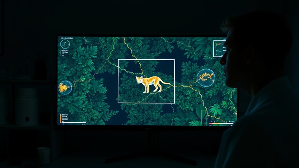
When Gemini style workflows are paired with these satellite products, the result is a multi scale view of wildlife. A single bear detected by a camera trap or a single bird recognized from a user photo is no longer just an isolated point. It becomes part of a dynamic landscape that can be analyzed for connectivity, pressure from land use change, climate exposure and restoration potential.
This is the kind of joined up picture conservation planners have been asking for since the early days of remote sensing.
Opportunities and early winners
The combination of Gemini, specialized wildlife models and satellite imagery opens several clear opportunities.
- Conservation organizations can process far more data with fewer staff, redirecting expert time away from manual labeling and toward strategic decisions about where to protect or restore.
- Governments and businesses can integrate biodiversity indicators directly into land use planning, infrastructure design and risk assessment, using AI generated maps to identify sensitive habitats before projects begin.
- Educators and citizen science platforms can offer engaging tools that help people identify species around them and place their observations on the same map layers used by professional scientists.
- Technology companies and startups gain a clear path to build products that turn raw imagery into actionable insights, from alerting rangers about potential poaching hotspots to monitoring progress toward nature related regulatory goals.
There is also a subtler benefit. When models like Gemini explain their classifications in natural language and translate field jargon into accessible terms, they bridge the gap between academic conservation science and the broader public. That makes it easier to build support for sometimes complex policies, such as restricting certain kinds of development in corridors that look ordinary to the untrained eye but are critical for migration.
Risks, limitations and what to watch carefully
Despite the promise, it is important to be realistic about what these systems can and cannot yet do. Training data for species recognition is still heavily biased toward charismatic and common species, while many rare or cryptic organisms remain underrepresented in photo archives.
Satellite resolution, even at sub meter scales, is not sufficient to detect small animals directly except in particular contexts, so most wildlife inferences rely on habitat proxies rather than direct counts.
Model errors are an unavoidable reality. Misidentifying a species in a citizen science app is mostly an educational issue, but misclassifying habitat suitability in a regulatory context could lead to projects proceeding where they should not, or conversely to unnecessary constraints.
There are also interpretability challenges. Complex deep learning pipelines that combine multiple data sources can be difficult for non specialists to audit, which complicates governance and trust.
Privacy and ethics present another layer. Camera traps often capture humans as well as animals, and satellite imagery can reveal patterns of human activity that communities may not want widely analyzed or shared. Platforms need clear policies for anonymization, data ownership and consent, especially when indigenous lands or local livelihoods are involved.
These topics are starting to appear in the scientific and policy literature, but standards are still emerging.
For Gemini specifically, there are questions about transparency and long term access. Conservation projects benefit from stable, open tools and documentation. If powerful models are only available through proprietary platforms, there is a risk that essential monitoring capabilities become dependent on commercial decisions rather than conservation needs.
That makes open source models such as SpeciesNet and community tools like MegaDetector strategically important complements, even as teams experiment with Gemini for higher level reasoning and multilingual support.
How this changes the next decade of wildlife work
Taken together, Gemini powered species identification, specialized wildlife classifiers and satellite based habitat analysis are moving biodiversity monitoring from a patchwork of local projects toward an integrated global system.
In the near term, expect to see more conservation programs adopting platforms that combine camera trap analytics, satellite habitat maps and AI driven dashboards, along with educational tools that bring the same insights to park visitors and community scientists.
Over the next decade the most significant changes may be cultural rather than purely technical. As ecologists, technologists and local communities learn to work with these tools, the practice of conservation could shift from static reports and occasional surveys to continuous monitoring and adaptive management informed by near real time data.
Gemini will not replace field biologists or local knowledge, but it can become a trusted assistant that helps them see patterns in the noise, spot early warning signals and communicate those findings clearly across disciplines and borders. The projects appearing today are early steps in that direction, and how responsibly they are developed and governed will determine whether this technology becomes a lasting foundation for protecting the worlds remaining wildlife.
Frequently Asked Questions
How Does Google Ensure Gemini’s Satellite Wildlife Data Respects Local Conservation Laws?
The way Google is threading Gemini into satellite wildlife monitoring matters right now because conservation is shifting from scattered field projects to always-on planetary analytics, and the legal safeguards need to scale with it. Regulators, park managers, and local communities are increasingly sensitive to how wildlife data is collected, processed, and exposed, especially when it can reveal the presence of endangered species or human activity in protected areas. Gemini and Google Earth AI sit directly in that tension, so the question is not only what the models can do, but how they are constrained to respect local conservation laws and data protection rules.
From camera traps to Earth scale wildlife intelligence
Modern wildlife monitoring did not start with satellites. It grew out of camera trap networks, research repositories, and community science platforms, all of which had to confront the risk that precise location data could help poachers rather than protect species. Wildlife Insights, the global camera trap platform that Google helps power, is a good example of how the field responded. It was designed to promote open data for conservation while deliberately masking sensitive information, especially for threatened species and images that include people.
Over time, Wildlife Insights and similar projects developed a set of geoprivacy practices. Exact coordinates for vulnerable animals were replaced by fuzzed locations, central study points, or randomized identifiers so that the public could see general distribution patterns without being able to navigate to a specific site. Community science tools such as iNaturalist adopted comparable approaches, offering open, obscured, and private location settings so observers and project leads could decide how much precision to reveal. Those practices became the informal baseline for responsible wildlife data handling before large multimodal models like Gemini entered the scene.
The next step was to move beyond single projects and camera traps into integrated views from satellites, climate data, and demographic layers. Google Earth AI, which is built on Gemini, takes decades of satellite imagery and environmental data and turns them into regional and global analytics that can be computed in minutes. That evolution makes compliance with conservation law more complex because now a single platform can infer habitat trends, species pressure, and land use conflicts at a national scale.
How Gemini and Earth AI handle wildlife data
Google positions Earth AI as a system that connects satellite imagery, climate records, population maps, and other geospatial layers to support analysis of biodiversity, deforestation, and nature loss. Within wildlife applications, Gemini models are used to detect patterns, build habitat models, and generate derived analytical products rather than expose raw, project-level data to general users. The terms used around Wildlife Insights show the design philosophy that carries over to this satellite-based layer.
Wildlife Insights explicitly allows its data to be used to develop and improve computer vision models, but only for conservation-related technology. It also allows derived regional and global analytical products that aggregate information at spatial scales such as national or regional level, with a clear commitment that these outputs will not identify individual projects or precise locations. In practice, that means wildlife data flowing into Gemini-powered systems is governed so that the models and dashboards highlight patterns across landscapes rather than show pinpoint coordinates for endangered animals.
This separation between raw data and derived products is central to legal compliance. Conservation statutes and data protection laws rarely object to high-level habitat or trend maps; what they worry about is exposure of precise sites, human faces, or culturally sensitive locations. By design, Earth AI emphasizes aggregated insights aligned with those expectations, while more detailed information sits behind additional controls or remains with the original data providers.
Respecting local conservation laws and data protection rules
Local conservation laws intersect with wildlife data in several ways. They may restrict disclosure of the locations of endangered species, regulate how images of people in protected areas are handled, or require permits before certain kinds of ecological information are shared with third parties. Wildlife Insights addresses these concerns through a combination of access policies, species-based sensitivity rules, and embargo mechanisms that are highly relevant to Gemini-powered satellite workflows.
A core safeguard is the sensitive species list. Wildlife Insights treats all terrestrial vertebrates that are listed as Critically Endangered, Endangered, or Vulnerable on the global Red List as sensitive, along with species protected under trade conventions such as CITES when they are hunted for commercial purposes. For any deployment that records sensitive species, public access to exact locations is restricted, and the platform replaces them with fuzzed coordinates that are averaged with other locations and truncated to a precision of about zero point one decimal degree, which corresponds to roughly eleven kilometers.
Public data downloads never include exact locations of deployments capturing sensitive species, they omit images of humans, and they exclude data from embargoed projects. Instead, users see general study area positions, fuzzed coordinates, and randomized deployment identifiers so that they cannot reconstruct the exact site from the metadata. Images of humans are not displayed or made available in public downloads, though metadata can record that a person was present at a camera location, which helps balance privacy obligations with research needs.
Embargo options provide another layer of legal compliance. Wildlife Insights allows data providers to embargo project data for up to forty-eight months before it becomes public, and during that period, the full dataset remains restricted. Access to any data, including embargoed projects and sensitive species records, can be limited to platform staff, trusted contractors, and designated users, with data providers assigning roles and permissions inside their organizations. When external researchers or agencies need exact locations, they must contact the project owner directly and request access, which allows the owner to factor in local regulations and community agreements before sharing.
For Gemini and Earth AI, these mechanisms function as input constraints and governance rules. Satellite-derived wildlife products can be generated in a way that respects embargoes, sensitivity categories, and access permissions, so that any publicly visible outputs remain compatible with local conservation requirements and data protection standards.
Technical safeguards: coordinate fuzzing and controlled access
The technical details of how location information is handled matter as much as the broad policies. Wildlife Insights does not simply round coordinates; it systematically alters them and strips contextual metadata so that reverse engineering becomes harder. For deployments capturing sensitive species, exact coordinates are replaced by values that have been averaged with other locations and truncated to around zero point one decimal degree. Location names are removed and deployment identifiers are randomized in public datasets, breaking simple attempts to match a project back to a site.
These practices mirror wider geoprivacy methods in conservation data science. Studies of the risk that poachers could find animals using public camera trap images note that Wildlife Insights and community science platforms have adopted obfuscation as a standard practice. Tools such as iNaturalist explicitly provide options for obscured locations, where the displayed point is randomly placed within a broader region, and for private locations, where the coordinates are hidden entirely. The convergence of these methods shows a shared understanding that precise geospatial data requires protection, especially when it relates to vulnerable species.
Access control is equally important. Wildlife Insights restricts access to the full dataset to platform staff, contracted partners, and data providers, who can manage user-level permissions and decide who in their organizations or partner networks can view sensitive information. Public downloads automatically remove sensitive elements by default, including coordinates for sensitive species, images of humans, and data from embargoed projects. When more detailed information is required, such as exact locations for field interventions, a formal request process routes the decision back to the project owner, reinforcing local stewardship.
Similar principles appear in other repositories, where the locations of endangered species are masked by assigning them to central project points rather than true coordinates in publicly accessible views. There is also emerging guidance on how AI-powered drones and satellite imagery should be handled in legal contexts, including the expectation that outputs used as evidence are accompanied by compliance certificates that document how they were generated and stored. Together, these technical and procedural safeguards create a governance fabric that Gemini-based systems can rely on when they ingest and process wildlife data.
Implications for conservation practice, regulators, and businesses
These safeguards have practical implications for conservation practitioners. On the positive side, they allow broad sharing of habitat models, trend analyses, and species distribution maps without exposing individual animals or communities to unnecessary risk. Poachers cannot simply query a public interface to find precise camera locations for endangered species, and people captured inadvertently in camera trap images are protected from public exposure. At the same time, park managers, nonprofits, and governments gain access to regional analytics that can inform land use planning, reserve design, and enforcement strategies.
For regulators, Gemini and Earth AI backed by Wildlife Insights style governance offer an example of how advanced analytics can be aligned with local laws. Aggregated outputs that avoid naming sites or individuals are easier to reconcile with privacy statutes and conservation rules than raw feeds of coordinates and imagery. Embargo periods, sensitive species categories, and consent-driven access requests give local authorities and project owners room to honor community agreements and indigenous rights before data moves across borders.
Businesses, particularly those involved in biodiversity reporting and nature-related financial disclosures, can leverage these systems to quantify impacts and dependencies without direct exposure to sensitive micro-level data. Earth AI enables rapid generation of indicators from decades of satellite imagery and climate records, which can feed into corporate risk assessments and sustainability strategies. However, firms still need strong internal controls to ensure that any downstream use of derived wildlife data respects the original legal conditions and does not reidentify sensitive sites through unintended combinations of datasets.
There are trade-offs. Fuzzing coordinates by roughly eleven kilometers and relying on central study points reduces analytic precision for some ecological questions, especially those that depend on fine-scale microhabitat information or detailed movement paths. Researchers may find themselves navigating more complex access processes to obtain the exact data required for specific studies, which can slow down urgent work in fast-changing landscapes. There is also the ongoing risk of function creep, where data originally collected for conservation could be repurposed for activities that conflict with local values or laws if governance weakens.
Legal frameworks are still catching up. AI-powered satellite imagery and sensor networks introduce new questions about how evidence is validated, what counts as acceptable surveillance of wildlife or people, and how liability is allocated when automated systems misinterpret patterns. Certificates and audit trails help, but regulators will likely demand more detailed documentation of how Gemini-derived wildlife insights are produced, including the models used, training data sources, and the precise steps taken to protect sensitive information.
Open questions and future directions
Despite the progress, several open questions remain. Sensitive species lists need constant updating as conservation status changes, and they may need to be tuned to local contexts where culturally important species require protection even if they are not globally threatened. Embargo rules might need more nuanced options, such as partial embargoes where some data fields are shared and others withheld, or dynamic embargoes that adjust as conservation risks rise or fall.
Consent and governance will likely move toward more participatory models. Indigenous communities and local landholders increasingly expect direct involvement in decisions about how ecological data from their territories is used. Access control systems in Wildlife Insights already allow project owners to decide who gets detailed information, but future frameworks may incorporate formal community-level permissions and veto rights. For Gemini and Earth AI, that could mean integrating consent registries or community governance APIs into model pipelines.
There is also a technical frontier. As generative models become better at filling in missing detail, there is a risk that aggregated outputs could be combined with other datasets to infer sensitive locations indirectly. Addressing that risk will require careful evaluation of how different layers interact and may lead to new standards for differential privacy or geospatial anonymization in conservation analytics. Research on how poachers or other bad actors might exploit public wildlife datasets will continue to inform those standards.
Finally, international coordination will be crucial. Conservation law is fragmented, and satellite-based insights ignore borders by design. Google and its partners will need to keep aligning Earth AI practices with evolving guidance from conservation organizations, scientific bodies, and regulators, while maintaining transparency about how Gemini models interact with wildlife data. Independent audits, open documentation, and collaboration with the wider conservation tech community will be essential for sustaining trust.
Key takeaways and what comes next
Gemini and Earth AI show that it is possible to scale wildlife analytics to the level of continents while keeping sensitive information under tight control through a mix of technical obfuscation, role-based access, and legally informed governance rules. Wildlife Insights has already operationalized many of these safeguards, including fuzzed coordinates for endangered species, hidden location names, randomized deployment identifiers, embargo mechanisms, and strict limits on public access to images of humans. Those practices provide a foundation for ensuring that satellite wildlife data respects both the letter and the spirit of local conservation laws.
The next decade will test how robust these arrangements really are. As more governments and businesses rely on Gemini-powered environmental intelligence, expectations for accountability, transparency, and community participation will rise. Success will depend not just on model performance, but on continuous refinement of data protection practices, strong legal frameworks, and genuine collaboration with the people who live alongside the wildlife these systems aim to protect. If that happens, satellite wildlife monitoring can become a pillar of conservation rather than a new source of risk, turning global scale sensing into a tool that truly serves local ecosystems and communities.
Can Indigenous Communities Access Gemini’s Wildlife Identification Data for Stewardship Purposes?
Indigenous communities can access wildlife identification data produced with Gemini and similar AI systems, but that access is largely indirect and conditional on how platforms, contracts, and Indigenous governance frameworks are set up. In practice, the real question is less about whether Gemini is available and more about who controls the data pipelines, what consent was given, and whether Indigenous data sovereignty is respected at every step.
Why this matters right now
Wildlife monitoring is shifting from field notebooks and manual surveys to vast networks of camera traps, acoustic sensors, and cloud-based analytics. AI models like Gemini can classify species, flag rare sightings, and turn millions of images into usable conservation intelligence in hours rather than months. That new speed and scale is arriving exactly when Indigenous communities are asserting strong rights over environmental data tied to their lands, waters, and territories.
Indigenous data sovereignty frameworks argue that data about Indigenous territories is not just scientific information. It is also political power, cultural knowledge, and sometimes evidence in resource disputes. That means any system that touches wildlife data on Indigenous lands, including Gemini-based workflows, has to be evaluated against principles of ownership, governance, consent, and benefit sharing, not just computational accuracy.
What Gemini actually offers in wildlife monitoring
Gemini is a general-purpose multimodal AI system that can be used to recognize animals, classify habitats, and summarize sensor data. By itself, it does not own or host conservation datasets. Instead, Gemini is integrated into tools and platforms that manage wildlife images, sounds, and metadata, often run by governments, universities, nongovernmental organizations, or companies.
Public conservation databases already show what this ecosystem looks like. The Collection of Biodiversity Information Sources maintained by the Government of Canada aggregates a range of resources, including bird monitoring networks, tree and insect databases, and platforms that store camera trap and acoustic data.
WildTrax, for example, provides a system where proponents can upload, manage, and analyze data from autonomous recording units and camera traps, keep data private during assessment, and then choose to make interpreted data openly available through WildTrax or NatureCounts. These platforms can be powered by AI models such as Gemini without changing the underlying governance questions: who owns the data, who can download it, and whose laws and customs apply.
A parallel model is emerging through Indigenous-led AI projects. In northern Australia, Indigenous ranger groups have developed wildlife monitoring systems that use AI to classify species from camera trap images while keeping raw image data under strict access controls. In one case, an open access species identification model was shared publicly, but the underlying images remained restricted in recognition of Indigenous data sovereignty rights of Traditional Owners, whose Country hosts the species being monitored.
This illustrates how AI capability can be decoupled from raw data access, which is critical for Indigenous control.
Pathways for Indigenous communities to access AI processed wildlife data
Indigenous communities can already access a wide range of conservation datasets that either are AI processed today or can be processed with tools like Gemini. Open registries and biodiversity platforms give a sense of what is possible when communities themselves choose what to share.
The global ICCA Registry is a public database of territories and areas conserved by Indigenous Peoples and local communities, sometimes called territories of life. Communities self-report information about their conserved areas, including geographic data, case studies, and imagery, and can download the database for analysis or visualization.
That data can be combined with AI tools to support planning, advocacy, and reporting, but the key point is that communities control the decision to submit and share their information.
In Canada, the Indigenous Guardians program supports Indigenous stewardship over traditional lands, waters, and ice, and provides an interactive map of funded initiatives. This map includes project descriptions and locations and can be used as a base layer for more detailed wildlife monitoring, including AI-enhanced analysis of camera trap and acoustic data.
Again, Indigenous organizations decide which projects participate and how much information is shared.
Historical experience shows that when Indigenous communities run environmental monitoring themselves, they become central creators and users of wildlife data. A long-term study of large-scale environmental monitoring by Indigenous Peoples reported that locally trained Indigenous technicians recorded tens of thousands of wildlife sightings and other ecological observations along many thousands of kilometers of transects.
The study found that the deep ecological knowledge of subsistence-oriented communities made data collection more accurate, and that Indigenous participation was essential for effective management of local ecosystems. That same logic applies to AI. The more that data collection and interpretation is led by Indigenous stewards, the more AI systems like Gemini can serve local priorities rather than external agendas.
Indigenous data sovereignty and OCAP in the age of Gemini
Access to Gemini-enabled wildlife data is only meaningful if it aligns with Indigenous data sovereignty. Indigenous data sovereignty is generally defined as the right of Indigenous Peoples to govern the collection, ownership, and application of data about themselves and their lands.
It includes both individual rights and collective rights, covering everything from access and privacy to decisions about how data can be used in research, policy, or commercial projects.
For many First Nations, these principles are expressed through OCAP, which stands for ownership, control, access, and possession. OCAP states that Indigenous communities collectively own information in the same way that individuals own their personal data, that communities must retain decision-making authority over how data is collected and used, that all community members must have access to information about themselves, and that actual possession of data infrastructure matters because it influences who can see and act on the data.
When wildlife datasets are stored on remote servers operated by large technology companies, OCAP raises questions about whether communities truly hold ownership and possession or whether they remain dependent on external service providers.
Work on Indigenous mapping in the cloud has flagged significant concerns. Analyses of First Nations use of tools such as Google geo services note that contracts are often pre-written without Indigenous input, that data stored in corporate clouds is ultimately possessed by the company rather than the community, and that governments may have legal and technical mechanisms to access data even when it is marked private or protected.
These findings underline that placing wildlife monitoring pipelines in the cloud, including Gemini-based systems, can weaken Indigenous control unless contracts, governance, and technical architecture are redesigned in line with Indigenous data sovereignty principles.
Scholars and practitioners working on environmental data rights have proposed practical steps to recognize Indigenous authority. Recommendations include scrutinizing institutional practices, improving permitting processes for accessing Indigenous lands, building collaborative relationships with Indigenous rights holders, and ensuring that data collection protocols incorporate cultural knowledge, such as using Indigenous place names and local categories.
They also emphasize agreements that clearly state who can grant access to data, when elders or cultural keepers must be consulted, and how online data must be cited with explicit indications of whether Indigenous permission was obtained and how content may be used. These ideas map directly onto AI-based wildlife monitoring.
Using Gemini under Indigenous governance
The most promising arrangement is not open Gemini access to any wildlife data, but Gemini workflows that operate under Indigenous governance from end to end. This means that Indigenous organizations decide which camera traps are deployed, which datasets are ingested, which AI models are used, and what happens to outputs.
In an Indigenous-led project, Gemini could run inside a cloud environment that is contractually structured to give an Indigenous nation control over data retention, access rules, and cross-border transfers. Data ingestion could be restricted to images and recordings collected under free, prior, and informed consent.
Model outputs could be stored in repositories governed by Indigenous institutions, with clear rules about which summaries are public and which stay within the community. The Warddeken example shows that this is technically feasible. There, Indigenous rangers work with AI models for wildlife monitoring while keeping raw images private and explicitly acknowledging Indigenous data sovereignty rights of Traditional Owners.
The model is shared openly, but the sensitive data underpinning it remains under Indigenous control.
At the same time, existing experiences with mapping in the cloud reveal structural limits. If Gemini is available only through platforms whose contracts and infrastructure are owned by large companies, then Indigenous control depends on what those contracts allow.
Without explicit Indigenous negotiation, pre-written terms and external possession of data can undermine ownership and sovereignty, even when communities can log in and download outputs. That is a gap between technical capability and political legitimacy.
Opportunities, risks, and practical implications
From a technology perspective, Gemini and similar AI systems can dramatically enhance wildlife stewardship. They can make it possible to process continuous flows of sensor data, detect changes in populations quickly, and integrate Indigenous observation records with national and global biodiversity datasets.
When these systems are configured under Indigenous governance, they can amplify Indigenous environmental authority, support guardianship programs, and help communities demonstrate the conservation value of their territories in forums such as the ICCA Registry.
From a business perspective, conservation technology companies and cloud providers have an opportunity to redesign their offerings in collaboration with Indigenous communities. That might involve co-developing data governance frameworks that embed Indigenous data sovereignty and OCAP principles into platform settings, revising terms of service to recognize Indigenous ownership, and allowing data residency on servers selected by Indigenous nations.
Companies that succeed in this will be better positioned to support long-term conservation partnerships rather than short-term data extraction.
The risks are equally real. If Gemini-enabled wildlife identification data flows out of Indigenous territories without clear consent, it can be used to support resource extraction, external conservation agendas, or surveillance that conflicts with local priorities.
If governments can access raw data stored in corporate clouds, they may use wildlife information in ways that communities did not intend, such as enforcing policies or regulations that lack local support. If Indigenous voices are absent from AI project design, the resulting systems may misrepresent ecological knowledge or ignore culturally important species and relationships.
So can Indigenous communities access Gemini wildlife data for stewardship
In practical terms, Indigenous communities can access wildlife identification data produced using Gemini in two main ways. They can use public or shared conservation platforms where AI-processed data, such as interpreted camera trap records, is available for download to any registered user, including Indigenous organizations.
They can also design and run their own Gemini-based workflows under Indigenous governance, keeping raw data under Indigenous control and deciding which outputs to share more widely.
The crucial point is that meaningful access is not just a technical issue. It depends on Indigenous data sovereignty, OCAP principles, robust consent processes, and institutional agreements that recognize Indigenous authority over environmental data.
The future of Gemini in wildlife stewardship will be decided less by model architecture and more by whether communities can own the data pipelines that feed and are fed by those models, on their own terms.
What Biases Might Gemini Have When Detecting Wildlife Across Different Global Ecosystems?
Artificial intelligence is quietly reshaping how the world measures biodiversity. Tools such as Gemini are starting to sit between raw images, sensor feeds and conservation decisions, from national park monitoring to corporate nature reporting. That makes a simple question urgent rather than academic. When Gemini looks at wildlife, which parts of the planet does it truly see, and which does it misread or ignore?
How We Got Here: Biased Data And Tech Centred On The Global North
Long before AI entered the picture, biodiversity data was uneven. Large databases and citizen science platforms have been built around researchers and volunteers who mostly live in high income countries and work near roads, cities and protected areas that are easy to reach. This has produced strong geographic and taxonomic skews. Populated regions in the Northern Hemisphere are heavily sampled, while vast areas of the tropics, drylands, deep oceans and Indigenous territories remain data poor.
Recent policy analyses note that existing biodiversity datasets overrepresent common species, accessible habitats and Global North locations, and underrepresent threatened taxa, remote ecosystems and non charismatic organisms such as plants, fungi and invertebrates. Large language models and vision systems trained on these datasets inevitably inherit those imbalances. They then project the same patterns back into maps, species lists and risk assessments that decision makers increasingly rely on.
What The Sonar Research Reveals About Gemini
A recent comparative study that evaluated several AI assistants, including Gemini, against the International Union for Conservation of Nature Red List showcases these biases clearly. The researchers asked each system to list endangered species and then compared the responses to authoritative conservation data. They found pronounced taxonomic and geographic bias in all tools, with Gemini often showing the widest spread between overrepresented and underrepresented regions.
In numeric terms, Gemini substantially overestimated endangered species from North America while underestimating those from Central America, Africa and Asia, resulting in a very high positive bias ratio for North America and strongly negative values for parts of the Global South. This pattern matches broader evidence that biodiversity information produced by AI systems tends to lean heavily toward well studied regions in the Global North, and to replicate long standing knowledge gaps elsewhere.
Taxonomically, the same study found that all evaluated tools favoured mammals and birds, while plants, fungi, insects and arachnids were consistently underrepresented. Gemini listed a relatively high fraction of vertebrates compared with the true composition of endangered species, illustrating a clear preference for large, conspicuous life forms that are prominent in media and research imagery. These results echo what ecologists have observed for years. Data collection and funding gravitate toward charismatic species, and AI systems trained on those data mirror that focus.
Translating Knowledge Bias Into Wildlife Detection Bias
The Sonar findings focus on textual knowledge and species lists rather than direct image detection, but the underlying mechanisms are the same. Gemini learns from a world in which most labeled wildlife images and monitoring records come from temperate zones, accessible landscapes and high income countries. Camera trap networks, for example, are often dense in North American and European reserves and sparse in many tropical forests and community managed lands, making those under sampled ecosystems effectively silent to the model.
Studies of AI models used with wildlife camera traps show that classifiers trained in one region can suffer sharp drops in accuracy when applied elsewhere, because they latch on to background scenery and local lighting conditions rather than purely on animal morphology. In some cases, object detectors mistake ice patches, shadows or human infrastructure for animals, or fail to recognise species when the vegetation structure and context differ from what the model has seen before. Gemini is subject to the same issues when it interprets images or videos of wildlife in ecosystems that diverge from its training distribution.
Put simply, Gemini is more reliable in open landscapes with sparse vegetation, clear sightlines and familiar colour palettes, where large mammals and birds stand out against the background. It is more likely to struggle in complex habitats such as dense forests, wetlands, coral reefs and structurally intricate grasslands, where small or cryptic species blend into the environment and where ground truth data are limited or uneven. Aquatic biodiversity research has documented similar problems. Models trained mainly on temperate freshwater systems often misclassify species in tropical waters because they have seen too few examples of those taxa and habitats.
Geographic And Sociocultural Blind Spots
The geographic bias measured in the Sonar study has direct implications for real world wildlife detection. When Gemini operates over imagery from North America or Europe, it is working in regions that appear far more often in the training data, and where citizen science platforms, research networks and protected area monitoring programs are strongly established. Its confidence scores and suggested species labels are therefore more likely to align with reality.
In contrast, remote landscapes in Central America, large parts of Africa and Asia, and many Indigenous territories contain rich biodiversity but poor digital representation. One recent analysis warns that tropical rainforests, grasslands and wetlands in the Global South risk becoming silent samples in AI systems because the sensors and observers needed to populate those datasets are concentrated elsewhere. Another study of ecological restoration content generated by chatbots showed that information related to high income countries was nearly eight times more frequent than that from low and lower middle income regions, and that Indigenous and community led practices were largely overlooked.
Those findings do not prove that Gemini is uniquely biased against Indigenous lands or Southern ecosystems, but they highlight a structural imbalance in the knowledge environment that Gemini depends on. If most of its examples of successful conservation and well documented wildlife come from Northern institutions and landscapes, its internal expectations about where biodiversity lives and how it is managed will skew accordingly. That can translate into under detection of species, misinterpretation of habitat quality and weak recognition of locally grounded stewardship when the model is pointed at areas far from its core data sources.
The Role Of Presence Only Citizen Science And Imbalanced Imagery
Much of the species occurrence data that feeds modern AI systems is presence only, meaning it records where species have been observed but not where they were searched for and not found. When combined with opportunistic sampling and heavy reliance on citizen science in cities, parks and roadside environments, these datasets create strong spatial and environmental biases.
Species distribution models that rely on such presence only data can mis estimate both the range and the apparent abundance of organisms, especially when under sampled habitats and remote regions are treated as if absence in the data equals absence in reality. Research on explainable AI for biodiversity monitoring notes that models trained on opportunistic or poorly balanced datasets tend to learn shortcuts based on background habitat rather than the ecological signals of interest, and that presence only inputs are particularly prone to these issues.
For Gemini, the consequence is that its internal picture of where wildlife lives and how common it is will be skewed toward places and species that generate many images and citizen reports. Sparse data for small, elusive or culturally under recognised species mean the model has fewer examples to learn from, which in turn lowers its ability to detect those organisms and increases the risk that it will misinterpret their habitat suitability or conservation status.
Why This Matters For Technology, Businesses And Society
From a technology perspective, the key lesson is that Gemini is not an objective wildlife sensor. It is a pattern matcher shaped by biased ecological data and by design choices that optimise performance on abundant imagery and familiar species. The consistency of taxonomic and geographic skew across different AI tools in the Sonar study suggests that these are ecosystem level problems, not quirks of a single product.
Businesses that integrate Gemini into sustainability reporting or environmental risk assessment workflows need to recognise that the model will be more reliable for projects in well studied Northern landscapes than for operations in data scarce regions. If a company uses Gemini to help prioritise conservation spending, there is a real danger that it will amplify existing biases by highlighting species and habitats that are already visible in global datasets while downplaying those that remain under documented but highly threatened.
For conservation organisations and public agencies, these biases touch on questions of justice. Analyses of AI chatbots in ecological restoration show that reliance on Northern sources can marginalise diverse expertise and erase Indigenous and community led practices from the narrative. When models like Gemini are used to summarise evidence or guide project design, that invisibility can translate into real inequities in funding and recognition. Species and ecosystems that fall outside the technical comfort zone of the model may struggle to compete for attention even if they are biologically and culturally significant.
Managing The Risks And Using Gemini Responsibly
None of this means Gemini is useless for wildlife work. AI can dramatically speed up the processing of camera trap images, satellite scenes and acoustic recordings, and it can help uncover patterns that would be difficult for humans to detect unaided. However, the current evidence suggests that Gemini should be treated as a tool that is most effective in data rich regions and for conspicuous organisms, and that its outputs need careful validation in remote, complex or socially marginalised landscapes.
Several practical strategies emerge from the research. First, teams should demand transparency around the ecological training data and intended use cases for any Gemini based wildlife workflows, so that they can judge whether their target ecosystems resemble the environments that the model knows well.
Second, they should pair Gemini with local expertise and fresh field data, especially in Indigenous territories and tropical or under sampled habitats, rather than treating the AI as a standalone authority. Third, they should actively direct monitoring and data collection efforts toward underrepresented taxa and regions, which can gradually correct the skew in the underlying datasets and improve model performance over time.
Takeaways And What To Watch Next
The core takeaway is that Gemini sees wildlife through a lens shaped by biased biodiversity data. It is more at home in the Global North than in many parts of the Global South, more attuned to large vertebrates than to plants, fungi and small invertebrates, and more comfortable in open, well sampled habitats than in dense forests, wetlands and other complex ecosystems. Presence only data and imbalanced imagery further distort its view of species ranges and habitat suitability, especially in places and communities that have historically been excluded from mainstream conservation science.
Looking ahead, the most important work is not just to refine Gemini’s algorithms but to rebalance the ecological data landscape it depends on. That means investing in monitoring in remote and Indigenous territories, documenting neglected taxa, and building collaborative pipelines that allow local knowledge holders to shape how AI systems interpret their lands and waters. If those changes happen, Gemini could evolve into a more equitable partner for global biodiversity monitoring. If they do not, its wildlife detection will continue to mirror old biases in new digital form, reinforcing the very conservation gaps that AI was supposed to help close.
How Often Is Gemini’s Wildlife Detection Accuracy Independently Audited by Third Parties?
The short answer is that there is no evidence of any regular independent third party audit focused specifically on Gemini’s wildlife detection accuracy, especially on high resolution satellite or conservation imagery. Public documentation and safety reports describe general model evaluations and audit logs for usage, but not a recurring, domain specific accuracy audit for wildlife detection, so the true frequency of such checks remains unknown.
Why This Question Matters Right Now
Wildlife conservation is increasingly data driven. Satellites, drones and camera traps feed vast streams of imagery into machine learning systems that promise to spot animals, flag poaching risks and track habitat change in near real time. When an advanced model like Gemini enters that picture, the stakes rise quickly. Conservation teams want to know not only whether the model works in principle, but whether its wildlife detection accuracy has been rigorously validated by experts without a direct stake in the product’s success.
Independent auditing has become a central trust mechanism for AI. In areas like financial services and medical devices, external evaluations help separate marketing claims from measurable performance. For wildlife detection and remote sensing, that level of scrutiny is still emerging, and Gemini’s ecosystem is a clear example of how far there is to go.
What Google And Gemini Actually Audit Today
Google’s own responsible AI guidance describes a layered evaluation framework for models like Gemini. It distinguishes development evaluations carried out during training, assurance evaluations performed by groups outside the core development team, and external evaluations by independent domain experts. These processes primarily focus on safety and policy compliance, including areas such as biohazards, persuasion and cybersecurity capabilities. They are important, but they are not described as ongoing audits of wildlife detection accuracy in conservation imagery.
Safety and factuality guidance for the Gemini API similarly centers on benchmarking for harmful or unsafe outputs, and recommends automated testing regimes rather than traditional human red teams in many cases. Again, this is about safety risk, not ecological detection reliability.
On the infrastructure side, Google Cloud provides extensive audit logging for services that underpin Gemini deployments. Vertex AI and the Gemini Enterprise Agent Platform support audit logs that record admin activity, data access and system events, which organizations can query through Cloud Logging and related tools. Those logs are vital for security, compliance and traceability, but they track who used a model and how, not whether its wildlife detections were objectively correct.
Google has even started publishing work on measuring the environmental impact of AI inference, including energy and emissions data, and explicitly notes that some claims in that area are not yet verified by independent third parties. That kind of disclosure shows a willingness to acknowledge where external validation is missing. It also underlines that many aspects of Google’s AI portfolio remain internally assessed rather than externally audited.
The Missing Piece: Wildlife Detection Accuracy
Within the available documentation and public reports, there is no description of a dedicated, recurring audit program in which independent conservation or remote sensing experts systematically test Gemini’s wildlife detection performance on large scale satellite or drone imagery. When audits and evaluations are mentioned, they focus on broad safety properties or general capabilities, not on whether Gemini can consistently and correctly identify animals in diverse ecological settings.
There are external evaluations that touch adjacent areas, but they paint a fragmented picture. One independent study compared Gemini with another large model on image classification tasks and included wildlife among several categories. The authors found that Gemini lagged behind the comparator model on overall accuracy and struggled particularly with more complex image types. This provides a useful empirical signal, yet it was a research exercise on mixed image data, not a formal audit of conservation grade wildlife detection systems.
Another field test looked at Gemini’s live camera mode for rare plant identification across several bioregions. After months of work, the investigators concluded that Gemini could be helpful as a support tool but was not reliable enough for regulatory or scientific decision making, with species level accuracy around a quarter in challenging categories and a clear warning against using the system for compliance work. The test demonstrates the kind of domain specific evaluation conservation practitioners care about, but it was focused on plants at ground level rather than large scale wildlife detection from imagery.
Taken together, these examples show that independent groups are beginning to probe Gemini’s visual performance in ecological contexts, yet they are not structured as regular third party audits with published schedules, standardized wildlife detection datasets and transparent reporting structures.
How Gemini Is Evaluated In Practice
Another dimension is who actually reviews Gemini’s outputs on a day to day basis. Reporting on the human evaluation pipeline for Gemini indicates that contractors are sometimes asked to assess responses even when they lack deep domain expertise in the topics at hand. Earlier guidance reportedly encouraged evaluators to skip prompts they did not fully understand, but more recent instructions push them to rate aspects they grasp and simply note their limited expertise for the rest.
That system can work reasonably well for general consumer queries, but it is not a replacement for specialized ecological validation by wildlife biologists, remote sensing scientists or conservation technologists. In frontier safety work, the Gemini model card and associated safety framework describe external testing by third party evaluators, including scenario based red teaming for chemical and biological risks. Those evaluations are more formal and include structured threat modeling for catastrophic scenarios, with results summarized in terms of alert thresholds and risk levels. However, they once again focus on preventing dangerous misuse, not on measuring the everyday accuracy of wildlife or habitat detection tasks.
The net effect is that Gemini benefits from a mix of internal safety benchmarking, infrastructure level audit logs and some external stress tests for high risk domains. None of these, at least in public documents, amount to a dedicated wildlife detection audit regime.
Why The Gap Matters For Conservation Work
For conservation organizations, wildlife detection is not an abstract metric. It underpins poaching alerts, species distribution models, impact assessments for infrastructure projects and monitoring for climate driven habitat changes. An AI system that overestimates wildlife presence can send scarce patrol resources to the wrong place. One that underestimates presence can miss critical breeding grounds or fail to catch illegal activity until it is too late.
The plant identification field test highlights how fragile ecological performance can be even when a model appears competent in everyday scenarios. The testers found that Gemini’s live camera mode struggled in rare and cryptic species categories, and explicitly advised against relying on it for regulatory decisions because the error rates exceeded acceptable scientific and legal thresholds. That is a cautionary tale for wildlife detection as well. Without careful auditing, similar weaknesses could undermine satellite based animal monitoring programs.
In sectors such as finance and healthcare, independent audits and certifications emerged partly because mistakes carried clear economic or regulatory consequences. Conservation often operates with fewer formal compliance requirements and tighter budgets, which makes external audits harder to fund and organize. Yet the ecological cost of misclassification can be just as serious, especially when decisions affect endangered species or indigenous communities.
Comparing Wildlife Detection To Other Audited Areas Of AI
One way to understand the current situation is to look at where independent auditing has already taken root around Gemini. Frontier safety evaluations prioritize catastrophic risk scenarios in areas like chemical and biological misuse and cybersecurity sabotage. External evaluators design tests to probe whether models could meaningfully assist harmful actors, and Google reports that recent Gemini versions did not cross new alert thresholds in those domains. This is a structured audit process, but its target is extreme misuse, not basic detection accuracy.
Responsible AI guidance describes standardized assurance evaluations across modalities, with carefully managed datasets and consolidated feedback loops. Those evaluations test safety policies and capability boundaries but are not framed as domain specific performance audits for conservation or remote sensing work. Likewise, safety benchmarking guidance encourages automated testing aligned with plausible misuse pathways, noting that such testing can be more scalable than traditional human red teams. Nowhere in these materials is there a clear commitment to regular, independent wildlife detection audits.
The contrast is stark. High risk misuse gets external scenario based scrutiny, while routine but mission critical tasks such as correctly identifying animal presence in imagery are left to internal benchmarking, ad hoc research studies and informal field trials.
What Robust Independent Wildlife Auditing Would Look Like
Given that no such regime is publicly documented today, it is useful to sketch what a credible independent audit of Gemini’s wildlife detection performance would entail. At minimum, auditors would need access to curated datasets of satellite, aerial and ground imagery with verified labels for species presence, counts and behavior. Those datasets would have to span diverse habitats, seasons, imaging conditions and sensor types to avoid overfitting to narrow cases.
Domain experts, including wildlife biologists and remote sensing specialists, would oversee labeling and establish clear definitions of what counts as a correct detection, a missed detection or a false alarm. The audit would separate evaluation of raw detection performance from assessment of decision pipelines built on top of that performance. For example, a conservation NGO might use Gemini outputs in patrol routing algorithms. Auditors would need to check both whether Gemini spots animals accurately and whether downstream systems respond appropriately to its errors and uncertainties.
To build trust, the auditing organization would publish methodology, aggregate results and error analyses, and disclose any constraints or conflicts of interest. If audits are repeated regularly, update schedules and scope changes should be documented so conservation teams can track whether performance is improving or regressing over time.
Finally, there would need to be a clear boundary between general platform audits and application specific evaluations. Gemini is a general model used for many tasks. A wildlife detection audit should be explicit about the configuration, training data and deployment context being evaluated, rather than assuming results automatically carry over to every possible use of the model.
The Bottom Line On Audit Frequency Today
When the discussion is narrowed to wildlife detection accuracy on conservation imagery, the public record tells a consistent story. Existing independent evaluations of Gemini either address high level safety risks, general image classification or niche ecological tasks such as rare plant identification. Internal evaluation frameworks emphasize safety benchmarking and frontier threat scenarios, while infrastructure level audit logs record usage and access events rather than accuracy metrics.
Where environmental impact data is shared, Google has been explicit that some claims are not yet independently verified. In that context, there is no publicly known regular schedule on which third party experts audit Gemini’s wildlife detection performance with conservation grade rigor, and no technical reports that document such evaluations on large scale satellite imagery. External audits and model cards concentrate on general capabilities and security properties, and Google’s audit logs are designed for monitoring activity and compliance rather than benchmarking detection accuracy for conservation tasks. As a result, the frequency and depth of any wildlife specific auditing remain opaque to outside observers.
What Conservation Practitioners Should Take Away
For practitioners, the key takeaway is not that Gemini is unusable for wildlife detection, but that its performance in that domain has not been subjected to transparent, recurring independent audits. Teams adopting Gemini for conservation work should treat vendor benchmarks and informal case studies as starting points, not as proof of reliability.
Wherever possible, they should design their own controlled evaluations, partner with academic or nonprofit groups that can provide external scrutiny, and insist on clear performance reporting that goes beyond generic accuracy claims. The broader industry trend is moving toward more structured external evaluations, especially for frontier risks and high impact applications. Extending that paradigm to ecological monitoring would align AI development with conservation ethics and help ensure that tools intended to protect wildlife do not inadvertently put species and communities at greater risk.
For now, conservation teams should treat Gemini as a promising but unverified tool for wildlife detection, and push hard for rigorous transparent auditing before trusting it with decisions that affect ecosystems and livelihoods.
Can Researchers Integrate Gemini’s Satellite Wildlife Outputs With Existing Biodiversity Monitoring Platforms?
Artificial intelligence in orbit is starting to look less like science fiction and more like a practical way to understand how life on Earth is changing. The important question now is not whether tools like Gemini can look at wildlife from space, but whether those outputs can truly plug into the biodiversity monitoring systems that governments and scientists already rely on for serious decisions.
The urgent moment for AI and biodiversity monitoring
Biodiversity loss is no longer an abstract concern. It sits alongside climate change as a defining risk for economies and societies, and the global community has responded with new monitoring expectations under frameworks such as the Convention on Biological Diversity and the post 2020 global biodiversity agenda.
At the same time satellites have become central for tracking land use, habitat change and ecosystem structure, creating a natural convergence between space based sensing and conservation science.
Within this landscape the concept of Essential Biodiversity Variables (EBVs) has become a cornerstone for organizing information. EBVs were introduced by the Group on Earth Observations Biodiversity Observation Network (GEO BON) as a minimum set of complementary measurements that capture the major dimensions of biodiversity change. They bridge the gap between raw observations and indicators used in policy, much as Essential Climate Variables do in climate monitoring.
This is the world into which Gemini and similar AI systems must fit if they are going to be more than interesting demos.
How biodiversity monitoring reached its current data standards
The EBV framework matters because it formalized how very different data streams should be stitched together. EBVs are organized into six classes covering genetic composition, species populations, species traits, community composition, ecosystem structure and ecosystem function.
The intention is that these classes can absorb a wide variety of primary observations and turn them into comparable, scalable products suitable for national reporting and global assessments.
Operationalizing EBVs is not trivial. Workflows identified in the scientific literature describe sequences that include identifying and aggregating raw data sources, quality control, taxonomic name matching and statistical modeling to produce gridded or otherwise harmonized outputs.
GEO BON and partner agencies have even begun to publish EBV raster datasets through dedicated portals, underscoring that satellite derived products are already part of accepted practice for ecosystem and habitat indicators.
Parallel efforts such as EuropaBON have used EBVs to refine policy relevant monitoring priorities for Europe, settling on dozens of specific variables across realms and EBV classes with input from institutions including the European Commission and GBIF.
This tells researchers two things. First, the bar for integration is high. Second, that bar is well defined, which makes it realistic for new AI derived products to slot in if they respect existing standards.
What Gemini can actually contribute today
Gemini is not a satellite in itself. It is a multimodal model that can interpret imagery, text and other inputs, which makes it an attractive engine for extracting structured information from Earth observation data.
Developers have already begun to use Gemini for environmental monitoring projects. For example, the GeoGemini application analyzes satellite imagery to detect environmental changes over time for climate and ecosystem assessment. The EcoSense system uses Gemini Pro Vision to spot signals such as deforestation, water pollution and wildfires in satellite imagery.
These early projects show that Gemini can turn pixels into interpretable environmental signals at scale.
Translating those capabilities into wildlife and biodiversity monitoring is a natural next step. In principle, Gemini can classify habitat types, detect changes in vegetation or water regimes, and in some contexts infer likely shifts in species distributions or ecosystem condition from those changes.
If its outputs are formatted correctly, they can become candidate EBV products or feed into other remote sensing indicator frameworks already endorsed within the Convention on Biological Diversity process.
Making Gemini outputs work with biodiversity platforms
From a practical standpoint, integration is less about the algorithm and more about the data plumbing. Researchers can integrate Gemini satellite wildlife outputs with existing biodiversity platforms by configuring structured JSON schemas that align with biodiversity and geospatial standards.
That usually means representing each observation or grid cell with explicit spatial coordinates, time stamps, classification labels and uncertainty metrics so that downstream systems can understand and filter the results.
Those structured outputs can then be converted into common geographic information system formats such as GeoTIFF for raster layers and shapefiles for vector data.
Once translated, they can be ingested by mainstream Earth observation cloud platforms and wildlife observatories that already combine satellite remote sensing, field surveys and species information. This includes national data hubs, global portals like GBIF for species occurrences, and EBV data services that focus on ecosystem structure and species distribution.
The key is to frame Gemini derived products as species occurrence layers or habitat condition layers that complement existing EBVs. For example, a Gemini model that maps potential nesting habitats over time could feed into EBVs related to species populations and ecosystem structure by providing consistent estimates of habitat extent and quality at large scales.
When linked with in situ observations, those satellite derived layers become part of integrated indicators such as species habitat indices or biodiversity intactness metrics used for national reporting.
Why this integration matters for technology and policy
If Gemini outputs can be aligned with EBVs and existing platforms, the implications are significant. For technology companies, it turns AI models into components of regulated monitoring workflows rather than standalone tools.
That creates demand for robust APIs, transparent uncertainty estimates and support for scientific data standards, rather than only user friendly dashboards.
For governments and conservation agencies, this kind of integration can lower the cost and latency of biodiversity reporting. EBVs are specifically designed to aggregate information across spatial and temporal scales, and satellite informed EBVs can offer more frequent updates than traditional field programs alone.
AI systems like Gemini can accelerate feature extraction from imagery, reducing the time between data acquisition and indicator updates, which is crucial as countries work to track progress on global biodiversity targets.
For researchers, integration opens space for new kinds of analysis. Once Gemini derived wildlife layers sit inside the same platforms as citizen science records, tracking data and historical remote sensing products, they can be cross validated and combined using established modeling workflows.
That enables experiments on bias correction, ensemble forecasting and long term trend detection that would be difficult if Gemini outputs lived in isolated AI pipelines.
Risks, limitations and open questions
Integration also forces uncomfortable questions. One concern is reliability. EBV workflows emphasize strict quality control, taxonomic consistency and reproducible modeling because indicators inform policy decisions at national and global levels.
Gemini systems will need transparent training data documentation, clear error characterization and versioning if their outputs are to be trusted alongside more traditional products.
Another issue is interpretability. Many EBVs are biological state variables, not just physical ones, and misinterpreting a signal from imagery as a biological change can mislead decision makers.
For instance, a change in vegetation reflectance could be due to phenology, weather or land use rather than biodiversity loss. Embedding domain expertise into the design and validation of Gemini models, and pairing satellite inference with field data, will be essential to avoid overconfident conclusions.
There are also governance questions. GEO BON and related networks exist partly to coordinate observation systems and standardize data so that they are technically feasible, economically viable and sustainable over time.
Commercial AI platforms move quickly and sometimes change models or pricing with little notice. Long term biodiversity monitoring cannot depend on unstable tooling, so institutions will need contingency plans, open source fallbacks or negotiated commitments if they integrate Gemini deeply into official workflows.
Finally, equity and access matter. Many regions contributing critical biodiversity information have limited capacity to run advanced AI systems.
If Gemini powered monitoring becomes a prerequisite for full participation in EBV based reporting, the global community will need financing mechanisms, training and infrastructure support to avoid widening existing data gaps.
Practical takeaways and what comes next
Researchers can in fact integrate Gemini satellite wildlife outputs with existing biodiversity monitoring platforms, but only if they treat Gemini as one component in a carefully structured data pipeline.
The path runs through JSON schemas that respect biodiversity and geospatial standards, conversion into established GIS formats, and alignment with EBV classes and indicator frameworks already recognized by GEO BON and the Convention on Biological Diversity.
The next few years will likely determine whether AI interpreted satellite data becomes a routine part of biodiversity monitoring or remains a niche capability.
Success will depend on rigorous validation against field observations, honest communication of uncertainty, and commitment from both AI providers and scientific networks to maintain interoperable, well documented data products.
If that happens, Gemini outputs could help fill spatial and temporal gaps in our understanding of species and ecosystems and make biodiversity indicators more responsive to real world change, rather than acting as yet another black box in the conservation data landscape.
Conclusion
Rare wildlife populations are under growing pressure from habitat loss climate change and illegal exploitation, while conservation teams struggle with limited budgets and patchy field data. At the same time, artificial intelligence applied to modern satellites can now scan thousands of square kilometers of habitat per day and pick out individual animals or invasive plants with striking accuracy, which makes the idea of using Google Gemini on high resolution satellite imagery highly relevant to conservation planning today.
From manual surveys to AI assisted monitoring
For decades, wildlife monitoring depended on ground surveys and aerial flights that were expensive slow and often limited to a few sample transects each season. Early use of satellite imagery focused more on mapping habitats and land use than on detecting the animals themselves, largely because resolution and sensor noise made individual animals hard to distinguish from background features.
That picture began to change as very high resolution commercial satellites became available and deep learning matured. In the Serengeti Mara ecosystem, researchers built a robust pipeline to locate and count large herds of wildebeest and zebra using fine resolution imagery between about 38 and 50 centimeters. Their system automatically identified nearly half a million individuals across thousands of square kilometers with an overall F1 score near 85 percent and precision approaching 88 percent, demonstrating that satellite based detection of terrestrial mammals could reach operational accuracy over heterogeneous landscapes.
Methodology also evolved. Wildlife survey specialists describe a progression from manual visual interpretation, to supervised pixel classification, to fully fledged object detection for species that meet criteria such as open landscapes clear color contrast and detectable body size. Similar approaches now support detection of large mammals like whales elephants and rhinoceros using submeter imagery from satellites such as WorldView 3, which delivers ground sampling distances around 0.29 meter and revisit rates up to roughly 15 times per day.
Parallel work showed that artificial intelligence could do more than find charismatic megafauna. Studies of invasive species trained convolutional neural networks to identify plants like leafy spurge from satellite scenes of the Twin Cities area with accuracy above 96 percent and demonstrated that lower resolution images over time could track spread rather than only detect presence. Recent work in Australia fed SkySat imagery into machine learning models that detected weeds such as African lovegrass and bitou bush with accuracies near 90 percent, underscoring the potential to use satellite AI as a frontline defense against biological invasions.
What Gemini adds to the satellite wildlife toolkit
Gemini is designed as a general purpose multimodal model that accepts text images video and other inputs and is exposed through the Gemini API and cloud platforms that allow developers to configure how visual information is represented. Documentation for the Gemini API explains that media resolution can be set to levels such as low medium high and ultra high, with image analysis generally recommended at the high level for detailed tasks including satellite imagery. In Vertex AI tuning guides, satellite imagery is explicitly listed as a domain where Gemini models can be fine tuned for improved classification accuracy by adjusting media resolution and token budgets.
This technical framing matters for wildlife monitoring. Conservation teams can send very high resolution satellite scenes into Gemini workflows using high media resolution settings, obtain rich embeddings of the imagery, and then adapt the model to tasks like species classification segmentation or anomaly detection through fine tuning. Because Gemini is multimodal, those image features can be combined with text data such as ranger reports species distribution models and regulatory constraints, which opens the door to assistant style tools that help ecologists interpret detection results in context rather than just deliver bounding boxes.
Gemini also sits atop a lineage of Google wildlife work. SpeciesNet, an open source model for camera trap images, now supports classification of about two thousand five hundred animal species, helping researchers process massive datasets from places as diverse as Tanzanian savannas and forests in Idaho. Wildlife Insights lets conservation scientists upload camera trap photos to Google Cloud run species identification models collaborate on annotation and visualize wildlife observations on maps to assess population health. Commentators describe integrating these ground based observations with satellite data so that artificial intelligence systems can both identify individual animals and monitor broader habitat changes such as deforestation flooding or encroachment on protected areas.
In that context, configuring Gemini for high resolution satellite imagery is less a standalone breakthrough and more a consolidation of proven detection pipelines into a flexible platform that conservation groups can access through standard cloud tooling.
Why rare species detection is a harder problem
Detecting rare species is fundamentally more difficult than monitoring abundant ones. Even for large animals such as whales, NOAA scientists launched the Geospatial Artificial Intelligence for Animals initiative to create a collaborative cloud application that supports annotation and validation of very high resolution satellite scenes, recognizing that expert labeled training data is the bottleneck for reliable detection. Rare species often occupy fragmented or visually cluttered habitats and may appear in small numbers per scene, which limits the examples available for training deep learning models and increases the risk of overfitting.
Wildlife survey guidance illustrates how the usual detection criteria can break down. Requirements such as open landscape clear color contrast detectable size distinct habitat association and temporal exclusivity are easier to satisfy for colonial or herd forming species in savannas than for solitary or cryptic animals in forests or wetlands. Studies of satellite based rhinoceros monitoring highlight that detection and counting are different tasks and that both can suffer from biases such as missing individuals under vegetation or confusing animals with rocks or shadows, especially when image quality or angle varies.
Explainability also becomes vital. A recent overview of explainable AI for biodiversity monitoring recommends techniques like gradient based visualizations and image perturbation to answer questions such as why a model classified a region as a given species and under which conditions detection tends to fail. These tools help ecologists confirm that models are attending to biologically meaningful patterns rather than spurious correlations and can expose brittleness to changes in lighting season or sensor noise before systems are used operationally in sensitive conservation decisions.
Opportunities for conservation and business
The fusion of Gemini style multimodal modeling with high resolution satellite imagery offers significant gains for conservation practice. Analysts note that AI enhanced satellite monitoring can process thousands of square kilometers per day and deliver near real time intelligence on animal movements habitat degradation and human encroachment, helping teams prioritize field interventions. Invasive species studies in Australia show that models that reach around 86 to 90 percent accuracy on key weeds can support more efficient control efforts and inform biosecurity strategies at landscape scales that would be impossible to cover manually.
Government agencies and nongovernmental organizations can use these capabilities to track migrations identify emergent hotspots of poaching or conflict and monitor compliance with protected area regulations. European projects already deploy AI and satellite communications to combat poaching in parks through systems that identify species with AI enabled cameras and send alerts to rangers when protected animals are detected in risky zones. When combined with Gemini, such systems could incorporate richer contextual reasoning, for example connecting a satellite detection event with recent camera trap sightings and patrol logs to prioritize on the ground responses.
There is also a growing business ecosystem around conservation technology. Providers of very high resolution imagery supply the raw data, while cloud platforms offer storage compute and AI services that can host Gemini based workflows along with more specialized detection models. Startups focused on environmental intelligence can build products that offer continuous monitoring of wildlife and habitats as a service to parks energy firms infrastructure developers or insurers that need to understand ecological risk. As Gemini becomes more straightforward to tune for domain specific imagery, these companies may reduce development times and costs relative to building bespoke architectures, though their competitive edge will still depend heavily on data quality and field partnerships.
Risks limitations and governance
Strong performance metrics do not eliminate the need for caution. Current wildlife and invasive species systems remain dependent on limited ground truth data derived from camera traps field surveys and expert annotation, which can leave important regions and species underrepresented in training sets. When models are deployed over new areas or under different environmental conditions, accuracy can drop, and false positives or negatives may go unnoticed if monitoring is excessively automated.
Spatial coverage is uneven. Commercial very high resolution imagery is more common over some parts of the globe than others, and detection methods work best in open landscapes where animals or plants stand out from their surroundings. Species in dense forests mountainous terrain or complex urban mosaics may be systematically harder to detect, reinforcing existing data gaps in biodiversity knowledge. Studies of invasive plants show that models trained in one region can struggle elsewhere due to differences in phenology or land use, underscoring the need for careful validation before scaling monitoring campaigns.
There are governance and ethical concerns as well. Wildlife monitoring can intersect with law enforcement, community land rights and geopolitical sensitivities. Poaching prevention systems that use AI and satellite communications already raise debates about surveillance, data ownership and the potential misuse of location information for purposes beyond conservation. If powerful models like Gemini are used to monitor landscapes continuously, stakeholders will need clear rules about who can access detections, how alerts are shared, and how indigenous and local communities are consulted.
Researchers working on explainable biodiversity AI argue for comprehensive documentation of training data evaluation protocols and model limitations so that automated monitoring augments rather than replaces human expertise. In practice, that means maintaining human in the loop workflows where ecologists review detections, challenge uncertain classifications and update models as new ground truth is collected.
What the Gemini wildlife story means looking ahead
Using Gemini on high resolution satellite imagery extends a broader shift in conservation from sporadic manually interpreted surveys toward continuous sensing powered by general purpose AI models that can be repurposed across tasks from animal detection to habitat change analysis. If ecologists combine these models with domain specific detectors for whales ungulates rhinoceros and invasive plants, they can build layered pipelines where one system flags candidate events and another applies specialist checks before population estimates or risk maps are updated.
Over the coming years, the most trusted solutions will likely be those that blend satellite AI outputs with local ecological knowledge community based monitoring and transparent communication about uncertainty rather than relying on fully automated dashboards. For enterprises and agencies investing in Gemini centered conservation tools, durable advantage will come from rigorous data curation field partnerships and attention to explainability and governance, not simply from connecting satellite feeds to a large model.
Viewed in this light, the idea of Gemini identifying rare wildlife species from space is not about sidelining biologists. It is about giving them a faster richer lens on ecosystems, so they can direct scarce resources where they will protect the most vulnerable populations and habitats while staying honest about what the algorithms can and cannot yet see.