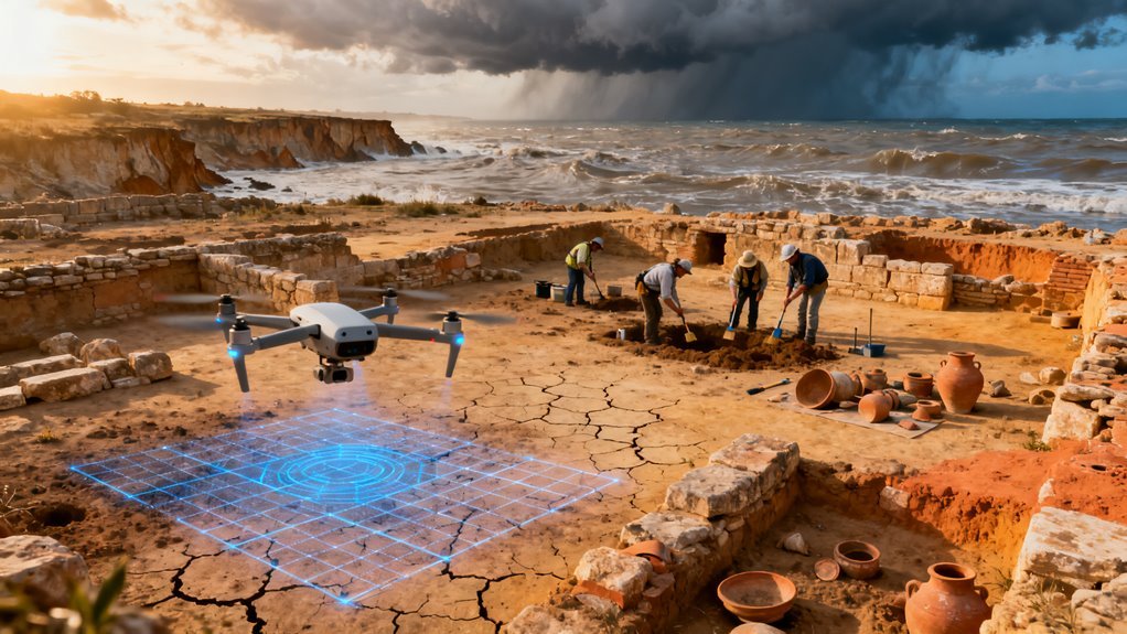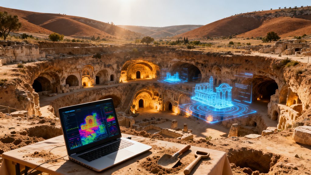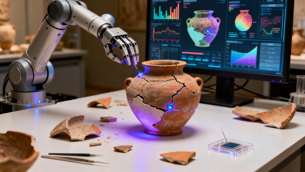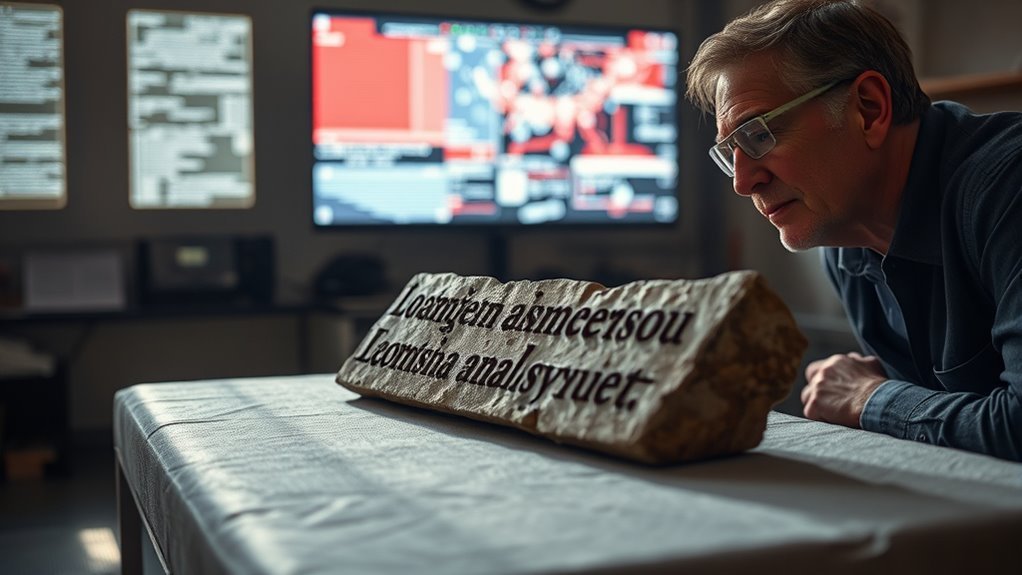

Archaeology is quietly entering a new phase, where conversations with artificial intelligence are starting to sit alongside field notebooks and site reports. Gemini, Google DeepMind’s multimodal model, is now woven into workflows that let historians and archaeologists speak in everyday language to vast collections of inscriptions and to equally vast archives of satellite imagery. This matters because the discipline is drowning in data and traditional methods cannot keep up with the pace of digitization, remote sensing campaigns, and new excavation records. At the same time, projects like Ithaca, Aeneas, and the Predicting the Past Skill demonstrate how ancient inscriptions can be restored, dated, and visualized through similarly conversational interfaces. Recent research shows that AI’s economic impact is primarily about task reconfiguration around assistance rather than wholesale job displacement.
Gemini is not arriving in a vacuum. It follows more than a decade of experimentation with machine learning for site detection, ground penetrating radar analysis, and automated documentation, and builds directly on earlier specialized models for ancient texts such as Ithaca and Aeneas. The shift now is that researchers no longer have to script complex queries or master niche software to tap into these systems. They can ask questions about inscriptions, landscapes, and possible buried structures in natural language and receive structured, map-ready outputs in minutes.
Gemini turns a decade of niche tools into a conversational partner, delivering structured, map-ready insights from everyday questions
Background: From manual catalogs to conversational models
For most of the twentieth century, inscription research meant wrestling with printed corpora, card indexes, and later database front ends that often required specialist knowledge just to run a basic search. Even once epigraphic collections moved online, finding patterns in dedicatory formulas or legal language across thousands of records demanded custom scripting and weeks of manual cleanup.
In 2022 DeepMind introduced Ithaca, trained on Greek inscriptions, followed by Aeneas in 2025 for Greek and Latin texts. These models learned to restore missing fragments, propose dates, and estimate where a stone was originally set based on subtle linguistic and stylistic cues. Gemini is now anchored to the outputs of Ithaca and Aeneas so that historians can ask questions as they would to a colleague and receive answers that combine restoration, dating, and geographic attribution in a single conversation.
Parallel developments have taken place in landscape archaeology, where deep learning models and geographic information systems have been used to mine satellite and aerial data for traces of ancient walls, mounds, and terracing, often with prediction accuracies around eighty percent when validated by experienced archaeologists. Researchers have begun to wrap these capabilities inside conversational interfaces, letting users query satellite images, lidar, and multispectral data through chatbot-style tools powered by large language models.
Gemini as a partner in inscription analysis
Within inscription studies, Gemini acts as an orchestrator for a whole stack of technical models. Instead of forcing historians to export tables from epigraphic databases and write new code for every question, Gemini can coordinate specialized tools to generate distribution maps and visualizations on demand. A historian can ask where certain dedicatory phrases cluster, which regions favor particular legal formulas, or how curse motifs spread over time and receive maps and summary graphics within a single session.
These visualizations are not just cosmetic. They make it far easier to see centers of innovation, peripheral uptake, and outliers that might signal unusual local practices or misdated stones. When textual content is carefully linked to geographic coordinates and chronological ranges, Gemini can highlight plausible routes along which cults spread, show how honorific practices shift from province to province, or contrast Greek and Latin corpora within a single conversation. This adds genuine analytical power to epigraphy rather than simply automating paperwork.
For many historians, the most important change is the lowering of technical barriers. Instead of learning query languages or advanced spatial analysis, they can pose interpretive questions and let Gemini translate those questions into database operations and geospatial workflows in the background. This opens quantitative and spatial approaches to a wider group of researchers and encourages collaborations in which epigraphers, archaeologists, and data scientists can share the same conversational environment and interrogate the same maps together.
From pixels to places: Gemini with geospatial models
On the landscape side, Gemini is being paired with geospatial foundation models trained on large volumes of satellite and aerial data to answer natural language questions about land surface changes and built structures across extensive regions. Recent studies in landscape archaeology have shown that deep learning applied to high-resolution airborne laser scanning and satellite imagery can automatically flag likely archaeological sites, allowing experts to focus on promising cells instead of scanning thousands of empty grids. In one Andean survey project, an AI-assisted workflow identified more than three hundred additional archaeological loci compared with manual or automated methods alone.
Gemini-centric workflows extend this logic by blending imagery, elevation models, maps, and socioeconomic information into a unified reasoning layer. Archaeologists can direct the system toward cloud-free mosaics and ask where terrain signatures suggest ancient walls, enclosure systems, or settlement mounds that diverge from modern infrastructure, without needing to specify which spectral bands or filters to apply. The model can then compare known sites against unexplored areas that share geomorphological and cultural patterns, returning ranked candidates and explanatory notes that can be exported into standard geographic information systems.
There is growing evidence that such AI-assisted approaches can shift early-stage fieldwork away from broad speculative coverage toward more focused investigation of zones that already show subtle signs of buried structures beneath the surface. By using remote analysis tools linked to Gemini, teams can scan thousands of square kilometers for anomalies in soil color, micro-relief, or vegetation stress that might indicate masonry or foundations, then integrate these signals with historic maps and settlement models to plan targeted surveys.
Looking beneath the surface: radar and subsurface detection
Detection of deeply buried or hidden structures pushes this approach further. Multi-sensor campaigns routinely collect synthetic aperture radar, ground penetrating radar, and magnetometry data that can reveal voids, shafts, and chambers invisible in ordinary optical imagery. Researchers have developed methods that combine spatial analysis with self-organizing maps to enhance and recognize archaeological features in radar and magnetic data, helping to characterize the state of conservation of buried remains and estimate their depth.
Gemini-centric geospatial workflows can ingest these multi-sensor data streams alongside surface imagery and topographic information, then contextualize any anomalies within known settlement histories and construction practices. If radar surveys around a monument such as the Great Pyramid of Giza show geometric cavities or linear features, the system can cross-reference these patterns with historical plans, nearby known structures, and typical tomb layouts to estimate how likely they are to represent human-made architecture.
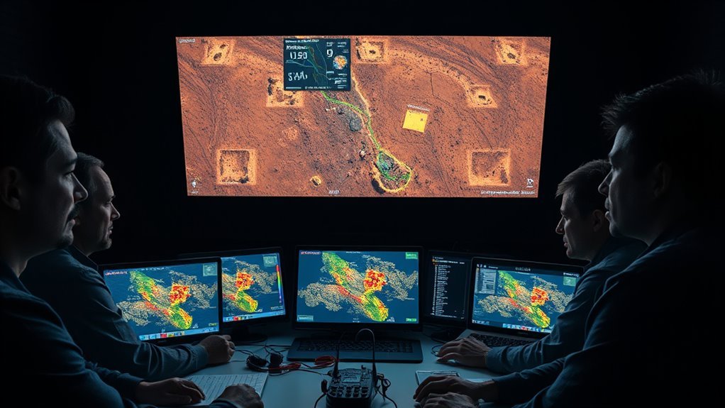
In public demonstrations, analysts have combined readings from several instruments and consulted multiple AI systems including Gemini to score possible Sphinx-like formations beneath desert sands, with probability estimates sometimes exceeding eighty percent before any excavation. Cultural landscape scanners built on similar principles can extend this logic to entire regions, continuously checking new satellite scenes for minimal vegetation, regular micro-topography, and other small-scale signals that betray buried masonry or foundations. Gemini then helps differentiate ancient complexes from recent construction and prioritize sites for excavation or more detailed geophysical work such as ground penetrating radar.
Benefits for archaeology and related fields
The practical benefits of this convergence are already visible. AI-driven inscription analysis compresses work that previously took weeks into minutes, allowing historians to move quickly from descriptive cataloging to substantive interpretation. AI-assisted remote sensing dramatically reduces the burden of manually scanning huge survey grids, while still leaving final judgments in the hands of skilled experts. Predictive models of site distribution support more efficient allocation of survey time and funding and can be tuned to minimize false negatives in areas of high heritage sensitivity.
Conversational interfaces backed by Gemini and similar models also change who can participate in these workflows. Reviews of AI chatbots for remote sensing show that such tools make complex geographic information far more accessible to non-specialists and facilitate real-time monitoring of sites that may be threatened by development or climate impacts. AI-powered documentation and digital twin creation further support conservation planning by modeling degradation scenarios and environmental risks for monuments and entire sites.
For technology companies and data providers, these developments open new possibilities for products and partnerships that sit at the intersection of satellite imaging, cloud computing, and cultural heritage management. Consulting projects already use Gemini to help institutions such as the United Nations interpret the historical and cultural context of gifts and artifacts, illustrating how similar methods can assist museums and archives in storytelling and curation.
Risks, limitations, and the need for discipline expertise
Despite the impressive capabilities, serious risks emerge if these systems are treated as oracles rather than assistants. Studies of AI-driven site prediction emphasize that models can be biased by uneven training data, limited negative samples, and assumptions baked into their feature selection. Explainable AI frameworks are being explored precisely because archaeologists need to understand why a model highlights a given location and how sensitive its predictions are to changes in input variables.
False positives are an unavoidable part of AI-assisted survey. Anomaly detectors may pick up natural geomorphology, recent agricultural works, or modern construction, and only field verification can definitively confirm or refute a candidate site. Overreliance on automated scores for features such as possible hidden chambers can waste resources or create unwarranted public expectations, especially when probabilities are reported without clear uncertainty ranges.
Large language models themselves bring familiar issues. They can hallucinate citations or overstate the certainty of inferences, particularly when data are sparse or contradictory. Gemini may inadvertently privilege well-documented regions over neglected ones, further reinforcing existing geographic and cultural imbalances in archaeological attention. There are also real concerns about accountability when models trained and hosted by commercial providers are used to inform heritage management decisions in local communities.
Responsible use therefore requires clear protocols. Ground truthing must remain central. Archaeologists need to be part of model design, not just consumers of outputs, and should help decide which features and training samples are appropriate for a given landscape or inscription corpus. Legal and ethical frameworks around data sharing, site confidentiality, and the rights of descendant communities have to evolve alongside these technical systems.
What this means for the future of archaeology and AI
From a broader perspective, Gemini’s role in archaeology is a test case for how general-purpose multimodal AI can be grounded in specialized scientific models and workflows. The combination of Ithaca, Aeneas, geospatial foundation models, and conversational interfaces points toward a future where domain-specific reasoning layers sit on top of general language capabilities.
In practical terms, that means a historian can move fluidly from reconstructing a damaged inscription to mapping comparable stones to exploring possible routes or cult networks, all within a single AI-assisted environment. Similar patterns are likely to appear in other disciplines that blend textual and spatial data, from environmental history to urban studies.
At the same time, archaeology’s long tradition of careful context, stratigraphic reasoning, and skepticism toward easy answers makes it a valuable proving ground for AI claims. The community’s insistence on field verification and interpretive nuance can help steer companies toward more transparent, collaborative models of deployment.
In the near term, expect to see more projects that use Gemini and related systems to stitch together satellite archives, excavation records, museum catalogs, and inscription corpora into unified research platforms. Over the longer horizon, AI-supported digital twins of entire cultural landscapes could integrate predicted buried features, conservation risk models, and historical narratives, offering powerful tools for both research and public engagement.
The key challenge will be ensuring that these technologies serve the needs of archaeology and local communities rather than the other way around. For now, Gemini’s experiments with antiquity provide a glimpse of how AI can move beyond generic chat into genuine collaboration with domain experts, turning dense data into meaningful questions and grounded interpretations. If archaeologists, historians, and technologists keep working together, the result could be not just faster discovery, but a richer, more connected understanding of how past communities built and inhabited their worlds.
Frequently Asked Questions
How Accurate Is Gemini at Distinguishing Natural Landforms From Human-Made Structures?
Artificial intelligence is already scanning vast amounts of satellite and aerial imagery, raising an obvious question for archaeologists, planners, and regulators. How much can Gemini really be trusted to tell a natural hill or riverbank from a buried fortification, road system, or other human structure? Right now, the honest answer is that its specific accuracy on this task is still unquantified and should be treated with caution.
Why this question matters now
Governments, heritage agencies, and commercial mapping firms are starting to experiment with large language models that can see images to triage remote sensing data and flag patterns that look archaeological or infrastructural. The appeal is strong. A system like Gemini can look at a terrain vignette and suggest that a circular ridge might be a hillfort or that a straight embankment is likely a road or wall. That could save specialists many hours of initial screening.
Benchmarking work on frontier models from Perplexity Sonar shows how close leading systems now come to human-level factual accuracy in text-heavy tasks. Sonar models achieve factual scores that exceed lighter versions of GPT-4o and approach or surpass the strongest competitors. These results support the idea that high-end models, including Gemini, can be powerful tools in data-rich workflows. They do not, however, tell us how reliably Gemini separates natural from human features in actual landscape imagery.
What the existing evidence really shows about Gemini’s spatial accuracy
There is no peer-reviewed study yet that tests Gemini specifically on the question of distinguishing natural landforms from human-built structures across a large curated dataset of remote sensing archaeology images. The available research instead gives indirect signals about how it handles related geospatial and visual classification tasks.
One recent study in geographic information science evaluated GPT-4o and Gemini 2.0 Flash on three spatial tasks: geocoding, elevation estimation, and reverse geocoding within Austria. Gemini was more precise than GPT-4o in several subtasks and achieved higher overall accuracy and F1 scores when identifying federal states from coordinates. At the same time, the model showed systematic and random errors and failed to reconstruct the state boundaries correctly, which exposed persistent misclassifications in geographic reasoning. That pattern is instructive. Gemini can approximate spatial information and capture broad topographic trends, but it does not yet deliver consistently reliable fine-grained geographic judgments.
A separate evaluation of multimodal models looked at how systems, including Gemini, performed on image classification and captioning tasks, including satellite data. The study reported that modern multimodal models such as GPT-4o and Gemini 2.5 Pro achieved solid accuracy and classification precision and were generally good at matching satellite scenes to ground truth categories. Yet even in these more straightforward tasks, they only reached moderate precision overall and sometimes misclassified ambiguous scenes. Ambiguity in imagery is exactly what makes subtle archaeological features hard to spot, so this limitation is directly relevant.
Another paper examined how ChatGPT and Gemini dealt with distinguishing AI-generated images from real photographs across several visual categories. In that test, ChatGPT correctly classified ninety percent of the images, while Gemini reached only fifty-two percent accuracy and was particularly prone to mislabel real photographs as synthetic. Although the task was not archaeological, this result highlights a broader issue. Gemini can struggle with fine distinctions in visual evidence even when the difference should be conceptually clear.
Product documentation from Google echoes these research findings. The general Gemini overview notes that responses can be inaccurate and that the system is not yet capable of reliably separating accurate information from inaccurate information on its own. The documentation for the Gemini image model explains that while the model can create convincing images of landscapes and other real-world scenes, its knowledge is not infallible and it may misinterpret complex diagrams or data. The description of Gemini capabilities in Google Earth further warns that this is a new and evolving technology that may sometimes produce inaccurate or inappropriate information. Taken together, these materials reinforce the message from independent studies. Gemini can be useful for spatial and visual tasks, but any single judgment it makes about terrain should be treated as provisional rather than definitive.
The benchmark gap for landform versus structure
In remote sensing archaeology, the most relevant published benchmarks so far focus on dedicated deep learning models rather than general-purpose systems like Gemini. One Europe-wide project trained a neural network to detect prehistoric hillforts in digital elevation models and then rigorously compared model outputs with a curated atlas and fieldwork data. Confidence scores above about ninety percent were treated as likely detections. Those candidate sites were then systematically checked against existing databases and remote sensing images and further evaluated by archaeologists. That pipeline gives a sense of the standard expected in the field. There are explicit thresholds, direct comparison with ground truth, and repeated rounds of human review.
By contrast, there is no equivalent published benchmark that puts Gemini into such a pipeline and measures how often it confuses natural features with human structures at scale. No study has yet reported precision, recall, false positive rates, or false negative rates for Gemini on targeted archaeological detection tasks using lidar, radar, or multispectral imagery. This absence does not mean Gemini performs badly. It means its performance on this specific question is largely unmeasured and therefore uncertain.
Computational archaeology researchers have emphasized that robust validation requires both technical checks and interpretive scrutiny. One key paper distinguishes between testing whether a computational pattern is really present in the data and judging whether the interpretation truly captures historical or cultural phenomena. Another study on the use of generative AI in interpreting the past shows how text and images from AI models can be compared with scholarly corpora using embedding distances to estimate how closely AI content aligns with expert knowledge over time. These works do not evaluate Gemini on landscapes directly, but they underline a principle that applies here. AI outputs in archaeology must be validated against independent data and expert interpretation before they are used as evidence.
AI as hypothesis generator, not automated excavator
Outside archaeology, the broader AI research community has begun to treat models as powerful hypothesis generators that still need structured validation. A recent survey of AI-assisted scientific hypothesis generation describes a pipeline where models propose hypotheses and multiple validation modules then test novelty, feasibility, precision, and scalability using simulation, human-in-the-loop evaluation, and retrieval-based verification. Feedback from these modules determines whether a hypothesis is accepted, refined, or discarded.
Archaeological tools are already adopting similar ideas. The IArch system offers a dashboard for processing heritage data and explicitly separates hypothesis generation from hypothesis validation. It uses clustering and classification together with explainability tools such as SHAP to suggest new labels and then supports researchers in checking and refining those suggestions. In other words, the AI is designed to expand the set of plausible interpretations, not to replace expert judgment.
The hillfort detection work in Europe follows this pattern in practice. Model predictions with high confidence scores are imported into geographic information systems and classified by archaeologists based on their likelihood of representing real sites. Vignettes of terrain are manually inspected and cross-checked against legacy data and field records before any potential site is accepted. The neural network is a very efficient scout, not an autonomous discovery machine.
Applied to Gemini, the lesson is straightforward. In remote sensing archaeology or landscape analysis, Gemini should be treated as a generator of candidate explanations for what a particular ridge, terrace, or embankment might be. Its suggestions are valuable when they help experts focus attention on unusual patterns and think through alternative interpretations. They are not by themselves sufficient to claim that a feature is definitively natural or human-made.
Practical implications for technology businesses and society
For technology developers and geospatial firms, Gemini offers genuine opportunities. Multimodal models are already able to caption and classify satellite imagery in ways that align reasonably well with ground truth categories. That can speed up inventory mapping, infrastructure monitoring, and environmental assessment workflows. Combined with tools like Perplexity Sonar that excel at factual retrieval and structured reasoning over text, these models can help analysts move more quickly from raw imagery to candidate narratives about what is happening in a landscape.
However, the risks are equally real. The research showing inconsistent geographic reasoning and moderate precision in image classification implies that Gemini will occasionally mislabel rivers as canals, embankments as walls, or plowed fields as archaeological sites. In archaeology, false positives can waste scarce survey resources, while false negatives can cause fragile heritage sites to be overlooked. In environmental or urban planning, misclassification could influence zoning decisions, conservation priorities, or infrastructure projects in ways that are costly or politically contentious.
There is also a trust issue. Public documentation acknowledges that Gemini can sometimes produce confident yet incorrect responses about factual topics and may invent or misrepresent information. If authorities or companies were to treat unvalidated Gemini outputs as authoritative evidence in heritage disputes, land claims, or environmental reviews, it would erode confidence in both AI tools and decision processes.
To mitigate these risks, organizations that use Gemini for landscape interpretation should build workflows that explicitly include cross-checking with high-resolution data, other sensing modalities such as lidar and radar, and existing archaeological or infrastructure databases. They should maintain transparent documentation about when AI models were used, what prompts were given, and how human experts reviewed and either accepted or rejected AI suggestions. These practices make it easier to audit decisions later and to improve models over time.
How this compares with earlier waves of computational archaeology
Earlier generations of computational archaeology relied heavily on rule-based geographic information systems and simple statistical models that encoded expert assumptions about where sites were likely to be found. Those tools were powerful but often rigid and limited in the patterns they could detect. Validation typically meant manual field checks against a relatively small set of model predictions.
Deep learning approaches such as the hillfort project introduced models that could scan entire regions and spot subtle geometric signatures in elevation data that might elude manual inspection. They also forced the field to confront new questions about bias, transparency, and reproducibility because their internal representations were harder to interpret. The emergence of Gemini and other multimodal language models adds a further layer. These systems are not only pattern detectors but also narrative generators. They can suggest historical scenarios, social interpretations, and even policy recommendations based on imagery and text.
That narrative capacity is both appealing and risky. Research on AI-generated interpretations of the past demonstrates that models can align closely with scholarly consensus in some areas but drift significantly in others, especially when training data are sparse or skewed. This makes it crucial to separate the descriptive task of recognizing that a feature looks like a rampart from the interpretive task of claiming it was built by a specific culture at a specific time. Gemini may assist with both tasks, but each needs its own validation logic and evidentiary standards.
What specialists should actually do with Gemini today
Given the current evidence, a reasonable working stance for archaeologists, geospatial analysts, and policymakers is cautious integration.
Gemini can be used to screen large imagery collections and highlight shapes that resemble known site types or infrastructure forms. Its probability scores and qualitative descriptions can help prioritize which vignettes deserve closer human attention. When combined with domain-specific models and tools such as IArch and dedicated hillfort detectors, it can add another perspective to the ensemble of signals analysts consider.
Yet any particular judgment by Gemini about whether a feature is natural or human-made should be treated as a hypothesis that requires further testing. Analysts should compare its suggestion with traditional remote sensing interpretation, consult existing site databases, and when possible, organize targeted field surveys or ground truthing. In other words, Gemini should sit near the front of the pipeline as a creative and efficient assistant, not at the end as an arbiter of truth.
Key takeaways and what to watch next
Gemini’s accuracy in distinguishing natural landforms from human-made structures has not yet been quantified in a dedicated peer-reviewed benchmark focused on remote sensing archaeology. Existing studies show that Gemini performs respectably but inconsistently on related tasks such as geographic reasoning, satellite image classification, and visual discrimination between synthetic and real photographs. Official documentation from Google likewise warns that the model may deliver inaccurate outputs, particularly for complex factual and visual questions.
Remote sensing archaeology provides a template for how AI should be used in this domain. Specialized deep learning models are treated as tools for generating candidate sites, which are then rigorously checked against databases, imagery, and fieldwork. AI suggestions are part of an inductive-deductive cycle rather than standalone evidence. General-purpose models like Gemini and text-focused systems such as Perplexity Sonar can enrich that cycle by offering cross-checked factual context and alternative hypotheses, but they must remain subject to expert validation.
Looking ahead, the most important developments will be systematic evaluations of Gemini and comparable models on carefully curated datasets of landscape imagery that explicitly label natural versus human features, including ambiguous borderline cases. Such work should report clear metrics for precision, recall, and error types and should involve collaboration between AI researchers and archaeological and geospatial practitioners. Until those benchmarks exist, the safest and most scientifically responsible position is to treat Gemini’s landscape judgments as informed hints rather than proof and to embed them in transparent workflows that prioritize reproducibility, expert oversight, and multi-source corroboration.
What Kind of Satellite Imagery Resolution Does Gemini Require for Reliable Site Detection?
Satellite imagery resolution is quickly becoming one of the quiet deciding factors in whether powerful AI systems like Gemini can genuinely see and understand what is happening on the ground, especially when the goal is to detect buried or faint archaeological sites from orbit. Reliable site detection from space is no longer science fiction, but it depends very directly on how fine each pixel is and whether subtle anomalies are visible at all.
Why Resolution Matters For Gemini Right Now
Gemini sits at the intersection of two mature technologies: remote sensing from satellites and large scale multimodal AI. The promise is compelling. Instead of researchers manually scanning thousands of images, AI can sift entire regions, highlight potential heritage sites, and track how they change over time, even under modern agriculture or urban expansion.
Satellite imagery itself is typically grouped into broad resolution classes. Low resolution data has pixels larger than about 30 meters, medium resolution covers roughly 5 to 30 meters, high resolution around 1 to 5 meters, and very high resolution pushes below 1 meter per pixel. These categories evolved over decades of Earth observation missions, from Landsat and MODIS at tens of meters to commercial constellations from companies such as Maxar and Planet at well under a meter.
For an AI system tasked with seeing buried walls, ditches, or subtle crop marks, that classification is not academic. It tells you at what point stones, trenches, field boundaries, and building outlines stop being individual features and become a single blended blur.
Historical Context How We Reached Sub Meter Imagery
The capability Gemini relies on has been built gradually since the late nineteen nineties. Early commercial high resolution satellites such as IKONOS delivered about 0.82 meter panchromatic resolution and 4 meter multispectral data, which was already transformative compared with older systems. QuickBird followed with about 0.61 meter panchromatic and 2.4 meter multispectral imagery.
As the market matured, newer platforms such as WorldView and GeoEye drove down pixel sizes further. WorldView 1 provided about 0.4 meter panchromatic resolution, while WorldView 2 delivered roughly 0.46 meter panchromatic data, though civilian products were typically capped at 0.5 meter. Documentation for standard imagery products from DigitalGlobe and later Maxar shows common offerings at 30 centimeter and 50 centimeter pixel sizes, often sharpened by combining panchromatic and multispectral bands.
At the same time, remote sensing handbooks began to tie resolution explicitly to typical uses. Data around 30 meters tends to serve global climate and land cover studies, around 10 meters for regional environmental work, a few meters for mapping, roughly 50 centimeters for engineering and planning, and about 30 centimeters for detailed inspection tasks. This mapping between pixel size and use case is crucial for understanding what Gemini can realistically do for buried site detection.
What Resolution Range Gemini Needs For Reliable Site Detection
When you translate those decades of practice into concrete requirements for Gemini, a clear threshold emerges.
Gemini needs sub meter satellite imagery for reliable buried site detection. In practical terms, the most robust performance is found around 0.3 to 0.5 meter ground sampling distance, where each pixel represents a patch of ground about the size of a single stone or small structural element. At this level, the model can learn fine grained patterns, spatial texture, slight color differences, and geometric alignments that correspond to walls, foundations, ditches, and other architectural traces.
Performance remains acceptable for larger features up to roughly 1 meter resolution, especially for linear structures such as roads, field systems, or large enclosures. An often cited rule of thumb in satellite analysis is to pick a resolution that is roughly one tenth the size of the feature you want to identify. If the aim is to spot a ditch that is several meters wide, 0.5 to 1 meter imagery can still work. If you are hoping to identify a narrow wall or a single grave outline, that resolution quickly becomes marginal.
Above this range, the task changes fundamentally. At 3 to 10 meter pixels, individual buildings shrink to only a handful of pixels and smaller structures vanish into the texture of the landscape. In that regime, Gemini can still be very useful, but mainly for regional scale crop mark mapping, broad soil mark detection, and long term monitoring of land use and vegetation rather than precise architectural feature recognition. The model becomes a regional analyst rather than a site scale detective.
The Role Of Optical Versus SAR Data
Gemini can work with both optical imagery and synthetic aperture radar, and each sensor type contributes differently to the problem.
Very high resolution optical data is often the first choice for buried site detection because it captures visible and near infrared reflectance. That is exactly what archaeologists rely on when they interpret crop marks and soil marks, where subtle differences in vegetation growth or soil moisture reveal underlying structures. Commercial catalogues show optical products at 30 centimeter and 50 centimeter resolution in panchromatic and pan sharpened form, which are well aligned with the 0.3 to 0.5 meter sweet spot for Gemini.
Synthetic aperture radar has a different set of strengths. SAR sensors can image the surface regardless of cloud cover or daylight and can be sensitive to surface roughness and moisture differences that may correlate with buried features or subsurface structures. While SAR resolution varies across missions, modern systems can achieve meter scale or better, giving Gemini another route to capture one meter anomalies that optical data might miss due to weather or lighting.
In practice, combining both modalities allows Gemini to cross check evidence. Optical data highlights tonal and color differences, while radar emphasizes structural and moisture related contrasts. For buried heritage, that multimodal fusion increases confidence that an anomaly is real and reduces the risk of chasing artefacts caused by agricultural activity or transient soil conditions.
How Gemini Handles Image Resolution Internally
Beyond the raw satellite pixel size, Gemini also has internal constraints on how it processes images. Documentation for Gemini three models introduces a media resolution setting that controls how many vision tokens the system allocates per input image, with options from low through ultra high. Higher settings give the model more capacity to interpret fine details but consume more tokens and increase latency.
Technical notes explain that images above a certain size are tiled into blocks on the order of several hundred pixels per side, and that pushing input resolution much beyond standard high definition tends to hit diminishing returns because of internal caps. For most detailed image tasks, the guidance is to use high media resolution and input frames around 720p to 1080p, which balances detail with efficiency. That means that even when Gemini receives 30 centimeter or 50 centimeter satellite data, it still must pack those pixels into an internal representation that preserves site level detail without overwhelming the model.
Output image resolutions for generated or edited content are also capped. Current tiers typically offer default images around 1024 by 1024 pixels, with the option to download at 2048 by 2048 in some subscriptions, while edited high resolution photographs are downscaled to a ceiling near 2048 pixels on the long side. For buried site detection workflows, that affects how results are visualized and shared, but the more critical factor remains the resolution of the input satellite data and the tiling strategy inside the model.
Implications For Researchers, Businesses, And Society
When an AI system requires 0.3 to 0.5 meter imagery for its best performance, that immediately raises questions about access and cost. Very high resolution satellite products are usually commercial, with pricing structures that can be challenging for underfunded heritage agencies and academic teams. Public data at 10 meters or coarser is widely available, but it simply cannot support the same level of site detection that Gemini can deliver on sub meter inputs.
For governments and businesses, the combination of Gemini and very high resolution imagery opens new possibilities. National heritage authorities can scan large agricultural regions for potential sites before major infrastructure projects begin. Insurance companies and infrastructure operators can monitor how construction or erosion may be impacting known monuments. Commercial satellite providers gain a powerful new use case for their highest resolution offerings.
There are also real risks. High resolution monitoring from space touches on privacy concerns when used over populated areas, even if the primary target is archaeological. Very fine imagery coupled with advanced AI models can reveal details of everyday life, traffic patterns, and building modifications that citizens may not expect to be scrutinized. Policy frameworks that were designed for human analysts need to be revisited for automated systems that can comb through far more data at once.
Finally, there is a risk of overconfidence. AI models can generate compelling probability maps and visual overlays, but buried archaeology is messy. Soil chemistry, crop choice, irrigation, and land management practices all affect how sites appear or fail to appear in imagery. Even with sub meter resolution, Gemini should be seen as a powerful assistant to field survey and expert interpretation, not a replacement.
Limitations And Open Questions
Several uncertainties remain, and acknowledging them is part of building a trustworthy picture of what Gemini can really do.
There is no single public specification that states exact detection rates for archaeological sites at each resolution band for Gemini. Instead, the ranges discussed above come from the combination of satellite resolution catalogues, typical use case guidance, and general remote sensing practice. That means local conditions can shift the thresholds. For example, in arid regions with strong soil contrasts, 0.5 to 1 meter imagery might be more effective than in temperate zones with dense vegetation.
Another open question is how well Gemini handles long time series at mixed resolutions, such as combining older one meter imagery with newer 30 centimeter data. Harmonising those inputs without introducing false trends is nontrivial and will require careful benchmarking.
There is also a broader technical challenge around model interpretability. When Gemini flags a faint linear anomaly as a likely buried wall, researchers need ways to understand which pixels and image cues drove that decision. Without that, it becomes difficult to calibrate expectations and refine resolution requirements for specific landscape types.
Key Takeaways And What Comes Next
The core message is straightforward. Gemini can support reliable buried site detection only when it is fed very high resolution satellite imagery. Sub meter data is essential, with a practical sweet spot around 0.3 to 0.5 meter and still useful performance for larger structures up to about 1 meter. Coarser imagery remains valuable for regional pattern analysis and long term monitoring, but it shifts the focus from fine architectural detail to landscape scale change.
In the near future, three trends are likely to shape this space. More satellites offering 30 centimeter or better resolution will expand coverage, reducing gaps in heritage monitoring. AI models like Gemini will continue to refine their multimodal capabilities, blending optical and radar data and learning from ground truth excavations. At the same time, regulators and heritage professionals will need to develop standards that balance scientific opportunity with ethical and privacy concerns.
If those pieces come together, Gemini and similar systems could become routine tools in safeguarding archaeological landscapes, helping societies see and protect what lies beneath the fields and cities they already know, without losing sight of the limits and responsibilities that come with that new kind of vision.
How Do Archaeologists Verify Gemini’s Predictions Before Starting Expensive Excavations?
Archaeologists treat Gemini style predictions as promising leads, not facts, and they run those leads through a layered verification process before anyone picks up a shovel. They combine remote sensing, expert review and targeted ground investigations so that only the most convincing AI flagged locations ever become candidates for expensive excavations.
Why verifying AI predictions matters now
Excavation is slow, costly and often destructive, even when it is carefully managed. Modern digs can run into hundreds of thousands of dollars in logistics, permits, specialists and post excavation analysis, and a misdirected project can waste limited funding and damage fragile landscapes.
At the same time, machine learning systems trained on satellite imagery, lidar and historical data are now capable of scanning entire regions and highlighting patterns that look like possible settlement remains or fortifications.
This combination creates both opportunity and pressure. There is a real chance to find buried sites that were missed by traditional survey methods, but there is also a risk that archaeologists might chase AI hallucinations or biased predictions. That is why the discipline has been building careful workflows that show how systems like Gemini can be used responsibly, with validation at every step.
From aerial photography to AI supported prospection
The idea of using distant views to find archaeological sites predates AI by many decades. Early in the twentieth century, researchers began to rely on aerial photographs to spot crop marks and subtle earthworks that were invisible at ground level.
Those methods expanded with the arrival of multispectral satellite sensors that capture vegetation health and soil differences across several bands of light, revealing buried walls, ditches and building foundations through their impact on plant growth and moisture retention.
Lidar has been especially transformative because it can strip away vegetation digitally and expose micro relief such as terraces, embankments and platform mounds even under dense forest cover.
Reviews of satellite remote sensing in archaeology show that combining lidar topography, multispectral vegetation indices and radar data gives the richest picture of past landscapes, far beyond what any single technique can offer on its own.
In parallel, multi sensor case studies have demonstrated how archaeologists already blend satellite images, lidar, ground penetrating radar and other geophysical tools to confirm that anomalies on maps correspond to buried structures.
For example, work at sites such as Porolissum used vegetation marks and elevation models to produce an archaeological binary map, then verified a regular pattern by surveying it with ground penetrating radar that matched the predicted layout almost exactly. This is the kind of multi step thinking that now underpins AI verification as well.
What models like Gemini are actually doing
Systems such as Gemini can ingest large amounts of imagery and contextual data and generate probability maps that highlight pixels or small areas with a high chance of containing archaeological features.
Similar deep learning approaches have already been used to detect hillforts in European landscapes by training neural networks on annotated lidar and terrain models, then scoring each grid cell for its resemblance to known sites.
In those projects, high scoring areas become heatmaps that can be overlaid on satellite or aerial imagery and then imported into geographic information systems. Archaeologists can interact with these overlays, inspect each candidate area, and integrate them with other survey data such as historical maps, gazetteers and previous fieldwork campaigns.
Essentially, Gemini plays the role of an automated scout, flagging possible patterns such as circular embankments, rectangular building footprints or regular alignments of features that might represent roads or field systems.
The crucial point is that the output is a ranked set of hypotheses. It suggests where past human activity might be present, but it does not decide what counts as a site. The interpretive and ethical responsibility remains with human archaeologists and heritage managers.
Desk based verification of Gemini flagged anomalies
When Gemini highlights an anomaly, the first step is a desk based verification phase that seeks independent confirmation from other remote sensing sources and archival material.
Archaeologists cross check each flagged area against multispectral satellite data, lidar derived elevation models and existing GIS layers to look for persistent patterns that cannot easily be explained by modern agriculture, drainage, construction or natural geology.
They study time series of satellite images to see whether vegetation marks or soil differences appear consistently under different seasonal and moisture conditions.
Work in places such as the Alazani Valley has shown how repeated multispectral observations across a growing season can reveal potential burial mounds more clearly at particular times of year, which are then marked for ground verification. That kind of seasonal reasoning is applied when assessing Gemini outputs as well.
The prediction overlays are also compared with national and regional site inventories, previous survey reports and local museum records.
Deep learning projects focused on hillforts have already demonstrated this practice by matching AI candidate locations against a curated database of known sites and legacy catalogues, then classifying each anomaly according to its likelihood of representing a previously recorded monument or an entirely new find.
Similar mapping and verification exercises use high resolution satellite data combined with lidar and thermal imagery to distinguish invisible cultural heritage sites from random noise, often guided by soil chemistry and metal detector results from earlier campaigns.
In other words, before anyone plans a dig, Gemini predictions are tested against everything archaeologists already know about the landscape. If an anomaly aligns with existing but fragmentary evidence, it gains credibility. If it contradicts well established geology or land use, it is treated with skepticism and may be discarded.
Expert review and adjustment of the AI model
Desk based checks are followed by detailed expert review. The highest scoring Gemini predictions are grouped into vignettes or tiles that archaeologists can inspect one by one, often starting with a few thousand of the strongest candidates.
Human specialists look at each vignette using different visualizations such as hillshade models, slope maps, vegetation indices or thermal composites to judge whether the pattern resembles known site types or obvious modern features like pipelines or plough scars.
Projects that rely on machine learning for site detection usually involve iterative refinement of the training data. Annotated datasets are adjusted by experts who correct mislabelled examples and add new ones, then retrain the model to reduce false positives and improve its ability to distinguish genuine remains from background noise.
This same logic applies when Gemini is deployed at scale: archaeologists treat the model as a partner whose suggestions must be critiqued and whose behavior can be tuned over time.
There is also growing awareness of the risk of bias. Discussions in the archaeological literature stress that AI systems will reflect gaps and distortions in their training data, which can skew identification toward certain regions, periods or monument types while overlooking others.
Researchers argue for more representative datasets, careful documentation of provenance, and the use of explainable AI techniques that help archaeologists understand why a model made a particular prediction rather than simply accepting its output.
Bringing these points together, verification is not only about checking individual anomalies. It is also about scrutinizing the behavior of the model itself, asking whether its successes and failures make sense in light of existing scholarship, and altering parameters when it consistently misinterprets the landscape.
Non invasive field verification
Only after remote sensing checks and expert review does the process move into the field and even then archaeologists usually begin with non invasive methods.
The aim is to ground truth Gemini predictions without committing to wide open trenches. Teams start with targeted field walking across the predicted areas, systematically recording artifacts on the surface, micro topography and any visible features such as ditches or small banks.
If Gemini suggests a buried building plan, for example, surveyors will look for changes in soil texture, scattered building materials or subtle level differences that correlate with the model output.
Next, geophysical prospection methods such as magnetometry, electrical resistivity and ground penetrating radar are deployed on the most promising anomalies.
Studies combining satellite multispectral data, lidar and drone based imaging show how remotely identified patterns can be tested by generating an archaeological binary map and then scanning selected locations with ground penetrating radar, which either confirms a buried structure that matches the predicted pattern or reveals that the anomaly was caused by natural factors.
Other projects have explored links between multispectral anomalies and ground features detected through soil chemistry and metal detector surveys, providing another non destructive way to verify invisible sites before excavation.
In each case, the goal is to overlay Gemini predictions with independent measurements of the subsurface and surface conditions. If multiple lines of evidence converge on a human made structure with a coherent shape and orientation, confidence increases. If geophysics shows nothing or reveals an irregular feature inconsistent with the AI guess, the prediction is downgraded.
Selective test excavations as the final check
Expensive open area excavations are reserved for anomalies that pass through all earlier filters. Even then, archaeologists prefer small test excavations or coring campaigns as a final check rather than immediately exposing large areas.
This approach is consistent with broader guidance on AI assisted discovery, which emphasizes that segmentation algorithms and site detection models require field validation before their results can be used for conservation decisions or major interventions.
A typical workflow might involve digging a few narrow trenches across the predicted edges of a supposed enclosure or building to confirm that ditch cuts, wall foundations or occupation layers really exist where Gemini indicated.
The stratigraphy is documented carefully, and samples are taken for dating and environmental analysis. If those limited interventions confirm a well preserved archaeological deposit and align with the model, the site becomes a candidate for a larger planned excavation or long term conservation measures.
If the trenches show nothing of interest, the team can withdraw with minimal cost and damage.
This combination of AI prospection, remote sensing, non invasive survey and selective testing gives archaeologists a much more precise way to decide where to invest scarce excavation resources.
Implications for technology, heritage management and society
The verification practices emerging around systems like Gemini have several important consequences.
For technology developers, they highlight that success in archaeology is not only about raw prediction accuracy but about how well models integrate with established workflows and data sources.
Tools that make it easy to export heatmaps into GIS, adjust thresholds interactively and trace the rationale for each prediction are far more likely to be adopted.
For cultural heritage managers, these workflows promise a more strategic use of budgets. Rather than surveying blindly or focusing only on areas threatened by development, AI supported prospection can quickly map candidate sites across large territories, then funnel attention toward the anomalies that survive rigorous verification.
That can improve site conservation by identifying undiscovered monuments and planning protection measures before they are at risk.
Societally, there is a chance to tell richer and more inclusive stories about the past, especially in regions where traditional survey has been patchy or difficult due to vegetation, politics or terrain.
At the same time, critics warn that if Gemini and similar models are trained mostly on well studied areas, they may reinforce existing biases and neglect marginal or Indigenous heritage landscapes.
Transparent verification procedures, shared training datasets and collaboration with local communities can mitigate some of these risks but cannot remove them entirely.
Limitations and open questions
Even the best verification pipeline cannot fully eliminate uncertainty. Remote sensing data vary in resolution and quality, lidar coverage is uneven, and environmental conditions can obscure or mimic archaeological signatures.
Ground penetrating radar and other geophysical techniques are powerful but sensitive to soil type and moisture, and they can miss subtle or deeply buried features.
There is also the question of how AI generated content fits within scholarly standards. Studies comparing AI outputs to academic writing in archaeology show notable differences that need to be understood and bridged rather than glossed over.
Archaeologists must continue to document their methods, explain why they accept or reject particular Gemini predictions and publish both successes and failures so that the broader community can learn from them.
Ethically, the ability to scan vast landscapes for hidden sites raises questions about data sharing, looting risk and the control of cultural heritage information.
Verification workflows do not solve these issues by themselves, but they offer a framework in which decisions about revealing or protecting locations can be made more deliberately, based on evidence rather than on blind trust in a model.
Key takeaways and what to watch next
- Gemini and similar systems act as powerful scouts, highlighting possible archaeological features across large regions, but their predictions are treated as hypotheses that must be checked against independent data and expert judgment.
- Verification combines multispectral satellite imagery, lidar, GIS analysis, archival records and multi sensor field surveys to filter out modern or natural features and to confirm persistent patterns linked to buried remains.
- Only anomalies that pass through remote checks, expert review and non invasive geophysics are tested with small excavations, which serve as the final step before any major dig is approved.
- The future of AI in archaeology will likely depend on explainable models, shared training datasets, and transparent workflows that integrate verification from the beginning, allowing the field to harness computational power while preserving its commitment to careful interpretation and stewardship of the past.
The way archaeologists verify Gemini predictions shows a discipline that is willing to experiment with new tools while insisting that every decision be grounded in evidence, context and responsibility, and that balance will determine how deeply AI reshapes the practice of discovering and protecting human history.
Can Local Communities Access Gemini-Based Maps to Protect Nearby Heritage Sites?
Artificial intelligence is starting to change how communities see and protect the places they live in, but the way they actually touch Gemini based heritage maps is more indirect than many assume. Most local groups do not open Gemini and start drawing new boundaries on a global map. Instead, they reach these AI enhanced views of heritage through web portals, experimental storytelling apps, mobile geographic tools, and shared data platforms that sit between the model and the land they care about.
From expert remote sensing to everyday heritage maps
AI has been reshaping heritage mapping for several years, largely through remote sensing and computer vision rather than conversational models. Deep learning systems now routinely analyze satellite and aerial imagery to detect archaeological sites with reported accuracies above ninety percent, even in complex environments such as tropical forests and deserts. Similar techniques help monitor historic buildings using image data from cameras, drones, and mobile devices, feeding into workflows for condition assessment and risk analysis.
This technical layer has traditionally lived in specialized software and research labs. Archaeologists and conservation scientists have used tools such as advanced GIS platforms, photogrammetry suites, and LiDAR processing pipelines to build detailed maps and models before applying AI to automatically highlight features of interest. That environment is powerful but not easily accessible to a community group trying to track flood risks around a local temple.
Over the past decade, a parallel movement has emerged that focuses on democratizing geographic technology. Community Landscape Archaeology projects use free mobile GIS applications together with remote sensing and AI analysis, inviting residents to mark culturally significant locations, connect them with narratives, and co-create models for recognizing archaeological landscapes. In these case studies, open source mobile GIS platforms are installed directly on participants’ devices so they can document and annotate heritage sites themselves and manage geospatial data in real time. This is the lineage that now intersects with Gemini.
Where Gemini fits into heritage mapping right now
Gemini is primarily a multimodal reasoning engine that can interpret text, images, and structured data, and in the cultural heritage space, it is usually woven into experiences that sit on top of existing map imagery rather than replacing the underlying mapping stack. Google Arts and Culture experiments such as Talking Tours use Gemini to analyze Street View panoramas, combine them with GPS coordinates and location names, then generate rich audio explanations about the sites people are virtually visiting.
In India, a dedicated Talking Tours edition connects Gemini to more than two hundred locations, from the Red Fort and the Taj Mahal to the ancient complexes of Hampi and other iconic sites. The model provides context-aware commentary and supports interactive dialogue about what appears in the scene, effectively turning a static panoramic map into a conversational guided tour. Gemini is not the map database in this case. It is the interpretive layer that helps people understand what the existing imagery represents.
Other projects use the Gemini API in heritage-themed applications. Intelligent Heritage Explorer SAWAH combines augmented and virtual reality with Gemini to create immersive explorations of Egyptian cultural sites, overlaying historical information and narrative content onto digital representations of monuments and landscapes. Again, the mapping data comes from other sources, while Gemini supplies flexible reasoning, description, and interactive guidance.
There is also work that connects Gemini to historical corpora rather than geographic maps. For example, a Predicting the Past skill integrates Gemini with specialized tools for attributing, restoring, and analyzing ancient texts, offering historians an interactive partner that can handle complex scholarly workflows through natural language. The pattern is similar. Gemini is being embedded into domain-specific platforms where the raw data and maps are managed by institutions and research projects, and communities interact through those platforms rather than inside the model itself.
How local communities actually access AI heritage maps
When community members gain access to AI enhanced heritage maps today, it nearly always happens through intermediaries that balance technical capacity with governance. Open Heritage collections on Google Arts and Culture provide digitized data from sites worldwide, including models and imagery that can be downloaded, remixed, and reused by institutions, educators, and creative communities. This gives technically capable local actors access to rich spatial and visual datasets that can then be connected to AI tools of their choosing.
Closer to everyday practice, platforms such as Heritage Community Builder focus explicitly on shared governance of heritage records. This tool keeps tangible assets like buildings, sites, and landscapes in the same space as intangible practices and stories, allowing communities and institutions to manage them together. Custodians can specify consent on a per item and per purpose basis, define access classes that range from fully public to sacred and sensitive, and control whether data can be used to train AI models, with training disabled by default. There are map views with sensitivity controls and non-map alternatives so that some information remains visible only through narrative or classified records rather than precise coordinates.
In community Landscape Archaeology projects, residents gain very direct access to mapping tools on their own phones. They record points of interest, link them to personal experience and local history, and collaborate with archaeologists in field surveys that feed into AI models capable of automatically recognizing elements of the archaeological landscape. These initiatives show a clear path for AI supported community mapping that does not require people to understand the underlying algorithms but still lets them co-own the data and interpretive frameworks.
Heritage Emergency and Resilience Lab activities extend this approach into risk and disaster preparedness. The lab combines digital documentation, GIS, drone mapping, remote sensing, AI-assisted assessment, virtual reality, and community-based knowledge to identify exposure, vulnerabilities, safe zones, and priority areas for heritage places. It employs AI for damage detection, change and crack analysis, predictive modeling, and automated reporting, while keeping storytelling and local experience at the center of decision-making. Community access again arrives through web mapping interfaces and structured engagement programs rather than direct manipulation of a conversational AI model.
Governance, consent and knowledge sovereignty
The question of who controls Gemini based maps is ultimately a question of data governance. Heritage Community Builder provides a concrete example of emerging frameworks that give communities more control over how their cultural records appear, who can see them, and whether AI can learn from them. By treating consent as granular, revocable, and tied to custodians rather than as a one-time blanket permission, it supports knowledge sovereignty where communities can decide how spiritual practices, sacred places, and sensitive histories enter digital spaces.
Community Landscape Archaeology efforts underline the importance of co-governance in practice. Participants meet in public forums and focus groups, work with archaeologists to design surveys, and use open source mobile GIS tools to collect their own data, which is then integrated with AI analysis. This process ensures that automated models are informed by local narratives and not just technical signals from remote sensing imagery. It also means communities can question and correct AI outputs instead of passively accepting them.
Risk-oriented labs like HER Lab add another dimension, using explainable AI to support heritage decision-making and prioritization. By making model reasoning more transparent, they help planners and residents understand why certain sites are classified as high risk or why some interventions are recommended over others. That transparency is crucial if communities are to trust Gemini based or AI assisted maps in the stressful context of emergencies.
Across these projects, there is a clear move toward co-governance committees, consent-centric frameworks, and shared validation ladders where expert review and community feedback both shape the final records. This is the environment into which Gemini integrations are likely to be deployed.
Opportunities and risks of Gemini enabled local mapping
The upside for communities is significant. When AI models can detect archaeological features and heritage buildings with high accuracy using satellite imagery, aerial photos, and mobile captures, it becomes possible to flag emerging threats or undocumented sites before they are lost. When those models are paired with platforms that residents can access directly, like mobile GIS apps or web mapping dashboards, local groups gain powerful tools to document damage, monitor encroachment, and support advocacy for protection measures.
Experiences such as Talking Tours or Intelligent Heritage Explorer demonstrate how Gemini can transform static imagery into conversational, context-rich guides that might be repurposed for locally focused tools. Imagine a community portal that uses Gemini to overlay historical narratives, conservation guidelines, and risk alerts onto a shared map of nearby temples or historic streets. The technical ingredients exist in prototype form, and the governance frameworks for controlling visibility and consent are starting to mature.
There are serious risks. Publishing exact locations of fragile or sacred sites in widely accessible AI enhanced maps can increase the threat of looting, vandalism, or unwanted tourist pressure. Researchers have long warned that remote sensing and automated detection, while immensely valuable for archaeology, must be accompanied by careful control over public disclosure of sensitive coordinates. Heritage Community Builder addresses this by allowing some information to appear in non-map views and by keeping sensitive map layers restricted according to community rules. That type of sensitivity control will be essential for any Gemini powered heritage portal aimed at local use.
Bias and uneven representation are another concern. Institutions with strong technical capacity, robust funding, and access to drones, remote sensing data, and high-quality digitization pipelines are far more likely to appear in AI heritage experiments than small rural communities. Without deliberate investment in community-based mapping projects and training, Gemini based tools could deepen existing gaps by providing rich interactive experiences for well-documented sites while leaving others invisible. Initiatives that install mobile GIS platforms on participant devices and empower them to curate their own heritage data show a practical way to counter that imbalance.
Finally, there are limits to how much direct control communities have over the mapping logic inside proprietary systems. Even when platforms expose Gemini or other AI tools through natural language interfaces, most configuration and risk mitigation decisions are still taken by institutions, labs, or project teams. Trustworthy use depends on transparent rules, clear opt-out pathways, and visible channels for contesting AI outputs.
What local access looks like in practice
On the ground, a community does not usually connect to a bare Gemini interface and ask it to redraw buffer zones around every historic site. A more typical scenario involves a partnership with a university, municipal authority, or heritage lab that sets up a shared portal. Residents might use a mobile app to photograph buildings or landscapes, mark problems such as cracks or encroaching development, and upload those records to a central dataset.
In the background, AI models trained on multispectral imagery and structural features could classify risk levels and suggest priority interventions, following workflows already described for AI based site conservation where data from phones, cameras, and drones is cleaned, analyzed, and compared over time. Gemini or a similar model might be used to translate those technical outputs into plain language explanations, action checklists, and community reports, while the map itself is still managed in a GIS platform with strict access and consent controls.
People experience this as an integrated system. They see a familiar map interface that can show or hide sensitive locations according to agreed rules, a record for each asset that includes both expert validation and community narratives, and an AI assistant that can answer questions about history, risk, or recommended conservation steps. The success of such systems depends less on Gemini alone and more on whether local actors have been involved in designing the tools, defining governance, and validating the AI outputs.
Takeaways and what to watch next
Gemini is beginning to appear in heritage mapping ecosystems, but it operates mostly as a reasoning and storytelling layer on top of maps rather than as a standalone mapping platform. Local communities access these capabilities through curated applications, web portals, and mobile GIS tools run by institutions, labs, and heritage projects, which integrate AI detections, remote sensing, and risk analysis into user-friendly interfaces.
The most promising developments are those that combine high accuracy AI detection with community led mapping, granular consent mechanisms, and explainable decision support. Platforms such as Heritage Community Builder, community Landscape Archaeology initiatives, and heritage resilience labs are already experimenting with ways to give communities meaningful control over what appears on maps and how AI models can learn from and act on that data.
Over the next few years, expect more heritage organizations and civic labs to connect Gemini or similar models to these frameworks, turning AI from a back-end detection engine into a visible partner in interpretation, planning, and everyday conservation work. The critical questions will be who sets the rules, how sensitive sites are protected, and whether communities are genuinely co-governing both the data and the AI, not just consuming polished experiences built elsewhere.
In short, local communities can access Gemini influenced heritage maps today, but always through platforms and partnerships that balance advanced technology with consent, narrative, and shared responsibility. The future of this space will be decided as much in community meetings and governance boards as in AI research labs.
What Safeguards Prevent Commercial Misuse of Gemini Archaeological Data by Developers?
Safeguards against commercial misuse of Gemini archaeological data matter now because researchers are starting to rely on general AI infrastructure to store and process fragile information about heritage sites, excavation records, and potential artifact locations. If that data is misappropriated or quietly reused for model training, resale, or black market discovery tools, the damage to cultural heritage and local communities could be irreversible.
The policy backbone that constrains commercial exploitation
Gemini’s first line of defense is its Prohibited Use Policy, which forbids illegal activity, deceptive practices, and uses that violate rights or enable harm to people or property. For archaeological work, this covers obvious risks such as using model outputs to locate and traffic artifacts, publish sensitive site coordinates, or help launder stolen cultural goods through online marketplaces.
These prohibitions apply to developers as well as end users, so building a commercial tool that monetizes sensitive archaeological finds in ways that contravene law or community rights is explicitly against the rules.
On the commercial side, Gemini API Additional Terms reinforce these protections by restricting what developers can do with certain AI outputs. For example, developers are forbidden from caching, framing, syndicating, reselling, or using grounded results to train other models or services.
That limitation matters when archaeologists use Gemini to ground answers in their own datasets or in search results about heritage sites. It prevents a third party from quietly packaging those results into a commercial dataset or reselling a derivative product that exposes excavation data without consent.
Data retention, abuse monitoring, and the fifty five day window
A key safeguard is how Gemini handles prompts and outputs for abuse monitoring. When developers use the paid Gemini API, Google logs prompts and responses for fifty five days specifically to detect and prevent violations of the Prohibited Use Policy and to maintain service safety.
During this window, those logs can be scanned by systems focused on policy enforcement, which makes it easier to spot suspicious activity such as repeated attempts to monetize exact site coordinates, burial locations, or proprietary field survey data.
Crucially, this abuse monitoring data is not used to train general AI models. It is only used for detection and enforcement models that support safety and compliance. That means archaeological prompts and outputs sent through the paid API are not silently swept into the general training corpus, even though they are temporarily retained for oversight.
This separation between safety logging and model improvement is one of the core safeguards against commercial misuse of sensitive research data.
At the same time, developers need to understand the limits. Logs can be retained longer if they are copied into datasets that a customer chooses to share with Google for model improvement, and those shared datasets are treated as demonstration data that may inform training and evaluation of future models.
If an archaeology lab uploads complete site registers to a shared dataset, the default protection against training no longer applies. The safeguard depends both on the platform rules and on disciplined data governance choices by the researchers themselves.
Training restrictions for paid API, Vertex AI, and enterprise platforms
There is now a clear historical shift in how major providers handle training on customer data. Early consumer tools often used most user inputs for model improvement by default.
Over time, paid and enterprise AI offerings moved toward contractual guarantees that customer data from those tiers would not be used to train general models without explicit permission.
Gemini follows that trend. For paid Gemini API usage, prompts and responses are excluded from training foundational models, and data is logged for a limited period only for safety, abuse detection, and legal compliance.
Vertex AI and Gemini for Enterprise provide stronger assurances, including strict data isolation, configurable zero data retention, and contractual guarantees that customer data will not be used to train or fine tune models outside the customer domain without prior permission.
In practice, this means archaeological institutions that operate on enterprise or Vertex AI tiers can store and process excavation records through Gemini based systems without those records being repurposed for general model training or resale.
Gemini Enterprise Agent Platform adds another safeguard through a training restriction clause stating that Google will not use customer data to train or fine tune any models without prior permission or instruction.
This applies to managed models on the platform, including pre general availability models, which often raise the greatest concern for research groups who worry about experimenting on early systems with sensitive data.
Differences between free and paid tiers and what archaeologists should avoid
The data protections described above do not apply equally to all Gemini access paths, which is an important nuance for archaeologists working with commercially sensitive or community controlled information.
The free Gemini API accessed through Google AI Studio uses submitted content such as prompts, uploads, and outputs to improve models by default. That includes text and images, so uploading detailed site maps or high resolution photos of artifacts in a free tier environment can lead to those materials being incorporated into future training data unless settings are carefully reviewed.
Paid Gemini API and enterprise tiers, by contrast, exclude prompts and responses from general model training. They use logging only for safety and operational purposes and allow administrators to configure retention windows and sometimes zero data retention for especially sensitive use cases.
From a practical E E A T perspective, any institution handling fragile archaeological datasets should treat the free tier as unsuitable for sensitive content and favor paid or enterprise environments that come with data processing agreements, clear training restrictions, and options for strict retention controls.
Output ownership and restrictions on resale of archaeological information
Safeguards are not just about training but also about who owns outputs and how they can be commercialized. Legal analyses of Gemini’s contracts highlight that paid tiers give customers ownership or strong control over outputs, while simultaneously limiting how grounded results and certain search related outputs can be resold or used for training other services.
Those restrictions reduce the risk that a developer could systematically harvest model answers containing sensitive site descriptions, aggregate them, and sell a commercial archaeological discovery dataset built primarily from Gemini outputs.
At the same time, standard cloud privacy and logging practices mean some operational data such as tokens, errors, and metadata may persist for security and analytics, even if prompts and responses are deleted from user accessible interfaces.
Institutions that care deeply about preventing commercial misuse therefore need to combine Gemini’s built in safeguards with their own policies on anonymization, access control, and audit trails.
Abuse monitoring, rate limits, and targeted misuse detection
Safety guidance for Gemini also encourages technical safeguards such as assigning each user a unique identifier and limiting the volume of queries within a specific period.
For archaeologists, this means a developer cannot easily spin up a consumer facing app that floods Gemini with automated queries trying to triangulate vulnerable sites at scale without triggering abuse monitoring and rate limits.
Combined with Prohibited Use Policy enforcement, these controls make it more likely that systematic attempts to monetize archaeological data in harmful ways will be detected and blocked.
Limitations and what responsible developers should do
Despite these safeguards, there are limitations that experienced practitioners need to keep in mind. Abuse monitoring logs can be retained for fifty five days by default, and in some cases copies of logs or analysis artifacts may persist even after user facing deletion.
Shared datasets can be used for model improvement, which means that sensitive archaeological registers or site catalogs should never be placed into datasets that are contributed for training or evaluation.
Free tiers remain unsuitable for confidential heritage data because they use submitted content for model improvement by default.
Responsible developers working with archaeological information should therefore align three layers of defense. First, choose paid API, Vertex AI, or enterprise tiers that prohibit training on customer data and offer data processing agreements and zero retention options.
Second, configure retention windows conservatively and avoid sharing datasets that contain any sensitive site or artifact information.
Third, design their own applications so that users cannot easily export or resell Gemini outputs that reveal sensitive locations or community owned knowledge, even if those outputs are technically allowed under contract.
The bottom line for archaeologists and cultural heritage institutions
Gemini’s safeguards against commercial misuse of archaeological data are grounded in three pillars. Prohibited use rules and safety guidance restrict illegal and harmful exploitation.
Abuse monitoring and retention policies create visibility into suspicious patterns while separating safety logging from general training.
Enterprise training restrictions and data isolation commitments protect customer data from being repurposed for broader model improvement or resale.
These safeguards are significant progress compared with earlier generations of consumer AI tools that routinely trained on user data and offered little clarity about output ownership.
They do not, however, eliminate the need for strong institutional data governance. Archaeological teams that treat Gemini as one component in a carefully controlled research environment, favor enterprise tiers, and avoid sharing sensitive datasets for training can substantially reduce the risk that their work will be commercialized without consent.
Those choices, combined with the platform’s formal restrictions and monitoring systems, are what ultimately prevent developers from turning fragile archaeological knowledge into a tradeable commodity.
Conclusion
Google Gemini is arriving at a moment when archaeology is finally ready to move at orbital scale. For decades researchers have known that satellite images and radar could reveal buried walls, ancient roads and mounded settlements, but turning that raw data into reliable maps of the past has been slow, manual work reserved for specialists staring at pixels. Today, modern neural models trained on years of remote sensing data can flag thousands of potential sites across entire regions, and tying that capability into a system like Gemini makes it far easier for archaeologists to search, query and interpret those signals in a way that fits real field practice.
Gemini’s integration with satellite and remote sensing data signals a shift toward archaeology conducted largely from orbit, where buried walls and mounded settlements emerge as patterns in multispectral imagery and radar backscatter. By automating detection while leaving interpretation and fieldwork to human experts, this approach accelerates discovery yet preserves scholarly oversight. As these models mature, they will quietly expand the known map of ancient landscapes, reshaping research questions and conservation priorities for institutions and communities across the globe.
How we reached satellite first archaeology
Remote sensing began as a way to capture photographs from planes and early spacecraft, with archaeologists manually inspecting variations in soil color, vegetation and shadows to infer buried structures. As digital sensors improved, techniques such as multispectral imaging helped researchers distinguish materials and subtle crop marks that hint at foundations or earthworks beneath the surface.
The real turning point has been synthetic aperture radar, which uses radio waves rather than visible light and can penetrate dry soil and sand under the right conditions. Work at the Saruq al Hadid site in Dubai has shown that satellite radar at L band frequencies can detect features larger than one meter buried less than two meters deep, especially in dry bare soils, confirming that radar anomalies can line up with active excavation areas and point toward new unexplored zones. Studies combining radar with multispectral imagery over the Cholistan Desert in Pakistan have trained machine learning models to recognize the distinctive signatures of Indus civilization mounded sites, then applied those models to create probability maps of mound locations over more than thirty six thousand square kilometers.
Similar approaches have been demonstrated in the Mesopotamian floodplains, where deep learning models using semantic segmentation have achieved around eighty percent detection accuracy and intersection over union scores above 0.8 on known mounded sites, providing detailed outlines that archaeologists can review in a human in the loop workflow. In north western Iberia, a hybrid algorithm that combines random forest soil classification from multitemporal Sentinel two data with a deep learning detector applied to LiDAR relief models has identified more than ten thousand burial mounds over nearly thirty thousand square kilometers, with detection rates close to ninety percent and precision approaching ninety seven percent. These numbers represent years of collaboration between remote sensing experts, data scientists and field archaeologists, and they set the baseline that tools like Gemini now build upon.
Where Gemini fits into the current technical stack
Much of the existing work in satellite archaeology already runs in cloud environments, notably through platforms that host petabytes of imagery and provide tools for geospatial analysis and machine learning. For example, the Cholistan Desert study implemented its mound detection algorithm in a cloud based geospatial system, using JavaScript and access to decades of imagery to generate its probability maps of Indus sites. The Cultural Landscapes Scanner project similarly develops artificial intelligence algorithms that scan remote sensing data to identify anomalies and traces linked to buried cultural heritage such as ancient structures and monuments.
Gemini primarily changes the interaction layer and the level of abstraction available to archaeologists. Instead of hand coding classifiers or relying solely on specialist interfaces, researchers can describe the kinds of sites they are interested in, the known examples they have, and the environmental context, then have Gemini orchestrate the retrieval of appropriate satellite and radar datasets, apply existing detection models and summarize candidate locations in natural language and visual overlays. By connecting multimodal understanding with geospatial pipelines, Gemini can help archaeologists move from a raw stack of imagery and probability rasters to a curated shortlist of well explained hypotheses, complete with uncertainty estimates and links to existing literature or comparable sites.
Importantly, the emerging best practice is not to let the model decide in isolation. The Mesopotamian floodplain work has already shown the value of human in the loop evaluation, where archaeologists review model outputs, confirm site outlines and feed corrections back into training, improving both detection accuracy and trust in the system. Reviews of remote sensing and machine learning for heritage also emphasize a full workflow that includes model validation on independent datasets and careful comparison against ground truth before any operational deployment. Gemini can serve as a bridge across these stages, helping experts move more smoothly from raw data to validated site inventories while keeping their judgment central.
What changes for discovery and research agendas
The most immediate impact of integrating Gemini into satellite archaeology is scale. Algorithms that once required dedicated teams and bespoke code now become callable services that a regional survey project or a small museum can tap into, provided they have access to the relevant data and some basic geospatial context. Large scale experiments have already shown what is possible. The Iberian burial mound study detected more than ten thousand tumuli, many previously unknown, over a vast area using a combination of satellite and LiDAR data. Combined with Gemini style assistance, such pipelines can be replicated or adapted more quickly for other mound rich landscapes, from the Eurasian steppe to parts of North America, dramatically expanding the catalog of known sites.
There are also significant implications for how research questions are framed. When automated systems can highlight clusters of potential sites and their environmental relationships, archaeologists can focus less on just locating sites and more on analyzing settlement patterns, trade routes and landscape use over millennia. Studies that once took years of manual survey can begin with a map of probable locations derived from remote sensing, then direct field teams to key areas where excavation or ground survey will be most informative. This shifts the balance of effort from broad reconnaissance toward targeted investigation, which can make limited funding and time go further.
For heritage management institutions, Gemini supported detection also means more comprehensive registers of sites that need protection. Remote sensing combined with artificial intelligence has already been used to detect and monitor looted archaeological sites, for instance in Afghanistan, where satellite image time series and ImageNet pretrained convolutional networks have reached F1 scores above 0.9 in distinguishing looted from preserved locations. Linking that capability with Gemini could give cultural heritage authorities faster alerts about new damage patterns or emerging threats, while also helping them prioritize conservation by visualizing where undiscovered sites likely lie beneath modern development or agriculture.
Risks, blind spots and political realities
Experience with existing systems makes clear that none of this is a magic answer. Detection rates near ninety percent and precision above ninety seven percent, as reported in some burial mound studies, are impressive but not perfect. Even the best models miss sites or misclassify natural features as archaeological, and accuracy can drop sharply when the environment or site type differs from the training data. Terrain with dense vegetation, steep slopes or complex geology poses particular challenges, and dedicated strategies are needed to identify and visualize underground structures without misinterpreting noise.
There is also the risk of overreliance. If institutions treat Gemini or any similar system as an oracle, they may neglect traditional survey methods, local knowledge and specialist photointerpretation, leading to blind spots where important sites never make it into the training data or the automated maps. Methodological reviews stress the importance of model validation against independent ground truth and the need to keep archaeologists deeply involved in defining what counts as a site, what kinds of errors are tolerable and which areas require manual scrutiny regardless of algorithmic confidence.
Ethical and political issues cannot be ignored. The same technologies that help detect looted sites can potentially reveal sensitive locations to bad actors if data and models are not handled carefully. In some regions, satellite aided discovery of previously unknown heritage can feed nationalist narratives or territorial disputes, with tangible consequences for communities living above or around these sites. Access is also uneven. Well funded institutions in wealthy countries are better positioned to make use of Gemini and large scale remote sensing than local museums or heritage agencies with limited connectivity and technical staff, which raises questions about who gets to write the first drafts of new archaeological maps and who benefits from them.
How archaeologists can use Gemini responsibly
Given these realities, the most productive way to see Gemini is as a collaborator that augments expert practice rather than a replacement. Practical workflows are emerging from current projects. One strategy is to use radar and multispectral based algorithms to generate candidate site maps, then bring those outputs into Gemini and ask for structured summaries by environmental context, potential era based on known analogues, and recommended field verification steps, all documented with clear confidence levels and citations to the underlying data and models.
Another strategy is to lean on Gemini for comparative research. Once a set of probable sites has been detected, archaeologists can query Gemini about similar patterns elsewhere in the world, drawing on studies such as the Iberian tumulus detection, Indus mound analysis or Mesopotamian floodplain segmentation, and use that to refine hypotheses before committing to excavations. Recent work with synthetic aperture radar in deserts that achieves accuracy within half a meter and can generate three dimensional models of anticipated structures shows how detailed the remote sensing picture can become, but also underlines the need for cautious interpretation. Visualizations are compelling, yet they remain models, not direct observations of the past.
Finally, there is an opportunity to use Gemini to explain findings more clearly to non specialists. Many heritage projects now provide web portals that visualize terrain surfaces and underground structures for public audiences, but communicating uncertainty and the difference between remote sensing probability and confirmed excavation results is challenging. A system that can translate technical performance metrics such as detection accuracy, precision and recall into understandable language, while preserving nuance, can help museums, local communities and policymakers engage with satellite archaeology in a more informed way. That clarity is part of what will make the technology trustworthy.
The road ahead
The trajectory is unmistakable. Remote sensing and artificial intelligence have already transformed what is possible in archaeological prospecting and heritage monitoring, from large scale mound detection to the identification of buried structures in deserts and complex terrains. Gemini’s role is to sit on top of that hard won foundation, connect it to a flexible multimodal interface and weave together imagery, radar, elevation data and scholarly literature so that archaeologists can ask better questions and get more actionable answers.
In the next few years, the most important advances may not be new models, but better integration. Shared training datasets, open evaluation benchmarks and cross institutional collaboration will matter more than any single tool, and success will be measured by how many sites move from algorithmic suggestion to carefully documented reality on the ground. If Gemini and related systems are deployed with transparent error reporting, respect for local stakeholders and a strong human in the loop ethos, they can help quietly redraw our map of the ancient world and give both researchers and communities a more informed basis for decisions about excavation, protection and storytelling. The past may increasingly be found from orbit, but it will still require human judgment to understand and preserve it reddit